Area Overview for CA17 4JT
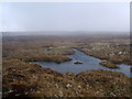
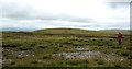
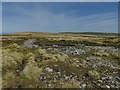
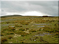
Photos of CA17 4JT


Area Information
CA17 4JT is a small residential cluster in England, covering an area of 11.8 square kilometres. This compact locality is home to a population of 1,078 people, resulting in a low density of five people per square kilometre. Living in CA17 4JT means settling into a quiet environment where properties are spread out across a significant land area. The area functions as a self-contained residential zone rather than a bustling urban centre. Its size allows for a slower pace of life, suitable for those seeking space and tranquility. Despite the small population, the community has established essential services within practical reach of all residents. You will find that daily life here is defined by low-density housing and a strong sense of local identity. The area does not compete with larger towns for density but instead offers a distinct character shaped by its geographical spread. Prospective buyers should appreciate that this postcode represents a specific, manageable slice of rural countryside. Your neighbours will likely be few, meaning less noise and fewer neighbours to deal with throughout your week.
- Area Type
- Postcode
- Area Size
- 11.8 km²
- Population
- 1078
- Population Density
- 5 people/km²
The property market in CA17 4JT is characterised by a stock almost entirely dominated by houses. With 75% home ownership, the area is firmly an owner-occupied market rather than a rental hotspot. You will find a scarcity of flats or high-density blocks within this postcode, as the accommodation type is exclusively houses. This market structure appeals to buyers seeking detached or semi-detached properties with yards and gardens. The low population density of five people per square kilometre supports a housing landscape where space is plentiful around each dwelling. Given the total population of just 1,078 residents, the number of properties for sale will always be limited compared to urban centres. Buying a home here offers security, as the high proportion of owners indicates long-term stability within the neighbourhood. Potential purchasers should be prepared for a niche market where inventory moves slowly. The dominance of houses means you can expect traditional building styles suited to the English countryside. Rental demand is unlikely to be high, making this an ideal location for those wishing to build equity.
House Prices in CA17 4JT
Showing 20 properties
| Address | Type | Beds | Baths | Last Sale Price | Last Sale Date | |
|---|---|---|---|---|---|---|
| 2, Castle Cottages, Mallerstang South Of Outhgill, Mallerstang, CA17 4JT | house | 3 | - | £306,000 | Aug 2025 | |
| Cocklake House, Mallerstang South Of Outhgill, Mallerstang, CA17 4JT | house | - | - | £740,000 | Mar 2023 | |
| Old Vicarage, Mallerstang South Of Outhgill, Mallerstang, CA17 4JT | house | - | - | £380,000 | Nov 2021 | |
| Southwaite Farm, Access Road To Southwaite From The B 6259, Mallerstang, CA17 4JT | Detached | 1 | 2 | £599,500 | Apr 2021 | |
| Hollins, Mallerstang South Of Outhgill, Mallerstang, CA17 4JT | Detached | - | - | £475,000 | Oct 2016 | |
| Brook Side, Mallerstang South Of Outhgill, Mallerstang, CA17 4JT | Detached | 4 | - | £276,000 | Aug 2013 | |
| Gate House, Mallerstang South Of Outhgill, Mallerstang, CA17 4JT | house | 3 | 1 | £255,000 | Aug 2012 | |
| 1, Castle Cottages, Mallerstang South Of Outhgill, Mallerstang, CA17 4JT | Terraced | - | - | £79,500 | Mar 2002 | |
| Castlethwaite, Mallerstang South Of Outhgill, Mallerstang, CA17 4JT | Semi-detached | - | - | £81,500 | Jul 1997 | |
| White Bracken House, Mallerstang South Of Outhgill, Mallerstang, CA17 4JT | Detached | - | - | - | - |
Energy Efficiency in CA17 4JT
Daily life in CA17 4JT centres on practical amenities located within easy travelling distance. Residents can utilise three key retail outlets nearby, including a Spar, a Co-op Kirkby, and another Spar store. These shops provide essential groceries and convenience items without the need for long journeys. Transport links are accessible, with Kirkby Stephen Railway Station located just a short drive or bus ride away. This station offers a vital connection to the wider rail network. The area lacks dedicated leisure centres or large parks within the immediate data, relying on the surrounding countryside for recreation. However, the region contains protected nature reserves, which may offer opportunities for local walks and outdoor activities. Dining and entertainment options are not detailed for this postcode, so residents likely rely on nearby towns for nights out. Your shopping runs will be handled efficiently by the local Spar and Co-op stores. The lifestyle here is functional and quiet, prioritising access to essentials over urban sophistication. Commuting to Kirkby Stephen remains the primary method for accessing broader services.
Amenities
Schools
Families living in CA17 4JT have access to one specific primary school within the immediate vicinity. Gunnerside Methodist Primary School serves the local children and currently holds a 'good' Ofsted rating. This single option indicates that you must transport older children to secondary education outside the postcode immediately, as no secondary schools are listed for this specific area. The presence of a 'good' rated primary school suggests a solid foundation for early year education. School transport considerations will be a key factor for parents considering homes in CA17 4JT, given the limited choice of nearby institutions. The school caters to the local population needs, serving families in the surrounding cluster of 1,078 residents. There are no other educational facilities listed, meaning all schooling needs beyond primary age require travel to neighbouring towns. Parents should research travel times to secondary schools if they have older children. The single primary option creates a focused educational community where proximity to Gunnerside Methodist Primary School is a decisive factor for buyers.
| Rank | School | Type | Entry gender | Ages |
|---|
Explore more schools in this area
Go to Schools tabDemographics
The community in CA17 4JT is defined by a mature and established resident base. The median age is 47 years, with adults aged between 30 and 64 years comprising the most common age range. This demographic profile indicates a settled population likely composed of families with grown children or empty nesters. Home ownership is exceptionally high, standing at 75% of all households. This figure suggests that the majority of residents bought their homes with a mortgage many years ago or inherited property. The prevailing accommodation type is houses, which aligns with the low-density nature of the settlement. The predominant ethnic group is White, reflecting the traditional demographic makeup of the region. There are no large pockets of deprivation within this postcode, and social conditions appear stable. The low population density of five people per square kilometre reinforces the idea of a tranquil living environment. Residents here enjoy a high proportion of owner-occupied homes, creating a stable community atmosphere. Households are primarily made up of traditional family units rather than shared housing arrangements.
Household Size
Accommodation Type
Tenure
Ethnic Group
Religion
Household Composition
Age
Household Deprivation
NS-SEC
Explore more demographic insights in this area
Go to Demographics tabPlanning
Planning Constraints
- Flood RiskPremium
- Ramsar Wetland SitesPremium
- Area of Outstanding Natural BeautyPremium
- Protected Nature ReservePremium
- Protected WoodlandPremium