Area Overview for Broughton & Scawby Ward
Photos of Broughton & Scawby Ward

Area Information
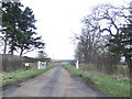
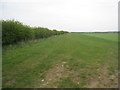
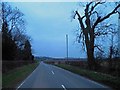
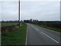
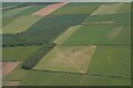
Living in Broughton & Scawby Ward offers a distinctly historical and rural character within North Lincolnshire. This unitary authority ward spans 40.4 square kilometres and sits just two miles north-west of Brigg. The landscape is defined by the Roman Ermine Street, which runs through the town of Broughton itself. You will find that the area extends beyond the main parish to include associated hamlets such as Wressle, Castlethorpe, and part of Scawby Brook. The core population stands at 4,587 residents, creating a compact community where daily life moves steadily. The history here runs deep, with evidence of settlement dating back to the Neolithic Stone Age when stone tools were found near Wressle. St Mary's Church remains a central landmark, featuring a rare Saxon staircase tower that is one of only four in the country. Gokewell Priory, founded in the late 12th century, also anchors the local heritage. To the west and north, extensive woodlands stretch towards Dragonby and Scunthorpe, providing a green backdrop that contrasts with the historic town centre. A former tower mill in Castlethorpe adds to the architectural interest, while the Doubletree by Hilton sits within the surrounding woods alongside a 27-hole golf course. Broughton officially achieved town status in 1974, yet it retains the quiet rhythm of a traditional village. The ward's identity is a blend of significant archaeological roots and modern recreational facilities. Whether you explore the historic streets or take a walk through the protected woodlands, the area maintains a strong connection to its past while serving current residents and newcomers alike. Homes in Broughton & Scawby Ward reflect this duality of ancient heritage and contemporary living.
- Area Type
- District Borough Unitary Ward
- Area Size
- 40.4 km²
- Population
- 4587
- Population Density
- 114 people/km²
Demographics
The community in Broughton & Scawby Ward is defined by a notable demographic shift towards retirement and stability. The median age reaches 70, indicating that the area is heavily populated by older residents. You are looking at a neighbourhood where the most common age group corresponds to the total population, suggesting a broad reliance on this specific demographic profile. This age structure often points to an area where pensioners and retired couples form the majority of the households. Home ownership is extremely high across the ward, with 79% of residents owning their homes outright or with a mortgage. This figure stands in stark contrast to areas dominated by private rental markets. The high ownership rate suggests long-term stability, as residents are unlikely to relocate frequently. Accommodation types mirror this stability, reflecting a stock built over generations rather than transient student housing or short-term lets. While specific data on ethnic diversity and religious affiliation is not available in the current records, the demographic profile strongly suggests a traditional community structure. The low population density of 114 people per square kilometre reinforces the sense of space and quiet. Living in Broughton & Scawby Ward means joining a community where residents are likely established locals who have stayed for decades. The area does not cater heavily to young professionals or families with very young children, based on the median age of 70. For those seeking a settlement location for retirement or a permanent home, the high ownership rate and stable population offer a secure environment.
Household Size
Accommodation Type
Tenure
Ethnic Group
Religion
Household Composition
Age
Household Deprivation
NS-SEC
Explore more demographic insights in this area
Go to Demographics tabPlanning
Planning Constraints
- Flood RiskPremium
- Ramsar Wetland SitesPremium
- Area of Outstanding Natural BeautyPremium
- Protected Nature ReservePremium
- Protected WoodlandPremium