Area Overview for Bridlington North Ward
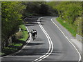
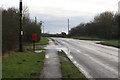
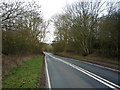
Photos of Bridlington North Ward

Area Information
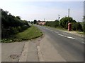
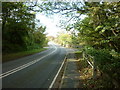
Bridlington North Ward stands as a distinct residential district within the broader town of Bridlington. This electoral ward forms one of three main administrative divisions for the area, representing a specific slice of life on the Holderness coast. The tract contains roughly 1162 residents spread across 23.1 square kilometres. This results in a low population density of 50 people per square kilometre, creating a spacious feel compared to more urban settings. The description provided by local authorities places these coordinates around 54.1137°N, 0.1442°W, situating it firmly on the North Sea edge. Living in Bridlington North Ward means engaging with a community that sits at the junction of key transport routes. You are located near the A165 trunk road, which connects Hull and Scarborough, while the A614 provides access towards York and Nottingham. The ward operates under the governance of Bridlington Town Council and the East Riding of Yorkshire unitary authority. Residents here benefit from being part of the wider civic structure that manages the town alongside Bridlington South and Bridlington Old Town and Central. The physical scale and administrative boundaries define a neighbourhood that balances coastal proximity with established road infrastructure for those who commute beyond the immediate seaside community.
- Area Type
- District Borough Unitary Ward
- Area Size
- 23.1 km²
- Population
- 1162
- Population Density
- 50 people/km²
Demographics
The community profile within Bridlington North Ward reflects a settled and mature population. The median age recorded for the area is 70, indicating that the most common age range consists of older residents. This demographic data distinguishes the ward from younger-centric urban zones. Home ownership is a defining feature of the local housing stock, with 78% of households reporting they own their properties. This high rate suggests a long-term community where residents have established roots rather than short-term tenancies. The data does not specify detailed breakdowns for household composition, predominant ethnic groups, or religious affiliations, but the overall picture points toward a stable residential environment. High ownership levels often imply that families seeking to live where they stay tend to favour this ward. The low population density of 50 people per square kilometre aligns with the age profile, suggesting an area where space and solitude may be prioritised. Every claim regarding the community structure is grounded in the provided statistics, showing a clear preference for staying put among the inhabitants. This demographic reality shapes the day-to-day rhythm of life for anyone considering homes in Bridlington North Ward.
Household Size
Accommodation Type
Tenure
Ethnic Group
Religion
Household Composition
Age
Household Deprivation
NS-SEC
Explore more demographic insights in this area
Go to Demographics tabPlanning
Planning Constraints
- Flood RiskPremium
- Ramsar Wetland SitesPremium
- Area of Outstanding Natural BeautyPremium
- Protected Nature ReservePremium
- Protected WoodlandPremium
- Crime RiskPremium