Area Overview for Brayton
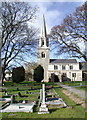
Photos of Brayton


Area Information
Brayton is a compact built-up area in England, covering 90.1 hectares and serving as a quiet, established community. With a median age of 70, it is a retirement-focused area, suggesting a population largely composed of older residents. The area’s small size means amenities and services are closely clustered, making daily life convenient. Brayton sits near Selby, a larger town with rail connections, and its proximity to multiple railway stations offers easy access to regional transport. The presence of three primary schools, including one with a ‘good’ Ofsted rating, indicates a family-friendly environment, though the demographic data suggests a mature population. Living in Brayton means prioritising proximity to essential services, with a low crime risk and strong broadband connectivity. It is not a high-density urban area but offers a slower pace of life, suitable for those seeking stability and accessibility. Homes in Brayton are predominantly owner-occupied, reflecting a community of long-term residents rather than transient populations. For buyers, the area’s distinctiveness lies in its balance of quietude and practicality, with a focus on retirement living and ease of access to nearby towns.
- Area Type
- Built Up Area 250
- Area Size
- 90.1 hectares
- Population
- Not available
- Population Density
- Not available
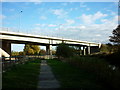
Living in Brayton offers access to a range of nearby amenities, including five retail outlets such as Tesco Brayton, M&S, and Iceland Selby. These shops provide essential services for daily living, from groceries to clothing. The area’s rail network, with stations at Selby, Hensall, and Whitley Bridge, ensures convenient travel to larger towns and cities. While there is no mention of parks or leisure facilities, the compact size of Brayton means amenities are within practical reach. The retail and rail options suggest a functional lifestyle, though the absence of recreational spaces may require residents to travel for leisure activities. The mix of retail and transport options supports a self-contained but modest lifestyle, ideal for those prioritising convenience over expansive amenities.
Amenities
Schools
Brayton is served by three primary schools, all of which are state-funded. Brayton Community Junior School and Brayton Church of England Voluntary Controlled Primary School are both primary institutions, while Brayton Church of England Primary School holds a ‘good’ Ofsted rating. The presence of multiple primary schools suggests a focus on education, though the absence of secondary schools may require families to commute to nearby towns for higher education. The mix of school types includes a voluntary controlled school, which is partially funded by the church, and a community school, indicating a range of educational philosophies. For families, this diversity could offer choice, but the lack of data on secondary education or school performance metrics beyond one ‘good’ rating means the quality of education cannot be fully assessed. Buyers with children should consider the need for additional schooling beyond primary level and the practicality of commuting.
| Rank | School | Type | Entry gender | Ages |
|---|
Explore more schools in this area
Go to Schools tabDemographics
Brayton’s population has a median age of 70, indicating a community heavily skewed towards older adults. The most common age range is ‘Total,’ which suggests a lack of detailed breakdowns but aligns with the high median age. Home ownership is exceptionally high at 83%, far exceeding the national average, which implies a stable, long-term resident base. The accommodation types and household compositions are not specified, but the high home ownership rate suggests a predominance of owner-occupied properties rather than rental units. There is no data on ethnic diversity or religious composition, but the area’s demographic profile points to a homogeneous population, likely reflecting broader regional trends. The absence of specific figures on deprivation or socioeconomic status means the quality of life cannot be contextualised in terms of economic challenges. However, the low crime risk and strong broadband connectivity suggest a generally secure and well-served environment. For those considering Brayton, the data highlights a mature, settled community with limited generational turnover.
Household Size
Accommodation Type
Tenure
Ethnic Group
Religion
Household Composition
Age
Household Deprivation
NS-SEC
Explore more demographic insights in this area
Go to Demographics tabPlanning
Planning Constraints
- Crime RiskPremium