Area Overview for Beeston & Holbeck Ward
Photos of Beeston & Holbeck Ward
Area Information
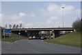
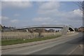
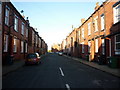
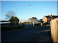
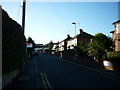
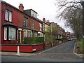
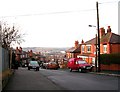
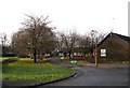
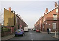
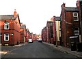
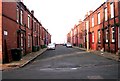
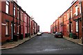
Beeston & Holbeck Ward represents a distinct segment of Leeds City Council, covering an area of 7.8 km² with a population of 10,201 residents. You will find this ward characterised by its dense urban residential fabric, which has evolved from a medieval sheep-farming township into a primarily working-class community. The area sits within the inner-city boundaries of West Yorkshire, where historical landmarks like Cad Beeston manor house and parts of Stank Hall Barn coexist with modern development. Daily life here is shaped by proximity to key locations such as Elland Road, the home of Leeds United Football Club, and Cross Flatts Park. Since 1866, Beeston has been a separate civil parish that merged with Holbeck in 1904 before joining Leeds in 1925. This history means the estate feels established and grounded, with transport links originally defined by turnpike roads like Elland Road and Dewsbury Road. Buying a home in Beeston & Holbeck Ward means entering a market defined by legacy industrial roots and tight urban spaces. You will not find sprawling greenbelts; instead, the landscape is dominated by terraced properties and high-density housing. The ward offers straightforward planning environments with no Ramsar wetland sites or Areas of Outstanding Natural Beauty restricting development. While specific journey times to major cities are not documented in current records, the rail station serves as a central hub for local movement. The community reflects its working-class origins, providing a stable environment where residents navigate a mix of historic charm and everyday urban practicalities.
- Area Type
- District Borough Unitary Ward
- Area Size
- 7.8 km²
- Population
- 10201
- Population Density
- 1313 people/km²
Demographics
The community within Beeston & Holbeck Ward is defined by a specific age profile and household structure. Data indicates a median age of 70, making this one of the older populations in the region. Because 'Age: Total' is listed as the most common age range, the demographic spread is represented by the aggregate resident group rather than a single narrow bracket. You are entering a neighbourhood where the average resident has lived through more than two decades of urban change. The area has a 1,313 people per km² density across its 7.8 km² footprint. This figure places Beeston & Holbeck Ward among the most densely populated urban wards in Leeds. A total of 38% of households own their homes, suggesting that slightly fewer than two out of every five residents are homeowners. The remaining majority likely rely on renting or other tenure arrangements. Although comprehensive breakdowns of predominant ethnic groups and religious affiliations are not detailed in the current records, the ward remains a consolidated urban entity with strong historical working-class roots. The household composition reflects the needs of an ageing population, consistent with the median age statistic. As you consider living in Beeston & Holbeck Ward, you should expect close neighbours and a community where long-standing residents form the backbone of the social fabric. The total population of 10,201 reflects a stable cohort that has adapted its lifestyle to suit an increasingly senior demographic.
Household Size
Accommodation Type
Tenure
Ethnic Group
Religion
Household Composition
Age
Household Deprivation
NS-SEC
Explore more demographic insights in this area
Go to Demographics tabPlanning
Planning Constraints
- Flood RiskPremium
- Ramsar Wetland SitesPremium
- Area of Outstanding Natural BeautyPremium
- Protected Nature ReservePremium
- Protected WoodlandPremium