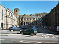
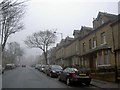
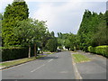
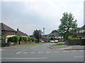
Area Overview for BD9 6RE
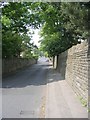
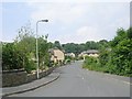
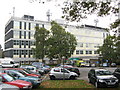
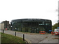
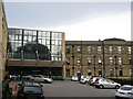
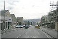
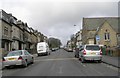
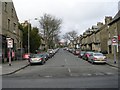
Photos of BD9 6RE
Area Information
Living in BD9 6RE places you in a compact residential cluster within the City of Bradford, a densely populated urban area in West Yorkshire. With a population of 2,220, this postcode is part of the Toller ward, known for its youthful demographic and strong community focus. The area’s character is shaped by its proximity to Bradford’s core amenities, including schools, retail hubs, and transport links. Daily life here is defined by a mix of urban convenience and community-driven initiatives, with grants supporting services for marginalised groups and the elderly. While the ward as a whole has a population of around 20,849, BD9 6RE itself reflects a smaller, tightly knit subset. The area’s young median age of 22 contrasts with the dominant adult age range of 30–64, suggesting a blend of long-term residents and newer arrivals. This is a place where cultural diversity is evident, with nearly 75% of the population identifying as British Asian, particularly of Pakistani heritage. The urban setting offers easy access to Bradford’s broader infrastructure, making it a practical choice for those prioritising connectivity over rural tranquillity.
- Area Type
- Postcode
- Area Size
- Not available
- Population
- 2220
- Population Density
- 5847 people/km²
The property market in BD9 6RE is characterised by a 68% home ownership rate, reflecting a mix of owner-occupied and rental properties. Given the area’s predominantly house-based accommodation, the housing stock likely includes family homes and larger units, which may appeal to buyers seeking space in a compact urban setting. However, the small size of the postcode area means that the immediate surroundings—such as nearby wards in Bradford—could offer more varied options. The high proportion of owner-occupied properties suggests a stable market, though buyers should consider the limited availability of properties within BD9 6RE itself. Those looking to expand their search might find opportunities in adjacent areas with similar characteristics. The focus on houses rather than flats indicates a preference for private, standalone living, which could be a draw for those prioritising privacy over high-density housing.
House Prices in BD9 6RE
Showing 1 properties
| Address | Type | Beds | Baths | Last Sale Price | Last Sale Date | |
|---|---|---|---|---|---|---|
| Duke Of Yorks Home, Duckworth Lane, Bradford, BD9 6RE | commercial | - | - | - | - |
Energy Efficiency in BD9 6RE
Residents of BD9 6RE enjoy a range of nearby amenities that support daily life, from retail to transport. The area is within practical reach of M&S Bradford and multiple Morrisons Daily stores, ensuring convenience for shopping and grocery needs. Rail stations such as Frizinghall and Bradford Forster Square provide access to broader transport networks, while metro stops at Ingrow West and Damems offer additional connectivity. Though specific parks or leisure facilities are not listed, the proximity to Bradford’s urban core suggests access to larger recreational spaces and cultural amenities. The presence of retail hubs and transport links creates a lifestyle that balances urban convenience with the practicalities of everyday living. This mix of amenities supports a dynamic, accessible environment where residents can meet both immediate and long-term needs.
Amenities
Schools
Residents of BD9 6RE have access to a range of educational institutions, including Bradford Girls’ Grammar School, which operates as both an independent school and an academy with a ‘good’ Ofsted rating. This dual status offers families flexibility in choosing between independent education and state-funded options with strong performance indicators. For younger children, Lady Royd Primary School provides a local primary education. The presence of a high-performing academy alongside a primary school creates a comprehensive educational ecosystem, catering to both secondary and early years’ needs. The ‘good’ Ofsted rating for the grammar school suggests a reliable standard of teaching, while the primary school’s proximity ensures ease of access for families. This combination of school types allows parents to select between independent and state-run institutions, reflecting the area’s diverse educational landscape.
| Rank | School | Type | Entry gender | Ages |
|---|
Explore more schools in this area
Go to Schools tabDemographics
The community in BD9 6RE is predominantly composed of adults aged 30–64, despite a median age of 22. This suggests a balance between younger residents and a core population of working-age adults. Home ownership rates stand at 68%, indicating a strong presence of owner-occupied properties, though rental options likely exist given the area’s density. The accommodation type is primarily houses, which may cater to families or those seeking more space in an urban setting. Ethnically, the area is defined by its high proportion of Asian residents, with the ‘asian_total’ group making up the majority. This aligns with broader trends in Toller ward, where nearly 75% of the population identifies as British Asian. The low proportion of White residents (14.3% in Toller) highlights the area’s distinct cultural makeup. While deprivation data is not explicitly provided, the presence of community grants for marginalised groups and elderly services suggests a focus on social equity. This demographic profile shapes a community that is both diverse and socially active, with initiatives aimed at supporting vulnerable populations.
Household Size
Accommodation Type
Tenure
Ethnic Group
Religion
Household Composition
Age
Household Deprivation
NS-SEC
Explore more demographic insights in this area
Go to Demographics tabPlanning
Planning Constraints
- Flood RiskPremium
- Ramsar Wetland SitesPremium
- Area of Outstanding Natural BeautyPremium
- Protected Nature ReservePremium
- Protected WoodlandPremium