Area Overview for BD9 6RB
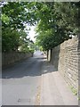
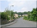
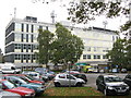
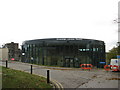
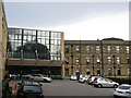
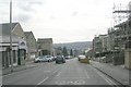
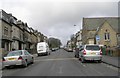
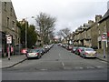
Photos of BD9 6RB
Area Information
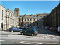
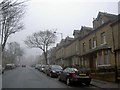
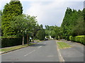
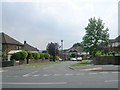
BD9 6RB is a small, densely populated residential postcode in the heart of Bradford, West Yorkshire. Covering just 3.0 hectares, this area is part of the Toller ward, known for its urban density and community-focused living. With a population of 2220 people and a population density of 73,800 per square kilometre, it reflects the compact nature of Bradford’s urban fabric. The area is home to a mix of families and professionals, with a median age of 22, though the most common age range is 30–64. This suggests a balance between younger residents and those in their prime working years. The high proportion of Asian residents, particularly Pakistani, shapes the cultural and social dynamics of the neighbourhood. Daily life here is defined by proximity to amenities, schools, and transport links, making it practical for commuters and families alike. While the area lacks natural landscapes, its urban setting offers convenience and accessibility, with a focus on community-driven initiatives and services.
- Area Type
- Postcode
- Area Size
- 3.0 hectares
- Population
- 2220
- Population Density
- 5847 people/km²
The property market in BD9 6RB is characterised by high home ownership (68%) and a predominance of houses. This suggests a stable, owner-occupied market rather than a rental-heavy area. The concentration of houses indicates a mix of family homes and possibly semi-detached or terraced properties, typical of urban Bradford. Given the area’s small size (3.0 hectares) and high density, the housing stock is likely compact, with limited scope for new development. For buyers, this means competition for existing homes, particularly those in good condition or with access to local amenities. The proximity to schools, transport, and retail could enhance property values, though buyers should consider the area’s urban constraints, such as limited green space and potential noise from nearby infrastructure. The market may appeal to first-time buyers or families seeking affordability within a connected urban environment.
House Prices in BD9 6RB
Showing 2 properties
| Address | Type | Beds | Baths | Last Sale Price | Last Sale Date | |
|---|---|---|---|---|---|---|
| Former 1, Squire Lane, Bradford, BD9 6RB | Flat | 2 | 2 | - | - | |
| Foster Beaver College, Bradford Girls Grammar School, Squire Lane, Bradford, BD9 6RB | commercial | - | - | - | - |
Energy Efficiency in BD9 6RB
Living in BD9 6RB offers a blend of urban convenience and community-focused amenities. Within practical reach are five retail outlets, including M&S Bradford and Morrisons, providing everyday shopping needs. The area’s transport links—five railway stations and two metro stops—ensure easy access to Bradford’s cultural and commercial hubs. While there are no named parks or leisure facilities in the data, the proximity to schools and retail suggests a focus on family-oriented living. The presence of multiple supermarkets and the density of transport options indicate a lifestyle prioritising accessibility over expansive green spaces. Residents can enjoy a vibrant urban environment with a strong emphasis on connectivity, making daily errands, commuting, and socialising efficient. The area’s compact nature means amenities are closely clustered, reducing travel time and enhancing the practicality of urban living.
Amenities
Schools
Near BD9 6RB are three schools, each catering to different educational needs. Bradford Girls’ Grammar School is an independent institution, offering a fee-based education, while another branch of the same name operates as an academy with a ‘good’ Ofsted rating. This dual presence suggests a range of options for families, from independent schooling to state-funded academies. Lady Royd Primary School provides early education and is likely a key resource for younger children. The mix of school types indicates a focus on both academic excellence and accessible public education. For families, the availability of a ‘good’-rated academy and a primary school within reach is a significant advantage, ensuring continuity in education from early years through to secondary schooling. The proximity of these institutions aligns with the area’s reputation as a family-friendly zone with strong community ties.
| Rank | School | Type | Entry gender | Ages |
|---|
Explore more schools in this area
Go to Schools tabDemographics
The community in BD9 6RB is predominantly young, with a median age of 22 and the most common age group being adults aged 30–64. Home ownership is high at 68%, with houses being the primary accommodation type. The area’s demographic profile is distinct: the predominant ethnic group is Asian (specifically, the ‘asian_total’ category), reflecting broader trends in Bradford’s Toller ward, where nearly 75% of the population identifies as British Asian. This diversity is supported by community grants and services targeting marginalised groups, women, and the elderly. The high population density—73,800 people per square kilometre—means the area is intensely populated, which can influence local infrastructure and social interactions. While no specific deprivation data is provided, the focus on community-driven resources suggests a need for targeted support to address potential challenges in housing, employment, or access to services.
Household Size
Accommodation Type
Tenure
Ethnic Group
Religion
Household Composition
Age
Household Deprivation
NS-SEC
Explore more demographic insights in this area
Go to Demographics tabPlanning
Planning Constraints
- Flood RiskPremium
- Ramsar Wetland SitesPremium
- Area of Outstanding Natural BeautyPremium
- Protected Nature ReservePremium
- Protected WoodlandPremium