Area Overview for BD9 6EZ
Photos of BD9 6EZ
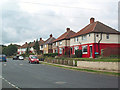
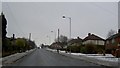
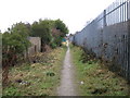
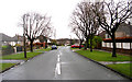
94 photos from this area
Area Information
Key information about the BD9 6EZ including its size, population, and administrative classification.
- Area Type
- Postcode
- Area Size
- 4408 m²
- Population
- 2273
- Population Density
- 6425 people/km²
House Prices in BD9 6EZ
16
Properties
£82,227
Average Sold Price
£30,000
Lowest Price
£121,000
Highest Price
Showing 16 properties
| Address | Type | Beds | Baths | Last Sale Price | Last Sale Date | |
|---|---|---|---|---|---|---|
| 174 Lynfield Drive, Bradford, BD9 6EZ | Semi-detached | 2 | 1 | £121,000 | May 2022 | |
| 188 Lynfield Drive, Bradford, BD9 6EZ | house | 2 | - | £87,000 | Feb 2021 | |
| 176 Lynfield Drive, Bradford, BD9 6EZ | Semi-detached | 3 | 1 | £85,000 | Dec 2020 | |
| 186 Lynfield Drive, Bradford, BD9 6EZ | house | - | - | £77,500 | Aug 2011 | |
| 166 Lynfield Drive, Bradford, BD9 6EZ | Semi-detached | - | - | £109,000 | May 2008 | |
| 190 Lynfield Drive, Bradford, BD9 6EZ | house | - | - | £102,000 | Mar 2007 | |
| 164 Lynfield Drive, Bradford, BD9 6EZ | Semi-detached | 2 | 1 | £98,000 | Apr 2006 | |
| 180 Lynfield Drive, Bradford, BD9 6EZ | Semi-detached | 2 | 1 | £74,000 | Dec 2005 | |
| 182 Lynfield Drive, Bradford, BD9 6EZ | house | - | - | £85,000 | Sep 2005 | |
| 162 Lynfield Drive, Bradford, BD9 6EZ | Semi-detached | 2 | 1 | £36,000 | Aug 2003 |
Page 1 of 2
Energy Efficiency in BD9 6EZ
Amenities
Schools
| Rank | School | Type | Entry gender | Ages |
|---|
Explore more schools in this area
Go to Schools tabDemographics
Household Size
Family (3-5 people)
most common
Accommodation Type
Houses
most common
Tenure
55
majority
Ethnic Group
asian_total
most common
Religion
N/A
most common
Household Composition
N/A
most common
Age
22
median
Adults (30-64 years)
most common
Household Deprivation
N/A
with no deprivation
NS-SEC
18
in Lower managerial occupations
Explore more demographic insights in this area
Go to Demographics tabPlanning
Planning Constraints
- Flood RiskPremium
- Ramsar Wetland SitesPremium
- Area of Outstanding Natural BeautyPremium
- Protected Nature ReservePremium
- Protected WoodlandPremium