Area Overview for BD9 5QF
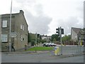
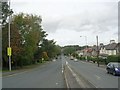
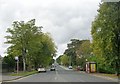
Photos of BD9 5QF

Area Information
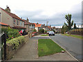
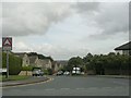
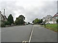
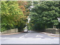
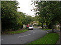
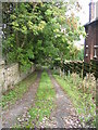
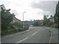
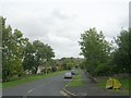
Living in BD9 5QF means being part of a small, tightly knit residential cluster in the City of Bradford, West Yorkshire. With a population of 1,843, this area blends historical roots with modern convenience. Situated near the villages of Frizinghall, Heaton, and Daisy Hill, it sits within the Heaton Ward, a locale with Anglo-Saxon origins and a legacy of agricultural land transformed into residential spaces by the 19th century. The area is defined by its proximity to Chellow Heights Reservoir and historic sites like St Barnabas Church, built in 1864. Daily life here balances quiet suburban living with access to nearby towns, rail networks, and a range of amenities. The postcode’s compact size means residents are close to both green spaces and urban infrastructure, creating a mix of tranquillity and practicality. For those seeking a community with a distinct character, BD9 5QF offers a blend of heritage and contemporary living, anchored by its strategic location near major transport routes and educational institutions.
- Area Type
- Postcode
- Area Size
- Not available
- Population
- Not available
- Population Density
- Not available
The property market in BD9 5QF is characterised by a high rate of home ownership (73%), indicating that most properties are owner-occupied rather than rented. The predominant accommodation type is houses, which suggests a focus on larger, family-friendly homes. This contrasts with areas dominated by flats or apartments, where rental demand often drives the market. The small size of the postcode area means the housing stock is limited, with fewer options available compared to larger urban centres. However, the presence of houses implies a market that may appeal to buyers seeking space and stability. For those considering the area, proximity to schools, transport links, and green spaces could enhance property value. Given the compact nature of BD9 5QF, buyers may need to look beyond the immediate postcode to find additional options, though the existing stock is likely to be well-established and of traditional construction.
House Prices in BD9 5QF
No properties found in this postcode.
Energy Efficiency in BD9 5QF
The lifestyle in BD9 5QF is shaped by its proximity to retail, transport, and green spaces. Within practical reach are five retail venues, including Morrisons Daily, M&S Bradford, and Co-op High, providing everyday shopping and dining options. The area’s rail network, with stations like Frizinghall and Shipley, connects residents to broader urban amenities, while metro stops at Ingrow West and Damems add flexibility for travel. Nearby green spaces, such as Chellow Heights Reservoir, offer recreational opportunities, though specific parks or leisure facilities are not detailed in the data. The mix of retail and transport infrastructure ensures that daily life is both convenient and connected. For those seeking a balance between suburban tranquillity and urban accessibility, BD9 5QF’s amenities reflect a practical, well-served community.
Amenities
Schools
Residents of BD9 5QF have access to a range of educational institutions, including state and independent schools. St Bede’s Catholic Grammar School and St Bede’s and St Joseph’s Catholic College serve primary and secondary education, offering faith-based options for families. Independent schools such as Netherleigh and Rossefield School and Shaw House School provide alternative educational pathways, often with smaller class sizes and specialist curricula. The mix of school types ensures that families can choose between state-run institutions with a broader catchment area or independent schools with more selective admissions. While no Ofsted ratings are provided, the presence of both Catholic and independent options suggests a diversity of educational philosophies and resources. For parents prioritising school quality, the proximity of these institutions to residential areas in BD9 5QF is a key consideration.
| Rank | School | Type | Entry gender | Ages |
|---|
Explore more schools in this area
Go to Schools tabDemographics
The demographic profile of BD9 5QF reflects a mature, stable population. The median age is 47, with the majority of residents falling into the 30–64 age range, indicating a community largely composed of working-age adults and families. Home ownership is high at 73%, suggesting a strong presence of long-term residents and a focus on property as an investment. The predominant accommodation type is houses, which aligns with the area’s suburban character and appeal to families. The predominant ethnic group is Asian_total, reflecting the broader diversity of Bradford’s population. This demographic mix contributes to a community with a range of cultural influences, though specific data on deprivation or income levels is not provided. The age distribution and high home ownership rates imply a relatively settled population, with fewer transient residents compared to other urban areas.
Household Size
Accommodation Type
Tenure
Ethnic Group
Religion
Household Composition
Age
Household Deprivation
NS-SEC
Explore more demographic insights in this area
Go to Demographics tabPlanning
Planning Constraints
- Flood RiskPremium
- Ramsar Wetland SitesPremium
- Area of Outstanding Natural BeautyPremium
- Protected Nature ReservePremium
- Protected WoodlandPremium