Area Overview for BD9 5PF
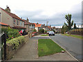
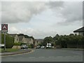
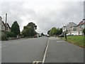
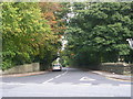
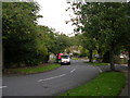
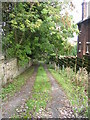
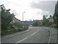
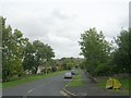
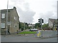
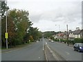
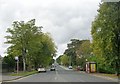
Photos of BD9 5PF

Area Information
Living in BD9 5PF means residing within a specific residential cluster characterised by a high density of 1,885 people per square kilometre. This postcode area, part of the wider Heaton Ward, offers a compact living environment distinct from the sprawling suburbs found elsewhere in West Yorkshire. The local history is deeply rooted, with origins tracing back to an Anglo-Saxon 'high farmstead' first mentioned in 1160. Today, the lanes connect to the historic villages of Frizinghall and Daisy Hill, while maintaining a strong, self-contained character. Residents benefit from a community where the past informs the present, anchored by landmarks like Heaton Hall and St Barnabas Church. Daily life here revolves around a tight-knit neighbourhood where privacy is balanced with proximity to services. The area is not defined by vast open spaces, but rather by a focused residential footprint that integrates well with the surrounding City of Bradford metropolitan borough. You will find yourself in an established zone where the built environment reflects centuries of change, from the former Woolsorters' Gardens to modern housing stock. The location offers a sense of rootedness, appealing to those who prefer a defined local identity over the anonymity of larger towns. It is a place where the history of the Field family and the Batt family continues to shape the surrounding streetscape.
- Area Type
- Postcode
- Area Size
- Not available
- Population
- 2154
- Population Density
- 1885 people/km²
The housing market in BD9 5PF reflects a mature, owner-led sector. With 69% home ownership, the area is predominantly comprised of residents who have purchased their homes and stayed put. This contrasts sharply with rental-heavy zones where tenants move frequently. The primary accommodation type here is houses, which generally offer more space, garden access, and distinct character compared to flats. For buyers looking at homes in BD9 5PF, the stock represents a established residential cluster rather than a developing estate in flux. This high ownership rate often implies that properties have been maintained by long-term residents rather than quick-flip landlords. When searching for homes in this specific postcode cluster, you will encounter a market where families have invested in their property over years or decades. The mix of houses suggests a preference for family-sized living or those seeking detached or semi-detached options. Since this is a small residential cluster, inventory may be limited, creating a competitive environment if multiple buyers seek the specific property types available. The nature of the housing stock aligns with the older demographic, where the appeal lies in permanence and space rather than modern luxury finishes.
House Prices in BD9 5PF
No properties found in this postcode.
Energy Efficiency in BD9 5PF
Daily life in BD9 5PF is supported by a network of amenities within practical reach. Retail options are well represented, with five notable shopping locations including Co-op High, M&S Bradford, and Morrisons Daily. You have access to groceries, clothing, and general spending without needing to travel far beyond your cluster. For daily necessities, these retailers provide a convenient routine, allowing you to run errands during the week or after school while children are at Heaton St Barnabas Primary. Transport links further enhance lifestyle convenience. Five railway services connect residents to Frizinghall Railway Station, Shipley Railway Station, and Saltaire Railway Station, facilitating weekend trips and commuting. Additionally, two metro stations at Ingrow West and Damems offer local connectivity for those needing specific transport routes. The area's history as part of the Heaton Estates Conservation Area influences the local character, preserving a specific aesthetic while accommodating modern amenities. Dining and leisure options are anchored by the presence of major high street brands, ensuring that basic lifestyle needs are met efficiently. The blend of historic parkland, such as the former Woolsorters' Gardens site, and modern retail creates a balanced environment for shopping and leisure.
Amenities
Schools
Families living in BD9 5PF have access to primary education through the immediate vicinity, with Heaton St Barnabas CofE Aided Primary School serving the local community. This institution holds a 'good' Ofsted rating, providing a standard of quality that schools inspectors deem satisfactory. For residents requiring primary schooling, the school is a named entity within the Heaton Ward, located in close proximity to the residential clusters of Frizinghall and Heaton. The data provided confirms the presence of this single primary option within the immediate school search radius of the postcode. There is no listed secondary school or independent college directly in the immediate data set for BD9 5PF, which suggests families may rely on catchment areas for secondary education or choose schooling outside the immediate gate premises. The 'good' rating of Heaton St Barnabas CofE Aided Primary School offers a solid foundation for early years education. It is an established Church of England Aided provider, indicating a specific ethos that parents might consider when mapping out their children's educational journey in this part of West Yorkshire. The school name remains constant as a reliable fixture in the local educational landscape.
| Rank | School | Type | Entry gender | Ages |
|---|
Explore more schools in this area
Go to Schools tabDemographics
The community in BD9 5PF is defined by a stable, mature population. The median age is 47, with adults aged between 30 and 64 years forming the most common age range. This demographic profile indicates a neighbourhood where long-term residents and established families dominate the street scene rather than transient young professionals. A significant 69% of households own their properties outright, suggesting a community deeply invested in their locality. This high level of ownership typically correlates with lower turnover and a more settled atmosphere. Accommodation types in this cluster consist primarily of houses, offering a traditional living experience rather than the high-rise apartment blocks found in some urban CBDs. The predominant ethnic group is Asian, contributing to a distinct cultural fabric within the estate. Living in BD9 5PF, you join a demographic that values stability and home ownership as a cornerstone of life. The age distribution means local amenities are likely tailored to the needs of middle-aged adults and older children, rather than a hub for university students or very young children. This creates a predictable and consistent community environment where neighbours are likely to know one another well.
Household Size
Accommodation Type
Tenure
Ethnic Group
Religion
Household Composition
Age
Household Deprivation
NS-SEC
Explore more demographic insights in this area
Go to Demographics tabPlanning
Planning Constraints
- Flood RiskPremium
- Ramsar Wetland SitesPremium
- Area of Outstanding Natural BeautyPremium
- Protected Nature ReservePremium
- Protected WoodlandPremium