Area Overview for BD9 5HG
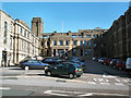
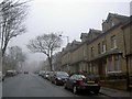
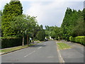
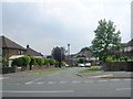
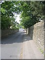
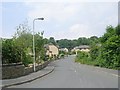
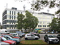
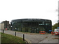
Photos of BD9 5HG
Area Information
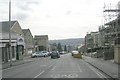
Living in BD9 5HG places you at the heart of a defined residential cluster with a clear population of 2,292 residents. This specific postcode operates as a distinct node within the wider urban fabric of West Yorkshire, offering a contained community feel despite its proximity to the broader city of Bradford. You will find that daily life here revolves around immediate local conveniences rather than distant city centres. The area is structured around practical accessibility, ensuring that essential services and transport links are within a short walk or drive. The character of BD9 5HG is defined by its density and residential focus. It functions as a self-sufficient unit where the needs of the 2,292 inhabitants are met efficiently through local planning. You do not need to travel far for your supermarkets, markets, or stations. The proximity to Frizinghall Railway Station allows for quick commutes without the need for extensive public transport networks. This location offers a balance between urban proximity and local autonomy. You can access the wider opportunities of Bradford while maintaining a distinct neighbourhood identity centred on your immediate surroundings.
- Area Type
- Postcode
- Area Size
- Not available
- Population
- 2292
- Population Density
- 11518 people/km²
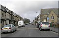
The property market in BD9 5HG is overwhelmingly dominated by owner-occupied housing, with 84 per cent of the stock held by owners. This statistic clearly marks BD9 5HG as a long-term residential settlement rather than a rental hotspot or investment speculation zone. The prevailing accommodation type is houses, which forms the bulk of the housing stock available in this small postcode cluster. You will find that the market here is characterised by stability. Searches for homes in BD9 5HG should focus on properties suitable for families or empty nesters given the house-type dominance. The high ownership rate means that when a property comes on the market, it has likely been improved and maintained by its current owner over many years. This contrasts sharply with areas where rental turnover drives quick moves and minimal maintenance. Builders and developers do not currently feature heavily here because the land is already utilised. The lack of new build information suggests an established village feel where the existing houses define the character of BD9 5HG. Buyers looking for traditional brick-built homes or semi-detached families will find this area aligns perfectly with their requirements. The market is lean, specific, and focused entirely on the existing brick stock rather than speculative new developments.
House Prices in BD9 5HG
No properties found in this postcode.
Energy Efficiency in BD9 5HG
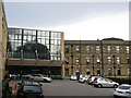
Your daily lifestyle in BD9 5HG revolves around a compact circle of practical amenities. Retail options are plentiful yet concentrated, with five main stores located within practical reach. M&S Bradford, Morrisons Daily, and Co-op High are the specific venues you will utilise for groceries and household goods. These shops provide everything you need without forcing a journey to the city centre. Transport connectivity reinforces this lifestyle independence. Frequent train services run from Frizinghall Railway Station, Bradford Forster Square Railway Station, and Bradford Foster Square Railway Station. You can easily commute through the network or travel to neighbouring towns. The Metrolink system is also accessible via Ingrow West and Damems stations, offering an alternative for weekend trips. This arrangement means BD9 5HG is self-sufficient. You do not need a car for daily necessities, though one is likely needed for leisure trips. The presence of these named venues ensures that "living in BD9 5HG" provides a streamlined routine. You can shop at Morrisons for breakfast and travel via Frizinghall for lunchtime meetings. This blend of near-instant retail and efficient rail links defines the rhythm of life here.
Amenities
Schools
Families living in BD9 5HG have two primary options for early education at the local level. Both Margaret McMillan Primary School and Scotchman Middle School are located near this postcode and serve the local catchment area. Margaret McMillan Primary School holds a good Ofsted rating, which provides reassurance regarding the quality of primary education in BD9 5HG. While Scotchman Middle School does not currently carry an Ofsted rating in the available records, its presence ensures continuity for pupils progressing from infant to middle years. The mix of schools offers a straightforward path for children living in this postcode. You can plan your child's education route beginning at one of these established local institutions. The proximity of these facilities means parents do not need to consider catchment extensions far beyond BD9 5HG boundaries. Just beyond these primary options, broader secondary education must be accessed through the wider Bradford system, but the first step of schooling remains local and robust. This configuration supports a stable start for children growing up in "homes in BD9 5HG".
| Rank | School | Type | Entry gender | Ages |
|---|
Explore more schools in this area
Go to Schools tabDemographics
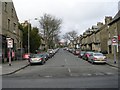
The community in BD9 5HG is defined by a mature demographic with a median age of 47 years. Most residents fall within the adults' bracket ranging from 30 to 64 years, indicating a population that has established roots in the area. This age profile suggests a neighbourhood dominated by families and working professionals rather than transient populations or students. You will find that the social fabric here supports long-term stability. Home ownership stands as the defining financial characteristic of the area, with 84 per cent of housing held by owners. This high rate of ownership signals a stable, invested community rather than a transient rental market. The accommodation type is predominantly houses, which aligns with the higher average age of the residents. You are likely to see properties designed for families or empty nesters rather than temporary student housing. Ethnically, the area centres on an Asian majority, making BD9 5HG a significant cultural hub within the local district. The high concentration of British Asian residents creates a community where cultural traditions and language are common fixtures of daily life. This diversity shapes the local businesses and social interactions you encounter when "homes in BD9 5HG" become your new base.
Household Size
Accommodation Type
Tenure
Ethnic Group
Religion
Household Composition
Age
Household Deprivation
NS-SEC
Explore more demographic insights in this area
Go to Demographics tabPlanning
Planning Constraints
- Flood RiskPremium
- Ramsar Wetland SitesPremium
- Area of Outstanding Natural BeautyPremium
- Protected Nature ReservePremium
- Protected WoodlandPremium