Area Overview for BD9 4JE
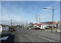
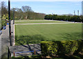
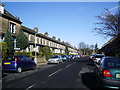
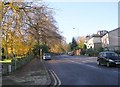
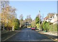
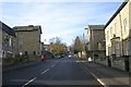
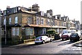
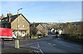
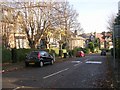
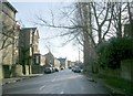
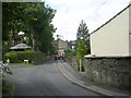
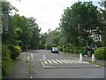
Photos of BD9 4JE
Area Information
BD9 4JE is a small residential cluster within the broader Heaton Ward in Bradford, West Yorkshire. With a population of 1,989, it reflects a tight-knit community rooted in historical significance. The area’s name derives from Anglo-Saxon origins, meaning “high farmstead,” and it encompasses villages like Frizinghall and Heaton, as well as the Chellow Heights Reservoir. This postcode sits near the 19th-century Woolsorters’ Gardens and is within walking distance of Heaton Hall, a historic estate linked to the Field family. Daily life here blends traditional architecture with modern convenience, offering proximity to rail networks and retail hubs. The median age of 47 suggests a mature demographic, with a strong presence of adults aged 30–64. The area’s character is shaped by its conservation status, with 32 listed buildings and preserved street layouts. Residents benefit from nearby amenities such as Saltaire Railway Station and Tesco Bradford, while the surrounding landscape includes green spaces like the reservoir. This is a place where history meets practicality, ideal for those seeking a settled, community-oriented lifestyle with easy access to transport and local services.
- Area Type
- Postcode
- Area Size
- Not available
- Population
- 1989
- Population Density
- 9871 people/km²
BD9 4JE is primarily an owner-occupied area, with 62% of homes owned by residents rather than rented. The accommodation type is predominantly houses, indicating a focus on single-family dwellings rather than apartments or flats. This aligns with the area’s historical development, including 19th-century villas and conservation areas like Heaton Estates, which preserve traditional materials and layouts. The limited size of the postcode suggests a niche market, with buyers needing to consider nearby areas for broader options. The high home ownership rate reflects long-term residency, with properties likely retaining value due to their historical significance and limited supply. However, the small population and specific postcode boundaries mean the market is not expansive. Buyers should assess the character of individual properties, as listed buildings and conservation areas may influence both aesthetics and maintenance costs.
House Prices in BD9 4JE
No properties found in this postcode.
Energy Efficiency in BD9 4JE
Living in BD9 4JE offers access to a range of amenities within easy reach. Retail options include Tesco Bradford, Aldi Canal, and Spar Otley, providing essentials for daily life. The area’s proximity to rail stations like Frizinghall and Saltaire ensures convenient travel, while Leeds Bradford Airport is within reach for those needing regional or international connections. Historically, the area is rich in character, with landmarks such as Heaton Hall, St Barnabas Church, and the Heaton Estates Conservation Area, which preserve 19th-century architecture and landscaping. The presence of listed buildings and green spaces like Chellow Heights Reservoir adds to the local charm. Residents benefit from a blend of practicality and heritage, with amenities that support both modern living and a connection to the area’s past.
Amenities
Schools
| Rank | School | Type | Entry gender | Ages |
|---|
Explore more schools in this area
Go to Schools tabDemographics
The population of BD9 4JE is 1,989, with a median age of 47, indicating a mature community. The most common age group is adults aged 30–64, suggesting a stable, established demographic. Home ownership is high at 62%, with houses being the predominant accommodation type. This reflects a residential area focused on family homes rather than rental properties. The predominant ethnic group is Asian_total, highlighting cultural diversity within the ward. While specific deprivation data is not provided, the high home ownership rate and presence of listed buildings suggest a mix of long-term residents and those invested in local heritage. The area’s demographic profile aligns with its historical roots, with a population that values stability and community ties. The absence of significant youth or elderly populations implies a balanced age distribution, supporting local services and amenities tailored to middle-aged households.
Household Size
Accommodation Type
Tenure
Ethnic Group
Religion
Household Composition
Age
Household Deprivation
NS-SEC
Explore more demographic insights in this area
Go to Demographics tabPlanning
Planning Constraints
- Flood RiskPremium
- Ramsar Wetland SitesPremium
- Area of Outstanding Natural BeautyPremium
- Protected Nature ReservePremium
- Protected WoodlandPremium