Area Overview for BD8 7JW
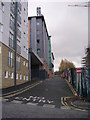
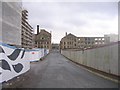
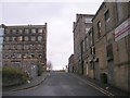
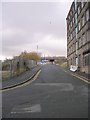
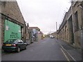
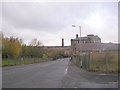
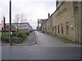
Photos of BD8 7JW

Area Information
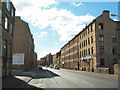
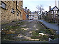
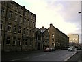
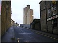
Living in BD8 7JW means inhabiting a densely populated, small residential cluster in Bradford, England. With a population of 2,833 and a density of 2,731 people per square kilometre, this area is compact and tightly woven. Historically a workers’ settlement, Manningham’s name derives from Old English, reflecting its rural origins before industrialisation transformed it. Today, it is a mixed community with a median age of 22, though the most common age range is 30–64, suggesting a balance of young professionals and established residents. The area’s character is shaped by its Victorian-era housing stock, industrial heritage, and proximity to key transport links. Despite its density, BD8 7JW retains cultural significance as Bradford’s former Jewish quarter, with synagogues and heritage sites still present. Daily life here is defined by proximity to retail, rail, and educational facilities, though the high crime risk reported in assessments necessitates caution. For buyers, the area offers a blend of affordability and historical interest, though its small size means limited housing options.
- Area Type
- Postcode
- Area Size
- Not available
- Population
- 2833
- Population Density
- 2731 people/km²
The property market in BD8 7JW is characterised by a low home ownership rate of 28%, meaning the majority of properties are rented. The accommodation type is predominantly flats, reflecting the area’s historical development as a densely packed residential cluster. This suggests a limited supply of owner-occupied homes, making the market more competitive for buyers. The small size of the area means housing stock is concentrated, with few new developments likely. For buyers, this presents both challenges and opportunities: while the market is niche, the presence of flats may appeal to those seeking affordability in a connected location. However, the low ownership rate also indicates that rental demand is high, which could influence property values and availability. Prospective buyers should consider the area’s compact nature and the need for proximity to transport links when evaluating properties.
House Prices in BD8 7JW
No properties found in this postcode.
Energy Efficiency in BD8 7JW
Daily life in BD8 7JW is shaped by its proximity to essential amenities. Retail options include Tesco Manningham, Iceland Manningham, and Asda Living, providing convenience for shopping. The area’s rail network, with multiple stations, ensures easy access to employment and leisure opportunities. Nearby airports offer additional travel flexibility. The historical character of Manningham adds cultural depth, with listed buildings and heritage sites such as Manningham Mills and Bradford Grammar School nearby. While the area’s density may limit green spaces, its industrial past and ongoing regeneration efforts contribute to a dynamic lifestyle. The mix of retail, transport, and historical landmarks creates a practical yet distinctive environment for residents.
Amenities
Schools
Residents of BD8 7JW have access to a range of educational institutions, including Midland Road Nursery School, which provides early years education, and Wapping First School, a primary school. For independent education, TLG Bradford and Al Mumin Primary and Secondary School offer alternative options, though Al Mumin has a satisfactory Ofsted rating. The One In A Million Free School, an academy with a satisfactory rating, adds further choice for families. The mix of state and independent schools allows parents to select between free public education and fee-paying alternatives. However, the Ofsted ratings for some schools are not outstanding, which may be a consideration for families prioritising high academic standards. The presence of multiple school types reflects the area’s diversity and the need for varied educational pathways.
| Rank | School | Type | Entry gender | Ages |
|---|
Explore more schools in this area
Go to Schools tabDemographics
The community in BD8 7JW is predominantly young, with a median age of 22, though the most common age group is adults aged 30–64. This suggests a mix of younger residents and families. Home ownership is low at 28%, indicating that most residents rent their homes. The accommodation type is primarily flats, reflecting the area’s compact nature and historical development as a workers’ settlement. The predominant ethnic group is Asian_total, highlighting the area’s cultural diversity. This demographic profile shapes the local character, with a focus on community and shared spaces. The low home ownership rate may impact long-term stability, but the presence of a 30–64 age group suggests a steady demand for housing. The area’s density and age demographics also influence local services, with schools and amenities tailored to families and younger populations.
Household Size
Accommodation Type
Tenure
Ethnic Group
Religion
Household Composition
Age
Household Deprivation
NS-SEC
Explore more demographic insights in this area
Go to Demographics tabPlanning
Planning Constraints
- Flood RiskPremium
- Ramsar Wetland SitesPremium
- Area of Outstanding Natural BeautyPremium
- Protected Nature ReservePremium
- Protected WoodlandPremium