Area Overview for BD8 0BJ
Photos of BD8 0BJ
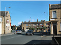
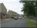
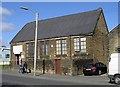
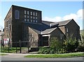
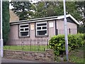
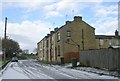
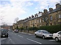
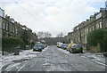
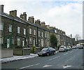
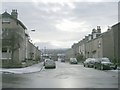
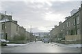
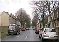
100 photos from this area
Area Information
Key information about the BD8 0BJ including its size, population, and administrative classification.
- Area Type
- Postcode
- Area Size
- 5334 m²
- Population
- 1916
- Population Density
- 15028 people/km²
House Prices in BD8 0BJ
38
Properties
£62,307
Average Sold Price
£16,000
Lowest Price
£125,000
Highest Price
Showing 38 properties
| Address | Type | Beds | Baths | Last Sale Price | Last Sale Date | |
|---|---|---|---|---|---|---|
| 72 Allerton Road, Bradford, BD8 0BJ | Terraced | 2 | 1 | £107,000 | Aug 2025 | |
| 50 Allerton Road, Bradford, BD8 0BJ | Terraced | 4 | 1 | £125,000 | Aug 2024 | |
| 66 Allerton Road, Bradford, BD8 0BJ | house | - | - | £100,000 | May 2024 | |
| 84 Allerton Road, Bradford, BD8 0BJ | Terraced | 3 | 1 | £88,000 | Dec 2023 | |
| 42 Allerton Road, Bradford, BD8 0BJ | Terraced | 2 | 1 | £59,000 | Dec 2021 | |
| 80 Allerton Road, Bradford, BD8 0BJ | house | 3 | 1 | £69,000 | Nov 2021 | |
| 64 Allerton Road, Bradford, BD8 0BJ | Terraced | 3 | - | £80,000 | Oct 2021 | |
| 78 Allerton Road, Bradford, BD8 0BJ | house | 2 | - | £87,500 | Jul 2021 | |
| 28 Allerton Road, Bradford, BD8 0BJ | house | - | - | £38,000 | Nov 2020 | |
| 44 Allerton Road, Bradford, BD8 0BJ | Terraced | 2 | 1 | £47,000 | Sep 2020 |
Page 1 of 4
Energy Efficiency in BD8 0BJ
Amenities
Schools
| Rank | School | Type | Entry gender | Ages |
|---|
Explore more schools in this area
Go to Schools tabDemographics
Household Size
Family (3-5 people)
most common
Accommodation Type
Houses
most common
Tenure
51
majority
Ethnic Group
asian_total
most common
Religion
N/A
most common
Household Composition
N/A
most common
Age
22
median
Adults (30-64 years)
most common
Household Deprivation
N/A
with no deprivation
NS-SEC
8
in Lower managerial occupations
Explore more demographic insights in this area
Go to Demographics tabPlanning
Planning Constraints
- Flood RiskPremium
- Ramsar Wetland SitesPremium
- Area of Outstanding Natural BeautyPremium
- Protected Nature ReservePremium
- Protected WoodlandPremium