Area Overview for BD8 0AN
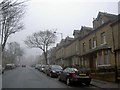
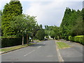
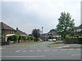
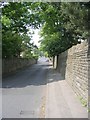
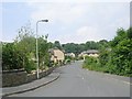
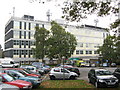
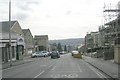
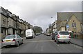
Photos of BD8 0AN


Area Information
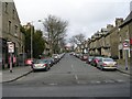
Living in BD8 0AN means inhabiting a densely packed urban enclave within Bradford’s Toller ward. This postcode area, spanning just 2.0 hectares, is home to 2,220 people, translating to a staggering population density of 109,590 people per square kilometre. The area is part of a larger residential district with a 2021 population of over 20,000, yet BD8 0AN itself is a microcosm of its surroundings. The community is young, with a median age of 22, though the most common age range is adults aged 30–64. This suggests a mix of established residents and younger families, creating a dynamic urban environment. The area’s proximity to key infrastructure, including rail stations and retail hubs, makes it practical for daily life. With broadband quality rated at 94/100 and mobile coverage at 85/100, residents enjoy reliable digital connectivity. The area’s character is shaped by its high proportion of British Asian residents, reflecting a culturally rich, community-driven environment.
- Area Type
- Postcode
- Area Size
- 2.0 hectares
- Population
- 2220
- Population Density
- 5847 people/km²
The property market in BD8 0AN is characterised by high home ownership (68%) and a focus on houses rather than flats or apartments. This suggests a residential stock that prioritises family-friendly, standalone homes. Given the area’s small size (2.0 hectares) and high population density, the housing stock is likely limited, with properties concentrated in a compact urban footprint. Buyers should consider the proximity to amenities, including schools and transport links, which are critical in such a densely populated area. The predominance of owner-occupied homes indicates a stable market, though the small area size may mean limited options for buyers seeking larger properties. The lack of planning constraints, such as protected woodlands or AONB designations, also means development pressure is minimal, preserving the existing housing stock.
House Prices in BD8 0AN
Showing 34 properties
| Address | Type | Beds | Baths | Last Sale Price | Last Sale Date | |
|---|---|---|---|---|---|---|
| 90 Crow Tree Lane, Bradford, BD8 0AN | Detached | 4 | 3 | £530,000 | Dec 2025 | |
| 9 Crow Tree Lane, Bradford, BD8 0AN | Terraced | 2 | 1 | £99,232 | Oct 2025 | |
| 81 Crow Tree Lane, Bradford, BD8 0AN | house | - | - | £300,000 | Sep 2023 | |
| 13 Crow Tree Lane, Bradford, BD8 0AN | Cottage | 1 | 1 | £61,000 | Dec 2022 | |
| 1 Crow Tree Lane, Bradford, BD8 0AN | Terraced | 3 | 1 | £165,000 | Jul 2022 | |
| 5 Crow Tree Lane, Bradford, BD8 0AN | Terraced | 3 | 1 | £106,000 | Jan 2020 | |
| 11 Crow Tree Lane, Bradford, BD8 0AN | Terraced | 3 | 1 | £115,000 | May 2019 | |
| 6 Crow Tree Lane, Bradford, BD8 0AN | Terraced | 3 | 1 | £100,000 | Dec 2017 | |
| 92 Crow Tree Lane, Bradford, BD8 0AN | Detached | 4 | 2 | £250,000 | Sep 2016 | |
| 3 Crow Tree Lane, Bradford, BD8 0AN | Terraced | 2 | - | £96,000 | Jul 2014 |
Energy Efficiency in BD8 0AN
Daily life in BD8 0AN is shaped by its compact urban layout and proximity to essential amenities. Retail options include M&S Bradford and Morrisons Daily, offering convenience for shopping and dining. The area’s rail and metro stations, such as Frizinghall and Ingrow West, provide easy access to transport networks, facilitating both commuting and leisure travel. While parks and green spaces are not explicitly listed in the data, the absence of protected natural areas suggests a focus on urban living. The community’s character is defined by its diversity, with cultural influences evident in local businesses and social initiatives. The high population density means amenities are tightly clustered, creating a vibrant, though potentially busy, environment. For residents, this balance of accessibility and urban density supports a practical, connected lifestyle.
Amenities
Schools
Residents of BD8 0AN have access to a range of educational institutions. Bradford Girls’ Grammar School, an independent school, and another instance of the same name operating as an academy with a ‘good’ Ofsted rating, offer secondary education options. Lady Royd Primary School provides primary-level education. The presence of both independent and state-funded schools gives families flexibility, with the academy’s ‘good’ rating indicating a reliable standard of education. The mix of school types ensures choices for different preferences and budgets. These institutions are likely to be central to the area’s community life, supporting both local families and broader educational needs. The proximity of schools to residential properties is a key consideration for homebuyers prioritising family-friendly living.
| Rank | School | Type | Entry gender | Ages |
|---|
Explore more schools in this area
Go to Schools tabDemographics
The demographic profile of BD8 0AN is defined by its youthful population, with a median age of 22, though the most common age group is adults aged 30–64. This suggests a mix of young professionals and families. Home ownership is high at 68%, with houses being the predominant accommodation type. The area’s ethnic composition is notable: the predominant group is Asian_total, with nearly 75% of the broader Toller ward identified as British Asian in 2011. This demographic concentration influences the community’s cultural and social dynamics. The population density of 109,590 per square kilometre is exceptionally high, reflecting a compact, urbanised setting. While this density can strain resources, it also fosters a tightly knit community. The low proportion of White residents (14.3% in Toller ward) underscores the area’s distinct identity, shaped by its heritage and social initiatives targeting marginalised groups.
Household Size
Accommodation Type
Tenure
Ethnic Group
Religion
Household Composition
Age
Household Deprivation
NS-SEC
Explore more demographic insights in this area
Go to Demographics tabPlanning
Planning Constraints
- Flood RiskPremium
- Ramsar Wetland SitesPremium
- Area of Outstanding Natural BeautyPremium
- Protected Nature ReservePremium
- Protected WoodlandPremium