Area Overview for BD7 4NQ
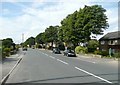
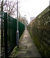
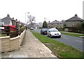
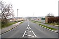
Photos of BD7 4NQ
Area Information
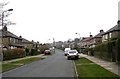
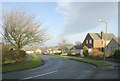
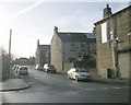
Living in BD7 4NQ means being part of a tightly knit residential cluster in England’s West Yorkshire, where the population of 1,715 is concentrated across just 1.9 hectares. This density creates a compact, community-oriented environment, with homes predominantly in single-family houses. The area sits within the Royds ward, historically marked by regeneration efforts that transformed formerly run-down 1950s and 1960s housing estates into a place with a “strong sense of community,” as noted by the Royds Community Association. Today, the area blends suburban housing with amenities like the £5 million Enterprise Park, which employs over 300 locals. While the population is small, the area’s proximity to Bradford’s city centre and its rail links offer easy access to urban opportunities. The median age of 47 suggests a mature demographic, with many residents likely drawn to the area’s post-regeneration stability and the presence of local institutions like Royds Hall, a Grade II* listed building with centuries of history. For buyers, BD7 4NQ offers a mix of practicality and heritage, though its limited size means housing stock is finite.
- Area Type
- Postcode
- Area Size
- 1.9 hectares
- Population
- 1715
- Population Density
- 2719 people/km²
The property market in BD7 4NQ is characterised by high home ownership (64%) and a focus on houses rather than flats or apartments. This suggests a suburban, family-oriented market where properties are likely to be larger and more private. Given the area’s small size—just 1.9 hectares—the housing stock is limited, meaning competition for available homes could be intense. The high proportion of owner-occupied properties indicates a community of long-term residents, which may contribute to a sense of continuity and stability. However, the lack of rental properties implies that buyers should consider the area’s limited scope for new development. For those seeking a home, the proximity to retail hubs like Tesco Bradford and rail stations such as Bradford Interchange offers practical advantages. The regeneration of the 1990s has likely influenced property values, with the Enterprise Park and community amenities adding to the area’s appeal. Buyers should note that the market is not expansive, and proximity to key services is a significant factor.
House Prices in BD7 4NQ
Showing 42 properties
| Address | Type | Beds | Baths | Last Sale Price | Last Sale Date | |
|---|---|---|---|---|---|---|
| 67 Speeton Avenue, Bradford, BD7 4NQ | Semi-detached | 2 | 1 | £114,000 | Apr 2025 | |
| 32 Speeton Avenue, Bradford, BD7 4NQ | Semi-detached | 3 | 1 | £175,000 | Jun 2023 | |
| 19 Speeton Avenue, Bradford, BD7 4NQ | house | - | - | £130,000 | Oct 2021 | |
| 37 Speeton Avenue, Bradford, BD7 4NQ | house | - | - | £132,000 | Jul 2021 | |
| 44 Speeton Avenue, Bradford, BD7 4NQ | house | - | - | £200,000 | Jun 2021 | |
| 40 Speeton Avenue, Bradford, BD7 4NQ | Semi-detached | 3 | 1 | £175,000 | Dec 2018 | |
| 61 Speeton Avenue, Bradford, BD7 4NQ | Semi-detached | 2 | 2 | £130,000 | Nov 2018 | |
| 69 Speeton Avenue, Bradford, BD7 4NQ | Bungalow | - | - | £151,500 | Nov 2018 | |
| 50 Speeton Avenue, Bradford, BD7 4NQ | Bungalow | 3 | 1 | £172,000 | Dec 2017 | |
| 55 Speeton Avenue, Bradford, BD7 4NQ | Semi-detached | 3 | - | £91,000 | Mar 2017 |
Energy Efficiency in BD7 4NQ
Residents of BD7 4NQ have access to a range of nearby amenities, including five retail venues such as Tesco Bradford, Aldi Clayton, and Heron Clayton, offering everyday shopping needs. The area’s rail network, with stations like Bradford Interchange and Low Moor, provides convenient travel options for commuting or leisure. While the data does not mention parks or green spaces explicitly, the historical context of the ward includes efforts to improve community facilities, such as the Royds Healthy Living Centre and multiple sports and health centres. The Enterprise Park, though focused on employment, also contributes to the local economy. The presence of six Homework Clubs suggests a community-oriented approach to education. Overall, the area’s lifestyle balances practicality with the benefits of regeneration, though its small size means residents may need to travel for more extensive recreational or cultural amenities.
Amenities
Schools
The nearest school to BD7 4NQ is Hollingwood Primary School, a primary institution serving the area. While the data lists the school twice, it appears to be the sole educational facility explicitly mentioned. The absence of secondary schools or other educational institutions in the provided data means families may need to look beyond the immediate vicinity for secondary education. The presence of a primary school suggests that the area is suitable for young families, though the lack of additional schools could be a consideration for those requiring a broader range of educational options. The quality of Hollingwood Primary School is not specified in the data, so further research would be needed to assess its performance. For now, the area’s school infrastructure is limited to primary-level provision.
| Rank | School | Type | Entry gender | Ages |
|---|
Explore more schools in this area
Go to Schools tabDemographics
The community in BD7 4NQ is predominantly composed of adults aged 30–64, with a median age of 47. This suggests a mature population, likely with established careers and families. Home ownership rates are high at 64%, indicating a stable, long-term resident base. The accommodation type is primarily houses, reflecting a suburban character rather than high-density housing. The predominant ethnic group is White, though specific diversity metrics are not provided. The area’s population density of 90,718 people per square kilometre is exceptionally high for its size, which may contribute to a tight-knit, familiar social fabric. However, this density also means limited space for expansion. The regeneration projects of the 1990s addressed historical deprivation, including male unemployment rates as high as 47%, and today’s demographic profile reflects those improvements. For buyers, the area’s demographic stability and mature age profile may appeal to those seeking a quiet, established neighbourhood with a focus on community.
Household Size
Accommodation Type
Tenure
Ethnic Group
Religion
Household Composition
Age
Household Deprivation
NS-SEC
Explore more demographic insights in this area
Go to Demographics tabPlanning
Planning Constraints
- Flood RiskPremium
- Ramsar Wetland SitesPremium
- Area of Outstanding Natural BeautyPremium
- Protected Nature ReservePremium
- Protected WoodlandPremium