Area Overview for BD7 4HU
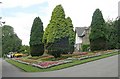
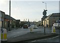
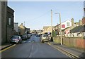
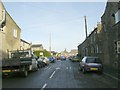
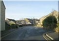
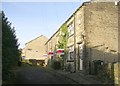
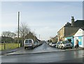
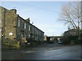
Photos of BD7 4HU
Area Information
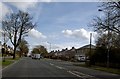
Living in BD7 4HU means inhabiting a compact, densely populated postcode area within Bradford, West Yorkshire. Covering just 2.0 hectares, this small residential cluster is home to 1,862 people, translating to a population density of 93,082 people per square kilometre. Despite its size, the area is rich in historical context, situated in the Great Horton ward, a conservation area preserving 17th-19th century buildings and industrial heritage. The community is tightly knit, with proximity to amenities like Tesco Bradford and multiple railway stations. Daily life here blends urban convenience with preserved historic character, from 18th-century cottages to Horton Park, a public space opened in 1878. The area’s compact nature means residents are within easy reach of retail, transport, and green spaces, though its density may feel intimate rather than sprawling. This is a place where history and modernity coexist, with a focus on conservation amid urban growth.
- Area Type
- Postcode
- Area Size
- 2.0 hectares
- Population
- 1862
- Population Density
- 8705 people/km²
The property market in BD7 4HU is characterised by a 58% home ownership rate, suggesting a balance between owner-occupied homes and rental properties. The predominant accommodation type is houses, which is unusual for a densely populated area but aligns with the ward’s conservation status, where historic and traditional housing stock is preserved. This mix of older buildings and more recent developments may appeal to buyers seeking characterful homes with a sense of history. However, the small area size—just 2.0 hectares—means the housing stock is limited, and opportunities for expansion or new builds are constrained. For buyers, this implies a focus on existing properties rather than new developments. The proximity to schools, retail, and transport infrastructure adds value, but the compact nature of the area means that property choices are closely tied to immediate surroundings, requiring careful consideration of location within the postcode.
House Prices in BD7 4HU
Showing 28 properties
| Address | Type | Beds | Baths | Last Sale Price | Last Sale Date | |
|---|---|---|---|---|---|---|
| 238 Poplar Grove, Bradford, BD7 4HU | house | - | - | £108,000 | Sep 2023 | |
| 294 Poplar Grove, Bradford, BD7 4HU | house | - | - | £228,000 | Apr 2023 | |
| 287 Poplar Grove, Bradford, BD7 4HU | Semi-detached | 3 | 1 | £130,000 | Jan 2023 | |
| 256 Poplar Grove, Bradford, BD7 4HU | house | - | - | £113,000 | Nov 2019 | |
| 291 Poplar Grove, Bradford, BD7 4HU | house | - | - | £105,000 | Oct 2018 | |
| 289 Poplar Grove, Bradford, BD7 4HU | Semi-detached | 3 | 1 | £127,000 | Nov 2017 | |
| 262 Poplar Grove, Bradford, BD7 4HU | house | - | - | £133,000 | Aug 2017 | |
| 252 Poplar Grove, Bradford, BD7 4HU | house | - | - | £92,000 | Aug 2017 | |
| 250 Poplar Grove, Bradford, BD7 4HU | Terraced | 3 | 2 | £148,000 | Jul 2016 | |
| 242 Poplar Grove, Bradford, BD7 4HU | house | 4 | 2 | £185,000 | Aug 2014 |
Energy Efficiency in BD7 4HU
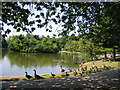
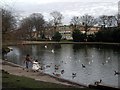
The lifestyle in BD7 4HU is shaped by its proximity to essential amenities and historical spaces. Residents have access to five retail outlets, including Tesco Bradford and Aldi Clayton, offering everyday shopping needs. The area’s railway stations provide swift links to urban centres, supporting both local and regional travel. Nearby, Horton Park—a public park opened in 1878—offers green space for recreation, complementing the conservation area’s 17th-19th century buildings. The ward’s listed structures and industrial heritage add cultural depth, while the compact layout ensures amenities are within practical reach. This blend of preserved history, modern convenience, and accessible greenery creates a lived-in, community-focused environment. However, the area’s density may mean limited private outdoor space, requiring residents to rely on shared or public areas for leisure.
Amenities
Schools
Residents of BD7 4HU have access to three primary schools within proximity: Southmere Primary School, Southmere Primary Academy, and another instance of Southmere Primary Academy, which holds an Ofsted rating of ‘good’. This concentration of primary schools provides multiple options for families, though the repetition of the same school name may indicate a single institution with multiple sites or a naming convention. The presence of two primary academies suggests a focus on educational quality, with at least one institution receiving a positive Ofsted assessment. For parents, this means a range of choices for early education, though the specific curricula or performance metrics beyond the Ofsted rating are not detailed. The density of schools in the area supports family-oriented living, ensuring children have access to local education without long commutes.
| Rank | School | Type | Entry gender | Ages |
|---|
Explore more schools in this area
Go to Schools tabDemographics
The demographic profile of BD7 4HU reveals a young, predominantly working-age population. The median age is 22, with the most common age range being adults aged 30-64 years. Home ownership stands at 58%, indicating a mix of owner-occupied properties and rentals. The accommodation type is primarily houses, reflecting a residential character distinct from high-density housing. The predominant ethnic group is Asian, which shapes the cultural fabric of the community. With a population density of 93,082 people per square kilometre, the area is highly compact, though this does not necessarily correlate with deprivation levels, which are not explicitly detailed in the data. The presence of multiple primary schools and proximity to retail and transport hubs suggest a functional, family-oriented environment. However, the high density may influence living conditions, though specific deprivation metrics are absent from the provided information.
Household Size
Accommodation Type
Tenure
Ethnic Group
Religion
Household Composition
Age
Household Deprivation
NS-SEC
Explore more demographic insights in this area
Go to Demographics tabPlanning
Planning Constraints
- Flood RiskPremium
- Ramsar Wetland SitesPremium
- Area of Outstanding Natural BeautyPremium
- Protected Nature ReservePremium
- Protected WoodlandPremium