Area Overview for BD7 4BU
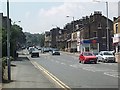
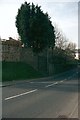
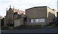
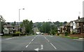
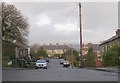
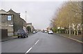
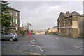
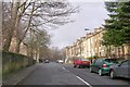
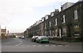
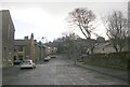
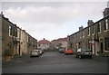
Photos of BD7 4BU

Area Information
BD7 4BU lies within the historic Great Horton ward of Bradford, a conservation area preserving 17th- to 19th-century buildings amid urban expansion. This small postcode area, spanning 6,841 m², is home to 1,594 residents, creating a densely populated community with a population density of 233,000 people per km². Situated 2.5 miles south-west of Bradford city centre, it blends historic charm with modern convenience. The area’s character is defined by its conservation status, which protects landmarks such as Hall’s House (1697) and Horton Park, a public space opened in 1878. Daily life here is shaped by proximity to rail networks and local shops, while the ward’s history as a former rural settlement with industrial roots adds depth to its present-day identity. The community is predominantly Asian, with a median age of 47, reflecting a mature, established demographic. Living in BD7 4BU means navigating a compact, high-density environment where historic architecture coexists with contemporary needs, offering a unique slice of Bradford’s evolving urban fabric.
- Area Type
- Postcode
- Area Size
- 6841 m²
- Population
- 1594
- Population Density
- 233008 people/km²
The property market in BD7 4BU is characterised by high home ownership (76%) and a predominance of houses as the primary accommodation type. This suggests a stable, owner-occupied market with limited rental activity, likely due to the area’s small size and conservation status. The concentration of houses reflects the historical development of Great Horton, where 17th- to 19th-century buildings coexist with more modern housing. For buyers, this means a focus on individual properties rather than flats or apartments, with potential restrictions due to the conservation area designation. The limited area size means the immediate surroundings may offer more varied housing options, but within BD7 4BU itself, properties are likely to be older, with historical features. Buyers should consider the compact nature of the postcode and the proximity to Bradford’s urban core, which may influence property values and availability.
House Prices in BD7 4BU
Showing 12 properties
| Address | Type | Beds | Baths | Last Sale Price | Last Sale Date | |
|---|---|---|---|---|---|---|
| 12 Welbeck Rise, Bradford, BD7 4BU | house | - | - | £170,000 | Jun 2023 | |
| 10 Welbeck Rise, Bradford, BD7 4BU | Semi-detached | - | - | £116,000 | Jan 2023 | |
| 8 Welbeck Rise, Bradford, BD7 4BU | Retail | 5 | 2 | £250,000 | Oct 2022 | |
| 12A Welbeck Rise, Bradford, BD7 4BU | house | - | - | £170,000 | Jun 2021 | |
| 6 Welbeck Rise, Bradford, BD7 4BU | Bungalow | - | - | £148,000 | Oct 2017 | |
| 2 Welbeck Rise, Bradford, BD7 4BU | Bungalow | 3 | - | £140,000 | Sep 2013 | |
| 4 Welbeck Rise, Bradford, BD7 4BU | Bungalow | - | - | £110,500 | Jul 2009 | |
| 14 Welbeck Rise, Bradford, BD7 4BU | Semi-detached | - | - | £125,000 | Mar 2007 | |
| 1 Welbeck Rise, Bradford, BD7 4BU | Bungalow | - | - | £121,500 | Aug 2006 | |
| 5 Welbeck Rise, Bradford, BD7 4BU | Bungalow | 3 | 1 | £41,000 | Nov 1996 |
Energy Efficiency in BD7 4BU
Living in BD7 4BU offers access to essential amenities within practical reach, including five retail venues such as Tesco Bradford and Aldi Clayton. These shops cater to daily needs, while the nearby railway stations provide easy access to Bradford’s wider network. The area’s historic character is complemented by Horton Park, a public space opened in 1878, offering greenery and recreational opportunities. The conservation area status preserves 17th- to 19th-century buildings, adding cultural value to the neighbourhood. Despite its small size, the area’s proximity to Bradford’s urban core means residents can enjoy both local charm and city amenities. The combination of historic sites, practical retail, and transport links creates a lifestyle that balances tradition with modern convenience, though the compact nature of the postcode requires some travel for broader services.
Amenities
Schools
| Rank | School | Type | Entry gender | Ages |
|---|
Explore more schools in this area
Go to Schools tabDemographics
The population of BD7 4BU has a median age of 47, with the most common age range being adults aged 30-64 years. This suggests a community of middle-aged residents, likely settled in long-term housing. Home ownership is high, at 76%, indicating a stable, owner-occupied demographic. The predominant accommodation type is houses, which aligns with the area’s conservation status and historical development as a residential zone. The predominant ethnic group is Asian_total, reflecting a culturally distinct community. While the data does not specify deprivation levels, the high population density and focus on home ownership suggest a mix of established residents and long-term residents. The absence of detailed diversity metrics means the community’s broader ethnic composition remains less defined, but the Asian majority is a clear feature. This demographic profile points to a mature, settled population with strong ties to the area’s heritage and infrastructure.
Household Size
Accommodation Type
Tenure
Ethnic Group
Religion
Household Composition
Age
Household Deprivation
NS-SEC
Explore more demographic insights in this area
Go to Demographics tabPlanning
Planning Constraints
- Flood RiskPremium
- Ramsar Wetland SitesPremium
- Area of Outstanding Natural BeautyPremium
- Protected Nature ReservePremium
- Protected WoodlandPremium