Area Overview for BD7 3HU
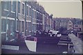
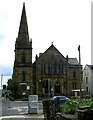
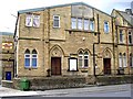
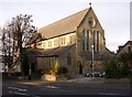
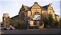
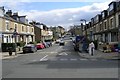
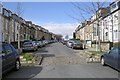
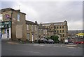
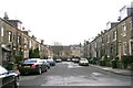
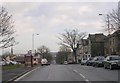
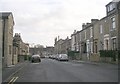
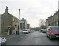
Photos of BD7 3HU
Area Information
Living in BD7 3HU means being part of a tightly packed residential cluster in the heart of Bradford’s city centre. This postcode covers just 1.6 hectares, yet it is home to 2,184 people, making it one of the most densely populated areas in England. The compact nature of BD7 3HU means proximity to amenities and transport hubs is a defining feature. As part of the City Ward, it lies within the inner ring road, placing residents at the core of Bradford’s urban fabric. The area’s character is shaped by its mix of housing stock and its position in a historically significant part of the city. While the population density is exceptionally high, the area is served by multiple retail and transport options, ensuring daily life remains convenient. With a median age of 22, the community is young, but the most common age group is adults aged 30–64, suggesting a blend of families and long-term residents. The presence of Asian communities, which form the predominant ethnic group, adds to the cultural diversity of this small but vibrant postcode.
- Area Type
- Postcode
- Area Size
- 1.6 hectares
- Population
- 2184
- Population Density
- 9794 people/km²
The property market in BD7 3HU is characterised by a 52% home ownership rate, suggesting a balance between owner-occupied and rental properties. Despite the high population density, the area is dominated by houses rather than flats or apartments, which is notable for a city-centre postcode. This mix of housing types may appeal to families seeking more space, though the limited area size means the housing stock is constrained. Buyers should consider that the small footprint of BD7 3HU may limit property availability, with potential interest extending to nearby areas. The predominance of houses could indicate a focus on long-term residency rather than short-term rental investment. For those seeking a home in this area, the compact nature of BD7 3HU means proximity to transport and amenities is a key advantage, though the high density may influence property prices and competition.
House Prices in BD7 3HU
Showing 3 properties
| Address | Type | Beds | Baths | Last Sale Price | Last Sale Date | |
|---|---|---|---|---|---|---|
| School House, Stratford Road, Bradford, BD7 3HU | commercial | - | - | - | - | |
| 11 Stratford Road, Bradford, BD7 3HU | Flat | - | - | - | - | |
| Stratford Grocers, 9-9-A Stratford Road, Bradford, BD7 3HU | shop | - | - | - | - |
Energy Efficiency in BD7 3HU
Life in BD7 3HU is centred around its proximity to retail and transport hubs. The area is within walking distance of five notable retail outlets, including Asda Little, Tesco Bradford, and Asda Bradford, ensuring easy access to shopping and daily essentials. The presence of multiple railway stations, such as Bradford Interchange and Bradford Forster Square, enhances connectivity to nearby towns and cities. While the area lacks dedicated parks or leisure facilities, its urban location means residents can quickly reach Bradford’s broader offerings, from cultural venues to open spaces. The compact nature of BD7 3HU means that convenience is prioritised, with amenities clustered closely. This makes it ideal for those who prefer a fast-paced, service-rich environment over expansive natural landscapes. The blend of retail, transport, and proximity to Bradford’s city centre creates a lifestyle focused on accessibility and practicality.
Amenities
Schools
| Rank | School | Type | Entry gender | Ages |
|---|
Explore more schools in this area
Go to Schools tabDemographics
The community in BD7 3HU is defined by its youthful median age of 22, though the most common age range is adults aged 30–64. This suggests a mix of younger residents and families, with a significant portion of the population in their prime working years. Home ownership stands at 52%, meaning nearly half of residents own their homes, while the remainder likely rent. The accommodation type is predominantly houses, which is unusual for a high-density area, indicating a mix of single-family homes and possibly larger properties. The predominant ethnic group is Asian_total, reflecting the broader demographic trends in Bradford. The area’s population density of 137,440 people per square kilometre is among the highest in the UK, which may influence community dynamics and the availability of shared spaces. This density, combined with a young adult population, could mean a focus on local amenities and services to meet the needs of residents.
Household Size
Accommodation Type
Tenure
Ethnic Group
Religion
Household Composition
Age
Household Deprivation
NS-SEC
Explore more demographic insights in this area
Go to Demographics tabPlanning
Planning Constraints
- Flood RiskPremium
- Ramsar Wetland SitesPremium
- Area of Outstanding Natural BeautyPremium
- Protected Nature ReservePremium
- Protected WoodlandPremium