Area Overview for BD7 2TD
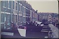
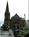
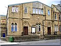
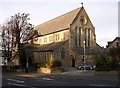
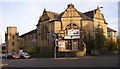
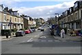
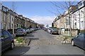
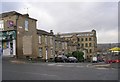
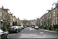
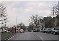
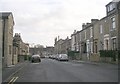
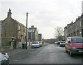
Photos of BD7 2TD
Area Information
Living in BD7 2TD means being part of a compact, densely populated residential cluster within the heart of Bradford, England. The area covers just 1.1 hectares, yet it accommodates 1,741 residents, resulting in a high population density of 1,665 people per square kilometre. This small postcode area is situated in the City of Bradford Metropolitan District Council, a ward defined by its central urban boundaries rather than standalone district status. Daily life here is shaped by proximity to the city’s core, with easy access to retail, transport, and educational institutions. The area’s youthful median age of 22 and a majority of residents aged 30–64 suggest a mix of young professionals and families. While the housing stock consists primarily of houses, the low home ownership rate of 28% indicates a rental-dominated market. This small area, though limited in size, offers a microcosm of Bradford’s urban character, blending residential living with the city’s broader infrastructure and amenities.
- Area Type
- Postcode
- Area Size
- 1.1 hectares
- Population
- 1741
- Population Density
- 1665 people/km²
The property market in BD7 2TD is characterised by a low home ownership rate of 28%, indicating that the majority of residents are renters rather than homeowners. The area’s housing stock is primarily composed of houses, which is notable given the high population density of 1,665 people per square kilometre. This suggests a limited supply of housing in a small area, potentially driving competition among buyers and renters. For homebuyers, the small size of BD7 2TD means that properties are likely to be concentrated within a tight radius, with limited scope for expansion. The predominance of houses may appeal to families seeking more space, but the low ownership rate implies that the area is more suited to those prioritising rental flexibility over long-term investment. Buyers should consider the area’s compact nature and the potential for high demand in a constrained market.
House Prices in BD7 2TD
Showing 34 properties
| Address | Type | Beds | Baths | Last Sale Price | Last Sale Date | |
|---|---|---|---|---|---|---|
| 34 Telford Court, Bradford, BD7 2TD | Flat | - | - | £60,000 | Feb 2006 | |
| 32 Telford Court, Bradford, BD7 2TD | Flat | - | - | - | - | |
| 8 Telford Court, Bradford, BD7 2TD | Flat | - | - | - | - | |
| 22 Telford Court, Bradford, BD7 2TD | Bungalow | - | - | - | - | |
| 2 Telford Court, Bradford, BD7 2TD | Flat | - | - | - | - | |
| 10 Telford Court, Bradford, BD7 2TD | Flat | - | - | - | - | |
| 30 Telford Court, Bradford, BD7 2TD | Flat | - | - | - | - | |
| 28 Telford Court, Bradford, BD7 2TD | Flat | - | - | - | - | |
| 14 Telford Court, Bradford, BD7 2TD | Flat | - | - | - | - | |
| 16 Telford Court, Bradford, BD7 2TD | Flat | - | - | - | - |
Energy Efficiency in BD7 2TD
The lifestyle in BD7 2TD is shaped by its proximity to retail and transport hubs. Nearby retail options include Asda Bradford, Morrisons Scholemoor, and Asda Little, providing residents with access to essential shopping and services. The area’s rail network, with five stations within practical reach, ensures convenient travel for commuting or leisure. While the data does not mention parks or recreational facilities, the presence of multiple retail and transport options suggests a focus on urban convenience. The compact nature of the area means that amenities are closely clustered, reducing the need for long commutes. However, the absence of specific details about leisure or green spaces leaves gaps in understanding the full range of lifestyle opportunities available to residents.
Amenities
Schools
Residents of BD7 2TD have access to a range of primary and secondary educational institutions. Nearby primary schools include Princeville Primary School, St William’s Catholic Primary School, and Willowfield School, all of which cater to younger children. For secondary education, Eden Boys’ Leadership Academy, Bradford is an outstanding-rated academy, offering a strong academic and leadership-focused curriculum. Co-op Academy Princeville, another academy in the area, holds a good Ofsted rating. The mix of primary schools and academies provides families with multiple options, from traditional primary education to specialist academies. The proximity of these schools to the area suggests that families with children have access to a variety of educational pathways, though the specific catchment areas for each school are not detailed in the data.
| Rank | School | Type | Entry gender | Ages |
|---|
Explore more schools in this area
Go to Schools tabDemographics
BD7 2TD has a median age of 22, with the most common age range being adults aged 30–64. This suggests a community that balances younger residents with a significant proportion of middle-aged individuals. Home ownership is low at 28%, indicating that most residents rent their homes. The area is predominantly composed of houses, which is unusual for a high-density postcode, and the dominant ethnic group is the Asian population. The population density of 1,665 people per square kilometre reflects a tightly packed urban environment, which can influence social dynamics and access to shared resources. While specific data on deprivation is not provided, the high density and rental market suggest potential challenges in housing affordability and community cohesion. The presence of a large Asian population may contribute to cultural diversity, though this is not quantified in the data.
Household Size
Accommodation Type
Tenure
Ethnic Group
Religion
Household Composition
Age
Household Deprivation
NS-SEC
Explore more demographic insights in this area
Go to Demographics tabPlanning
Planning Constraints
- Flood RiskPremium
- Ramsar Wetland SitesPremium
- Area of Outstanding Natural BeautyPremium
- Protected Nature ReservePremium
- Protected WoodlandPremium