Area Overview for BD7 2EP
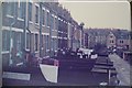
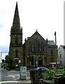
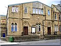
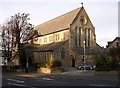
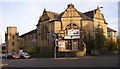
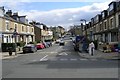
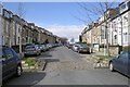
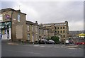
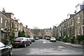
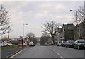
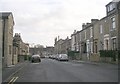
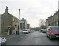
Photos of BD7 2EP
Area Information
Living in BD7 2EP means being part of a densely populated, compact residential area within the heart of Bradford, West Yorkshire. The postcode covers just 2,091 square metres, housing 2,109 residents in a tightly packed urban setting. This area is defined by its central location within the City of Bradford Metropolitan District Council, bounded by the inner ring road. Daily life here is shaped by proximity to the city’s core, with easy access to transport networks and retail hubs. The area’s small size means residents share a close-knit environment, though the high population density of 1,008,714 people per square kilometre reflects the challenges of urban living. Historically, the ward has been a focal point for civic and cultural activity, with landmarks like Bradford City Hall nearby. While the area lacks green spaces or natural constraints, its strategic position offers convenience for those prioritising connectivity over open space. For buyers, BD7 2EP represents a blend of urban practicality and accessibility, though the compact footprint means every amenity is within walking distance.
- Area Type
- Postcode
- Area Size
- 2091 m²
- Population
- 2109
- Population Density
- 12290 people/km²
The property market in BD7 2EP is characterised by high home ownership (73%) and a focus on houses, which is atypical for a densely populated urban postcode. This suggests a mix of semi-detached or terraced homes, likely built to accommodate the area’s historical role as a central urban ward. Given the small area size and high population density, the housing stock is likely limited, with little scope for new developments. The predominance of owner-occupied properties indicates a stable market, though buyers should consider the challenges of urban living, such as limited green space and potential noise. The proximity to transport hubs and retail centres may offset these drawbacks, making the area appealing to those prioritising convenience. However, the compact footprint means properties are likely smaller, and buyers should assess whether the urban environment aligns with their lifestyle preferences. The market is unlikely to cater to those seeking large homes or extensive outdoor space.
House Prices in BD7 2EP
Showing 18 properties
| Address | Type | Beds | Baths | Last Sale Price | Last Sale Date | |
|---|---|---|---|---|---|---|
| 13 Warrenton Place, Bradford, BD7 2EP | Terraced | 2 | - | £68,000 | Jul 2018 | |
| 19 Warrenton Place, Bradford, BD7 2EP | Terraced | 2 | 1 | £51,000 | Sep 2017 | |
| 7 Warrenton Place, Bradford, BD7 2EP | house | - | - | £58,000 | May 2016 | |
| 3 Warrenton Place, Bradford, BD7 2EP | house | - | - | £48,000 | Mar 2014 | |
| 5 Warrenton Place, Bradford, BD7 2EP | house | - | - | £70,000 | Aug 2012 | |
| 29 Warrenton Place, Bradford, BD7 2EP | Terraced | - | - | £127,000 | Nov 2007 | |
| 17 Warrenton Place, Bradford, BD7 2EP | Terraced | 3 | 1 | £80,000 | Oct 2007 | |
| 21 Warrenton Place, Bradford, BD7 2EP | house | - | - | £95,000 | Oct 2006 | |
| 35 Warrenton Place, Bradford, BD7 2EP | house | - | - | £118,000 | Sep 2006 | |
| 9 Warrenton Place, Bradford, BD7 2EP | Terraced | - | - | £72,000 | Aug 2005 |
Energy Efficiency in BD7 2EP
Life in BD7 2EP revolves around its compact urban layout, with amenities clustered closely. Retail options include major supermarkets like Asda Bradford, Tesco Bradford, and Aldi Clayton, ensuring easy access to groceries and daily essentials. The area’s railway stations—Bradford Forster Square, Bradford Interchange, and others—provide reliable public transport links, connecting residents to surrounding areas. While the postcode lacks parks or green spaces, its proximity to Bradford’s city centre offers cultural and leisure opportunities. The presence of multiple schools and a young population suggests a family-friendly environment, though social life may depend on nearby venues. The high population density means shared spaces are common, but the area’s convenience and accessibility make it practical for those prioritising connectivity over open space. Overall, BD7 2EP offers a compact, functional lifestyle with essential services within walking distance.
Amenities
Schools
Residents of BD7 2EP have access to several primary schools, including Horton Grange Primary School and Farnham Primary School, both of which hold a ‘good’ Ofsted rating. Waverley Middle School is also listed, though its type is inconsistently noted as primary. The presence of multiple primary schools suggests the area is well-served for families with young children, though no secondary schools are mentioned. The ‘good’ ratings at Horton Grange and Farnham indicate above-average standards, which is reassuring for parents. However, the lack of secondary school options may require families to travel further for secondary education. The concentration of primary schools reflects the area’s role as a residential hub for families, with schools positioned to serve the local population. For buyers prioritising education, the availability of rated primary schools is a key advantage, though secondary schooling may necessitate additional planning.
| Rank | School | Type | Entry gender | Ages |
|---|
Explore more schools in this area
Go to Schools tabDemographics
The community in BD7 2EP is predominantly composed of adults aged 30–64, with a median age of 22, suggesting a mix of young professionals and families. Home ownership is high at 73%, indicating a stable residential population, though the area’s small size means most properties are owner-occupied rather than rented. The accommodation type is primarily houses, which is unusual for a densely packed urban postcode, hinting at a mix of semi-detached or terraced housing. The predominant ethnic group is the Asian community, though specific subgroups are not detailed. The age profile suggests a balance between working-age residents and younger families, with no data on deprivation levels. This demographic mix supports a local economy reliant on retail and transport, with nearby schools and amenities catering to both children and adults. The high home ownership rate and presence of families indicate a long-term commitment to the area, though the compact size may limit opportunities for expansion or new development.
Household Size
Accommodation Type
Tenure
Ethnic Group
Religion
Household Composition
Age
Household Deprivation
NS-SEC
Explore more demographic insights in this area
Go to Demographics tabPlanning
Planning Constraints
- Flood RiskPremium
- Ramsar Wetland SitesPremium
- Area of Outstanding Natural BeautyPremium
- Protected Nature ReservePremium
- Protected WoodlandPremium