Area Overview for BD7 2AJ
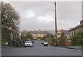
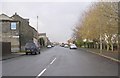
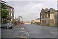
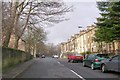
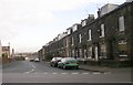
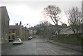
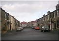
Photos of BD7 2AJ

Area Information
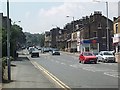
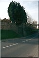
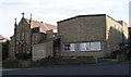
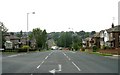
BD7 2AJ is a compact residential postcode nestled in Great Horton, a historic ward within Bradford, West Yorkshire. Covering just 3.4 hectares, it is densely populated, with 1,483 residents packed into 43,979 people per square kilometre. This small area lies approximately 2.5 miles south-west of Bradford city centre, blending urban convenience with preserved heritage. Great Horton’s conservation area safeguards 17th- to 19th-century buildings, including listed structures like Hall’s House and the Old Bell Chapel, alongside 18th-century workers’ housing. The area’s character is shaped by its industrial past, with cotton mills and chapels from the 1800s now integrated into modern living. Daily life here balances proximity to Bradford’s amenities with a quieter, historically rich environment. While the population density is exceptionally high, the community feels tightly knit, with a median age of 47 and a strong presence of adults aged 30–64. The area’s mix of conservation and contemporary living makes it distinctive, offering a glimpse into Bradford’s evolving identity.
- Area Type
- Postcode
- Area Size
- 3.4 hectares
- Population
- 1483
- Population Density
- 4487 people/km²
The property market in BD7 2AJ is dominated by owner-occupied homes, with 78% of residents in private residences. The area is primarily composed of houses rather than flats, which is atypical for a small, densely populated postcode. This suggests a mix of older, historic properties—many preserved in the conservation area—and more recent builds catering to the area’s high demand. The limited size of BD7 2AJ (3.4 hectares) means the housing stock is finite, and buyers may need to look beyond the immediate postcode for options. The presence of listed buildings and conservation area restrictions could influence property values, with historic homes potentially commanding premium prices. For buyers, this area offers a chance to own a home in a preserved historic setting, though the small footprint may limit availability.
House Prices in BD7 2AJ
Showing 1 properties
| Address | Type | Beds | Baths | Last Sale Price | Last Sale Date | |
|---|---|---|---|---|---|---|
| Multi Packaging Solutions Uk, Mps Front Of, Chesapeake Branded Packaging, Chelsea Road, Bradford, BD7 2AJ | Office | - | - | - | - |
Energy Efficiency in BD7 2AJ
Living in BD7 2AJ offers a blend of convenience and character. Within practical reach are five retail outlets, including Aldi Clayton, Heron Clayton, and Tesco Bradford, providing everyday shopping needs. The area’s proximity to Bradford’s rail network—five stations within walking distance—ensures easy access to the city’s cultural and commercial hubs. Horton Park, opened in 1878, offers green space for recreation, while the Great Horton Conservation Area preserves historic buildings like Hall’s House and the Old Bell Chapel. This mix of retail, transport, and heritage creates a lifestyle that balances modern essentials with a sense of history. The compact nature of the area means amenities are close, though the high population density may mean shared spaces. For residents, daily life is shaped by a tight-knit community, accessible services, and a preserved urban landscape.
Amenities
Schools
| Rank | School | Type | Entry gender | Ages |
|---|
Explore more schools in this area
Go to Schools tabDemographics
The population of BD7 2AJ is predominantly adults aged 30–64, with a median age of 47. Over three-quarters of residents—78%—own their homes, reflecting a strong owner-occupied market. The area is primarily composed of houses, not flats, which is unusual for a densely packed postcode. The predominant ethnic group is Asian, shaping the community’s cultural fabric. With 1,483 people in just 3.4 hectares, the population density of 43,979 per square kilometre is among the highest in the UK, indicating a compact, possibly multi-generational living environment. This density may mean limited private space but also a close-knit community. The high home ownership rate suggests stability, though the lack of specific deprivation data means quality of life factors like access to services and green space must be inferred from the area’s amenities and infrastructure.
Household Size
Accommodation Type
Tenure
Ethnic Group
Religion
Household Composition
Age
Household Deprivation
NS-SEC
Explore more demographic insights in this area
Go to Demographics tabPlanning
Planning Constraints
- Flood RiskPremium
- Ramsar Wetland SitesPremium
- Area of Outstanding Natural BeautyPremium
- Protected Nature ReservePremium
- Protected WoodlandPremium