Area Overview for BD7 1QG
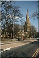
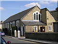
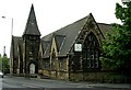
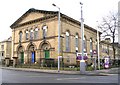
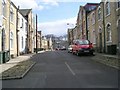
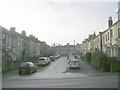
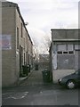
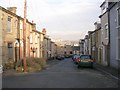
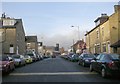
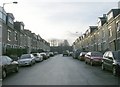
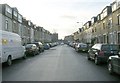
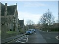
Photos of BD7 1QG
Area Information
Living in BD7 1QG means being part of a tightly packed residential cluster in the heart of Bradford, West Yorkshire. This postcode covers just 1.3 hectares, yet it is home to 2,051 people, creating a densely populated urban environment. The area sits within the City Ward, a central electoral district bounded by the inner ring road, and is part of the broader Bradford metropolitan area. Daily life here is shaped by proximity to the city’s core, with easy access to retail, transport, and public services. The community is defined by its compact nature, where homes are closely spaced and shared spaces are limited. While the area lacks green expanses, its strategic location offers convenience for commuters and access to the city’s cultural and economic hubs. With a median age of 22, the population skews younger, though the most common age group is adults aged 30–64, suggesting a mix of long-term residents and newer arrivals. The area’s character is influenced by its demographic makeup, with the Asian community forming the predominant ethnic group. For those considering BD7 1QG, the challenge lies in navigating its density, while the reward is proximity to essential services and transport links.
- Area Type
- Postcode
- Area Size
- 1.3 hectares
- Population
- 2051
- Population Density
- 7622 people/km²
The property market in BD7 1QG is characterised by a 40% home ownership rate, indicating that a majority of properties are rented rather than owned. This suggests a rental market that caters to younger residents, students, or those seeking temporary housing in the city centre. The accommodation type is predominantly houses, which is notable in a small, densely populated area. This mix may reflect a combination of family homes and smaller properties, though the exact distribution of property sizes is not specified. The high population density of 162,665 people per square kilometre means that housing stock is limited, and properties are closely spaced. For buyers, this presents both challenges and opportunities: the area’s compact nature may limit availability, but its proximity to transport, retail, and schools could make it attractive for those prioritising convenience. However, the high density and focus on houses may also mean that properties are smaller or older, requiring careful consideration of space and condition. The market is likely competitive, with demand driven by the area’s central location and access to essential services.
House Prices in BD7 1QG
Showing 100 properties (first 250)
Energy Efficiency in BD7 1QG
Residents of BD7 1QG have access to a range of amenities within practical reach, including five retail venues such as Asda Little, Lidl Bankfoot, and Spar Manchester. These shops provide convenience for daily errands, from groceries to household essentials. The area’s proximity to multiple railway stations, including Bradford Interchange and Forster Square, adds to its connectivity, enabling easy travel to other parts of the city. While the data does not mention parks or leisure facilities, the compact nature of the area suggests that public spaces may be limited, with residents relying more on nearby urban amenities. The presence of multiple retail outlets and transport options contributes to a practical, urban lifestyle, though the high population density may mean that communal spaces are shared among many. For those prioritising convenience and access to services, BD7 1QG offers a functional environment, though the lack of green spaces may be a drawback for those seeking more relaxed surroundings.
Amenities
Schools
The primary school nearest to BD7 1QG is Copthorne Primary School, which holds an outstanding Ofsted rating. This school serves the local community and is a key consideration for families prioritising education. As a primary school, it caters to children aged 4–11, though the data does not specify the presence of secondary schools in the immediate vicinity. The outstanding rating suggests that the school provides high-quality education, with strong performance in academic and pastoral care. For parents, this is a significant advantage, as it reduces the need for long commutes to other educational institutions. However, the absence of secondary school information in the data means that families may need to look further afield for secondary education. The presence of a well-rated primary school enhances the area’s appeal, particularly for those with young children, though the limited range of educational institutions may be a consideration for long-term residents.
| Rank | School | Type | Entry gender | Ages |
|---|
Explore more schools in this area
Go to Schools tabDemographics
The population of BD7 1QG is 2,051 people, with a median age of 22, reflecting a younger demographic than the national average. However, the most common age range is adults aged 30–64, indicating a stable core of middle-aged residents. Home ownership in the area stands at 40%, suggesting that a significant portion of the housing stock is rented out, likely to younger individuals or families. The accommodation type is predominantly houses, which is unusual in a densely populated urban area, hinting at a mix of family homes and smaller properties. The predominant ethnic group is the Asian community, which shapes the cultural and social fabric of the area. The population density of 162,665 people per square kilometre is exceptionally high, comparable to major city centres, which may influence the sense of community and access to shared spaces. This density also means that amenities and services are closely concentrated, though it may contribute to a more intense urban living experience. The data does not provide direct information on deprivation levels, but the high population density and housing type suggest a balance between affordability and limited space.
Household Size
Accommodation Type
Tenure
Ethnic Group
Religion
Household Composition
Age
Household Deprivation
NS-SEC
Explore more demographic insights in this area
Go to Demographics tabPlanning
Planning Constraints
- Flood RiskPremium
- Ramsar Wetland SitesPremium
- Area of Outstanding Natural BeautyPremium
- Protected Nature ReservePremium
- Protected WoodlandPremium