Area Overview for BD6 3XA
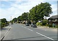
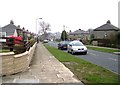
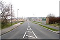
Photos of BD6 3XA
Area Information
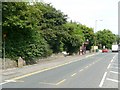
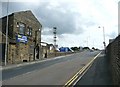
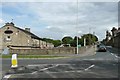
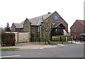
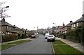
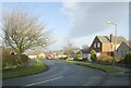
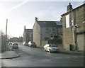
Living in BD6 3XA, a small residential cluster in Queensbury, West Yorkshire, offers a blend of historical charm and modern convenience. The area spans 5,629 square metres and is home to 1,592 people, creating a densely populated yet compact community. Queensbury’s origins as a resting point on the 1740 Bradford-Halifax turnpike road are still evident, with historic buildings like the Baptist chapel (1820) and Black Dyke Mills (1820s–1890s) anchoring the conservation area. Residents benefit from proximity to railway stations such as Low Moor and Bradford Interchange, while the village retains a village feel with local shops like Tesco Queensbury and Heron Clayton. The area’s compact size means amenities are within practical reach, and its low crime risk (Safety Score 69/100) adds to its appeal. For those seeking a mix of heritage and accessibility, BD6 3XA provides a distinct living experience in a well-connected part of Bradford.
- Area Type
- Postcode
- Area Size
- 5629 m²
- Population
- 1592
- Population Density
- 4207 people/km²
The property market in BD6 3XA is characterised by a high rate of home ownership (66%) and a focus on houses rather than flats or apartments. This suggests a community of long-term residents who value private, family-oriented living spaces. The small area size (5,629 m²) and high population density mean the housing stock is likely limited, with little scope for new developments. For buyers, this implies a competitive market for existing properties, particularly houses, which may hold their value due to the area’s historical significance and low environmental constraints. However, the lack of rental market data means it is unclear whether the area attracts investors or is primarily owner-occupied. Buyers should consider the compact nature of the area and its proximity to amenities when evaluating properties.
House Prices in BD6 3XA
Showing 19 properties
| Address | Type | Beds | Baths | Last Sale Price | Last Sale Date | |
|---|---|---|---|---|---|---|
| 12 Bittern Court, Bradford, BD6 3XA | Semi-detached | 2 | 1 | £149,950 | Nov 2025 | |
| 3 Bittern Court, Bradford, BD6 3XA | Semi-detached | 3 | 2 | £197,000 | Jun 2024 | |
| 5 Bittern Court, Bradford, BD6 3XA | Semi-detached | 2 | 1 | £129,000 | Feb 2022 | |
| 14 Bittern Court, Bradford, BD6 3XA | Terraced | 2 | 1 | £127,000 | Feb 2021 | |
| 10 Bittern Court, Bradford, BD6 3XA | Semi-detached | 2 | 1 | £115,000 | Oct 2020 | |
| 9 Bittern Court, Bradford, BD6 3XA | Flat | - | - | £85,000 | Nov 2019 | |
| 16 Bittern Court, Bradford, BD6 3XA | Flat | - | - | £79,950 | Apr 2019 | |
| 22 Bittern Court, Bradford, BD6 3XA | Semi-detached | 5 | 1 | £168,000 | Oct 2018 | |
| 2 Bittern Court, Bradford, BD6 3XA | Terraced | 3 | 2 | £122,500 | Aug 2017 | |
| 11 Bittern Court, Bradford, BD6 3XA | Flat | - | - | £76,000 | Aug 2016 |
Energy Efficiency in BD6 3XA
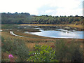
Residents of BD6 3XA have access to a range of local amenities within practical reach. The retail sector includes Tesco Queensbury, Heron Clayton, and Aldi Clayton, providing everyday shopping needs. The area’s historical character is complemented by its proximity to the Queensbury Conservation Area, which features sites like the Baptist chapel (1820) and Black Dyke Mills (1820s–1890s). While no parks or leisure facilities are explicitly named in the data, the village’s compact layout ensures a walkable environment. The presence of railway stations and historic roads adds to the area’s convenience, blending practicality with heritage. For those seeking a mix of retail, history, and accessibility, BD6 3XA offers a lifestyle that balances tradition with modern necessities.
Amenities
Schools
| Rank | School | Type | Entry gender | Ages |
|---|
Explore more schools in this area
Go to Schools tabDemographics
The community in BD6 3XA is predominantly composed of adults aged 30–64, with a median age of 47. This suggests a mature population, likely with established careers and families. Home ownership is high at 66%, with houses being the primary accommodation type, indicating a stable, long-term resident base. The predominant ethnic group is White, reflecting the area’s historical roots and limited demographic diversity. The high population density (282,814 people per square kilometre) means the area is tightly packed, which could influence social dynamics and community cohesion. While no specific data on deprivation is provided, the high home ownership rate and low crime risk imply a relatively stable quality of life, with residents prioritising security and permanence in their housing choices.
Household Size
Accommodation Type
Tenure
Ethnic Group
Religion
Household Composition
Age
Household Deprivation
NS-SEC
Explore more demographic insights in this area
Go to Demographics tabPlanning
Planning Constraints
- Flood RiskPremium
- Ramsar Wetland SitesPremium
- Area of Outstanding Natural BeautyPremium
- Protected Nature ReservePremium
- Protected WoodlandPremium