Area Overview for BD6 3WZ
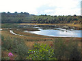
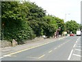
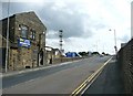
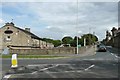
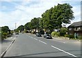
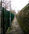
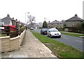
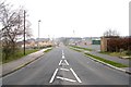
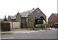
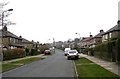
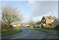
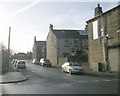
Photos of BD6 3WZ
Area Information
Living in BD6 3WZ, a small residential cluster in the village of Queensbury, West Yorkshire, offers a blend of historical charm and modern convenience. Nestled in the City of Bradford district, this area spans 4,940 square metres and is home to 1,592 residents, creating a densely populated yet compact community. Queensbury’s origins trace back to the 18th century, when it served as a resting point on the Bradford-Halifax turnpike road. Today, its character is defined by historic buildings, including the 1845 Holy Trinity Church and the Black Dyke Mills, which once powered the local economy. The area’s proximity to nearby towns like Halifax and Boothtown, combined with its elevation of 335 metres above sea level, offers both scenic views and practical connectivity. Residents benefit from nearby amenities such as Tesco Queensbury and Lidl Shelf, while rail links to Low Moor and Bradford Interchange provide access to regional transport networks. This postcode is ideal for those seeking a traditional, tightly knit neighbourhood with a rich heritage and accessible infrastructure.
- Area Type
- Postcode
- Area Size
- 4940 m²
- Population
- 1592
- Population Density
- 4207 people/km²
The property market in BD6 3WZ is characterised by a strong emphasis on owner-occupied homes, with 66% of properties owned by residents rather than rented. The accommodation type is predominantly houses, reflecting the area’s historic development as a village with detached and semi-detached dwellings. This contrasts with urban areas where flats or apartments dominate. The small size of the area—just 4,940 square metres—means the housing stock is limited, creating a niche market where properties are likely to be in high demand. For buyers, this implies a focus on individual homes rather than larger developments. The presence of historic buildings, such as the Black Dyke Mills and Holy Trinity Church, may also influence property values, with heritage features adding to their appeal. However, the small footprint of the area means that buyers must consider proximity to nearby towns for additional amenities.
House Prices in BD6 3WZ
Showing 19 properties
| Address | Type | Beds | Baths | Last Sale Price | Last Sale Date | |
|---|---|---|---|---|---|---|
| 1 Yeoman Court, Bradford, BD6 3WZ | Semi-detached | 2 | 2 | £120,595 | Jan 2022 | |
| 6 Yeoman Court, Bradford, BD6 3WZ | Detached | 3 | 1 | £178,500 | Mar 2020 | |
| 3 Yeoman Court, Bradford, BD6 3WZ | Semi-detached | 2 | - | £118,000 | Aug 2019 | |
| 20 Yeoman Court, Bradford, BD6 3WZ | Semi-detached | 3 | 2 | £137,000 | Jun 2019 | |
| 9 Yeoman Court, Bradford, BD6 3WZ | Semi-detached | 4 | 3 | £146,000 | Apr 2019 | |
| 11 Yeoman Court, Bradford, BD6 3WZ | house | 3 | 2 | £140,000 | Jan 2019 | |
| 2 Yeoman Court, Bradford, BD6 3WZ | Semi-detached | 3 | 2 | £130,500 | Nov 2016 | |
| 17 Yeoman Court, Bradford, BD6 3WZ | Semi-detached | 3 | 2 | £123,000 | Aug 2014 | |
| 19 Yeoman Court, Bradford, BD6 3WZ | house | - | - | £115,000 | May 2012 | |
| 15 Yeoman Court, Bradford, BD6 3WZ | house | 3 | - | £150,000 | Aug 2008 |
Energy Efficiency in BD6 3WZ
Residents of BD6 3WZ have access to a range of local amenities within practical reach. The retail sector includes Tesco Queensbury, Lidl Shelf, and Heron Clayton, providing everyday shopping needs. These stores cater to a community that values convenience, with a mix of national chains and local businesses. The area’s historic character is complemented by its transport links, with rail stations like Low Moor and Bradford Interchange offering easy access to cultural and commercial centres. While the data does not specify parks or recreational facilities, the village’s conservation area status suggests preserved green spaces and heritage sites. The presence of the National School (now Russell Hall First School) and historic churches indicates a community focused on education and tradition. Overall, daily life in BD6 3WZ balances practicality with the charm of a historic village setting.
Amenities
Schools
| Rank | School | Type | Entry gender | Ages |
|---|
Explore more schools in this area
Go to Schools tabDemographics
The population of BD6 3WZ is 1,592, with a population density of 322,283 people per square kilometre, reflecting a closely knit community. The median age is 47, with the majority of residents aged 30–64, indicating a mature demographic skewed towards adults. Home ownership rates stand at 66%, suggesting a stable, long-term resident base. The predominant accommodation type is houses, aligning with the area’s traditional village layout. The predominant ethnic group is White, which is consistent with broader trends in the region. This demographic profile implies a community with established roots, where family homes and local institutions like the National School (built in 1850) remain central to daily life. The high proportion of owner-occupied properties also suggests a low turnover of residents, fostering a sense of continuity and familiarity.
Household Size
Accommodation Type
Tenure
Ethnic Group
Religion
Household Composition
Age
Household Deprivation
NS-SEC
Explore more demographic insights in this area
Go to Demographics tabPlanning
Planning Constraints
- Flood RiskPremium
- Ramsar Wetland SitesPremium
- Area of Outstanding Natural BeautyPremium
- Protected Nature ReservePremium
- Protected WoodlandPremium