Area Overview for BD6 3UD
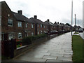
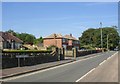
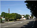
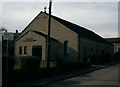
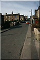
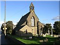
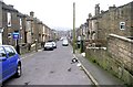
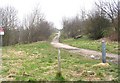
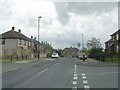
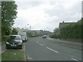
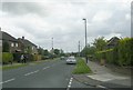
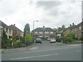
Photos of BD6 3UD
Area Information
Living in BD6 3UD means being part of a tightly knit residential cluster in the Royds ward of Bradford, a historically significant area with a strong sense of community. The postcode covers just 1.6 hectares, housing 2,096 people in a densely populated space. This area, once marked by deprivation in the 1990s, has transformed through regeneration efforts, including the £5 million Enterprise Park, which now employs over 300 locals. The ward blends suburban housing with community-focused amenities, from the Grade II* listed Royds Hall to the Royds Healthy Living Centre. Proximity to schools like Reevy Hill Primary and Buttershaw Middle School, along with nearby rail stations such as Low Moor and Bradford Interchange, ensures connectivity to Bradford’s city centre and beyond. Daily life here balances suburban tranquility with the vibrancy of nearby retail hubs like Tesco Bradford and Lidl Shelf. The area’s character is shaped by its history of community-led renewal, offering residents a mix of heritage and modern infrastructure.
- Area Type
- Postcode
- Area Size
- 1.6 hectares
- Population
- 2096
- Population Density
- 5264 people/km²
The property market in BD6 3UD is characterised by a 43% home ownership rate, suggesting that most residents rent rather than own their homes. The area’s accommodation is primarily houses, reflecting a suburban rather than high-density housing stock. Given the postcode’s small size (1.6 hectares), the housing stock is limited, and the immediate surroundings likely offer similar patterns. For buyers, this means competition for available properties, particularly given the area’s recent regeneration and proximity to amenities. The focus on owner-occupied homes is modest, indicating a rental market driven by local employment opportunities at the Enterprise Park and nearby businesses. Prospective buyers should consider the area’s compact nature and the potential for limited housing choices.
House Prices in BD6 3UD
Showing 35 properties
| Address | Type | Beds | Baths | Last Sale Price | Last Sale Date | |
|---|---|---|---|---|---|---|
| 56 Ridings Way, Bradford, BD6 3UD | Semi-detached | 2 | 1 | £110,000 | Jan 2023 | |
| 19 Ridings Way, Bradford, BD6 3UD | Detached | 3 | - | £160,000 | Jun 2021 | |
| 37 Ridings Way, Bradford, BD6 3UD | Semi-detached | 2 | 1 | £88,000 | Oct 2019 | |
| 46 Ridings Way, Bradford, BD6 3UD | Semi-detached | 2 | 2 | £86,000 | Oct 2019 | |
| 29 Ridings Way, Bradford, BD6 3UD | house | 3 | 1 | £125,000 | Jul 2019 | |
| 27 Ridings Way, Bradford, BD6 3UD | Detached | 3 | 2 | £118,000 | Jun 2019 | |
| 54 Ridings Way, Bradford, BD6 3UD | Semi-detached | 2 | 1 | £60,000 | Mar 2019 | |
| 47 Ridings Way, Bradford, BD6 3UD | Semi-detached | 2 | 1 | £90,000 | May 2018 | |
| 53 Ridings Way, Bradford, BD6 3UD | Semi-detached | 2 | 1 | £75,000 | Mar 2018 | |
| 57 Ridings Way, Bradford, BD6 3UD | Semi-detached | 3 | 2 | £71,000 | Apr 2016 |
Energy Efficiency in BD6 3UD
Residents of BD6 3UD have access to a range of amenities within practical reach, including retail options like Tesco Bradford, Lidl Shelf, and Co-op Wibsey. These shops provide daily essentials, while the nearby Enterprise Park offers employment opportunities and a dynamic business environment. The area’s regeneration has also introduced community facilities such as the Royds Healthy Living Centre and multiple sports and health centres. Parks and green spaces, though not explicitly named in the data, are implied through historical references to unmanaged areas transformed by community efforts. The combination of retail, employment, and community-focused amenities creates a convenient lifestyle, blending suburban comfort with urban connectivity.
Amenities
Schools
Nearby schools include Reevy Hill Primary School, Farfield Primary and Nursery School (rated ‘good’ by Ofsted), and Buttershaw Middle School. These are all primary schools, with no secondary schools listed in the data. Families relying on these institutions must plan for secondary education elsewhere, potentially in Bradford’s city centre. The presence of two primary schools with a ‘good’ rating suggests accessible, quality early education, though the absence of secondary options may require commuting. The Royds Community Association’s focus on education, including six Homework Clubs, complements school provision. Parents should verify secondary school options and consider travel times for older children.
| Rank | School | Type | Entry gender | Ages |
|---|
Explore more schools in this area
Go to Schools tabDemographics
BD6 3UD’s population of 2,096 is predominantly adults aged 30–64, with a median age of 47. Only 43% of residents own their homes, indicating a rental-heavy market, while the majority of accommodation is in houses rather than flats. The predominant ethnic group is White, reflecting the area’s historical roots and limited demographic diversity. This age profile suggests a community focused on family life and stability, though the high proportion of renters may indicate economic pressures or a transient population. The ward’s regeneration has improved quality of life, but the lack of data on income levels or deprivation beyond historical context means the full picture of socioeconomic conditions remains partially obscured.
Household Size
Accommodation Type
Tenure
Ethnic Group
Religion
Household Composition
Age
Household Deprivation
NS-SEC
Explore more demographic insights in this area
Go to Demographics tabPlanning
Planning Constraints
- Flood RiskPremium
- Ramsar Wetland SitesPremium
- Area of Outstanding Natural BeautyPremium
- Protected Nature ReservePremium
- Protected WoodlandPremium