Area Overview for BD4 9YS
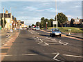
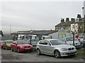
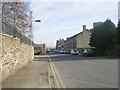
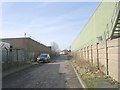
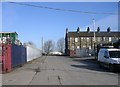
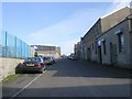
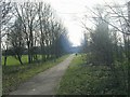
Photos of BD4 9YS


Area Information
Living in BD4 9YS means being part of a small, tightly knit residential cluster in the City of Bradford, West Yorkshire. With a population of 1,273, this area is a quiet extension of the historic village of Tong, known for its 18th-century architecture and conservation status. The ward’s origins trace back to pre-Norman times, with landmarks like St James’s Church and Tong Hall adding historical depth to daily life. Residents benefit from proximity to Tong Lane, a linear village with red-brick and gritstone buildings unique to Bradford. While the area’s size is modest, it offers a blend of heritage and practicality, with nearby railway stations and retail amenities. The low flood risk and absence of environmental constraints make it a stable place to live, though the high crime risk requires attention. For those seeking a balance between tradition and modern convenience, BD4 9YS provides a distinct character within the broader Bradford landscape.
- Area Type
- Postcode
- Area Size
- Not available
- Population
- 1273
- Population Density
- 3637 people/km²
The property market in BD4 9YS is characterised by a low home ownership rate of 39%, suggesting that rental properties may constitute a significant portion of the housing stock. The area’s accommodation type is predominantly houses, which contrasts with higher-density urban areas but aligns with its rural-suburban setting. Given the small population and limited area, the housing stock is likely constrained, making it a niche market for buyers seeking single-family homes. The low flood risk and absence of environmental planning constraints may enhance property appeal, though the high crime risk could deter some investors. For buyers, this small area offers a focused selection of homes, but proximity to larger Bradford districts may be necessary for broader housing options. The historical character of the ward, including listed buildings, could also influence property values and desirability among heritage-focused buyers.
House Prices in BD4 9YS
No properties found in this postcode.
Energy Efficiency in BD4 9YS
The lifestyle in BD4 9YS is shaped by its proximity to retail and transport hubs. Residents can access Morrisons Daily, Farmfoods Home, and Asda Ring for everyday shopping, while nearby railway stations provide links to Bradford’s broader network. The area’s historical character, including Tong’s conservation status and listed buildings like Tong Hall, adds cultural value to daily life. However, the absence of parks or leisure facilities in the data suggests that outdoor recreation may require travel to adjacent areas. The mix of retail and transport options supports a practical lifestyle, though the small population and limited amenities mean community activities may be sparse. For those prioritising convenience over expansive leisure options, BD4 9YS offers a compact, serviceable environment with a focus on heritage and connectivity.
Amenities
Schools
Residents of BD4 9YS have access to several primary schools, including St Columba’s Catholic Primary School, a Voluntary Academy with a ‘good’ Ofsted rating, and Knowleswood Primary School, which appears twice in the data. Holme Middle School is also listed, though its exact type is not specified. The presence of multiple primary schools suggests a focus on early education, with two institutions receiving formal recognition for quality. Families may benefit from competition among schools, potentially offering choices in curriculum or facilities. However, the absence of secondary schools in the data means students may need to travel to nearby areas for further education. The ‘good’ rating at St Columba’s indicates a reliable option for parents prioritising established institutions, while the duplication of Knowleswood Primary School may reflect administrative details rather than additional capacity.
| Rank | A + A* % | School | Type | Entry gender | Ages |
|---|---|---|---|---|---|
| 1 | N/A | St Columba's Catholic Primary School | primary | N/A | N/A |
| 2 | N/A | Holme Middle School | primary | N/A | N/A |
| 3 | N/A | Knowleswood Primary School | primary | N/A | N/A |
| 4 | N/A | St Columba's Catholic Primary School, a Voluntary Academy | primary | N/A | N/A |
| 5 | N/A | Knowleswood Primary School | primary | N/A | N/A |
Explore more schools in this area
Go to Schools tabDemographics
The community in BD4 9YS is predominantly composed of adults aged 30–64, with a median age of 47. Home ownership stands at 39%, indicating a mix of owner-occupied and rental properties, though the latter likely dominates given the small population. The accommodation type is primarily houses, reflecting a residential focus rather than high-density living. The predominant ethnic group is White, with no specific data on diversity beyond this. This age profile suggests a population of middle-aged individuals and families, potentially seeking stability in a low-risk environment. However, the 39% home ownership rate may imply limited long-term investment in property, influencing the local housing market’s dynamics. The absence of detailed deprivation data means quality of life factors like access to services or employment opportunities remain unquantified, though nearby amenities and transport links offer practical support.
Household Size
Accommodation Type
Tenure
Ethnic Group
Religion
Household Composition
Age
Household Deprivation
NS-SEC
Explore more demographic insights in this area
Go to Demographics tabPlanning
Planning Constraints
- Flood RiskLocked
- Ramsar Wetland SitesLocked
- Area of Outstanding Natural BeautyLocked
- Protected Nature ReserveLocked
- Protected WoodlandLocked
- Crime RiskLocked