Area Overview for BD4 8NX
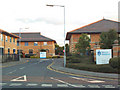
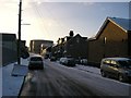
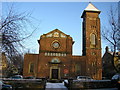
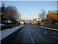
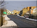
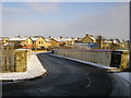
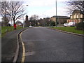
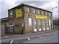
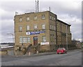
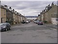
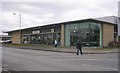
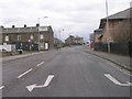
Photos of BD4 8NX
Area Information
BD4 8NX is a small residential postcode in the Bowling and Barkerend area of Bradford, West Yorkshire. With a population of 2,226, it forms part of a compact cluster of homes near the city’s eastern edge. The area is defined by its proximity to the Bradford Inner Ring Road, railway lines, and local streets like Rooley Lane and Otley Road. Historically, it was shaped by industrial landmarks such as Barkerend Mills, established in 1815, and the Barkerend Workhouse, which operated until 1851. Today, the community is served by multiple railway stations, including Bradford Interchange and Forster Square, offering easy access to Bradford city centre and beyond. Leeds Bradford Airport is within reach, adding to the area’s connectivity. Residents benefit from nearby community facilities like St Clement’s Church, which features Pre-Raphaelite art, and the Karmand Centre, which hosts outdoor sports. The area’s mix of historical roots and modern amenities makes it a distinctive choice for those seeking a balance between urban convenience and local character.
- Area Type
- Postcode
- Area Size
- Not available
- Population
- 2226
- Population Density
- 4750 people/km²
BD4 8NX is a small area where houses form the primary accommodation type, reflecting a more traditional housing stock. With a home ownership rate of 39%, the market appears to be split between owner-occupied properties and rental homes. This balance suggests a mix of long-term residents and those in transient housing situations. Given the area’s size, the housing stock is likely limited in variety, with fewer opportunities for new developments. Buyers should consider that the small footprint of the postcode may mean competition for properties, particularly as the area is near transport hubs and amenities. The presence of railway stations and proximity to Bradford city centre could make it attractive for commuters, though the lower home ownership rate may indicate a reliance on rental options. Prospective buyers should also note the lack of high-density housing, which may appeal to those seeking a quieter, more established residential environment.
House Prices in BD4 8NX
No properties found in this postcode.
Energy Efficiency in BD4 8NX
The lifestyle in BD4 8NX is shaped by its proximity to retail, transport, and community hubs. Residents have access to five retail venues, including Spar and Asda, providing convenience for grocery shopping and daily essentials. The area’s five railway stations, such as Bradford Interchange and Forster Square, offer easy access to Bradford city centre and surrounding areas, while Leeds Bradford Airport is within reach for regional travel. Community facilities include the Karmand Centre, which hosts outdoor sports like cricket, and children’s centres that support local families. The area’s historical sites, such as the partially demolished Barkerend Mills, add a layer of cultural interest. While the data does not mention parks or leisure facilities explicitly, the presence of community groups like the Barkerend Environment Group suggests active local engagement. The mix of practical amenities and historical context creates a lifestyle that balances modern convenience with a sense of local identity.
Amenities
Schools
Residents of BD4 8NX have access to a range of local schools, including Fearnville Primary School, Tyersal Middle School, and Meadow Bank Community School. Fearnville Primary School appears twice in the data, suggesting it may serve multiple age groups or have multiple sites. Tyersal Middle School is listed as a primary school, which is unusual for a middle school designation, though this may reflect local administrative categorisations. Meadow Bank Community School is an academy, offering a potentially broader curriculum or governance structure. The mix of primary schools and an academy provides families with options for early education and secondary schooling, though no Ofsted ratings are provided. The presence of multiple schools within close proximity indicates a focus on education accessibility, which is likely a key consideration for families in the area.
| Rank | School | Type | Entry gender | Ages |
|---|
Explore more schools in this area
Go to Schools tabDemographics
The population of BD4 8NX is predominantly adults aged 30–64, with a median age of 47. This suggests a mature, stable community with a focus on established households. Home ownership stands at 39%, indicating that a significant portion of residents rent rather than own their homes. The area is characterised by houses as the primary accommodation type, reflecting a more traditional housing stock compared to high-density developments. The predominant ethnic group is White, though specific data on diversity beyond this is not provided. The age profile and home ownership rate imply a community that may prioritise long-term residency over transient living. With no data on deprivation levels, it is unclear how economic factors might influence quality of life, but the presence of local amenities and transport links suggests a functional infrastructure for daily needs.
Household Size
Accommodation Type
Tenure
Ethnic Group
Religion
Household Composition
Age
Household Deprivation
NS-SEC
Explore more demographic insights in this area
Go to Demographics tabPlanning
Planning Constraints
- Flood RiskPremium
- Ramsar Wetland SitesPremium
- Area of Outstanding Natural BeautyPremium
- Protected Nature ReservePremium
- Protected WoodlandPremium