Area Overview for BD4 7NP
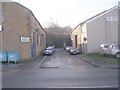
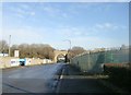
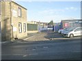
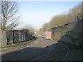
Photos of BD4 7NP
Area Information
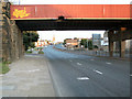
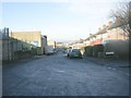
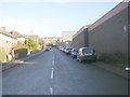
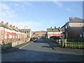
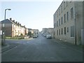
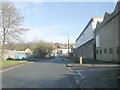
Living in BD4 7NP means residing within a specific residential cluster in the Bowling and Barkerend ward of the City of Bradford Metropolitan District Council. This tiny postcode area covers just 1.4 hectares but houses a population of 1,642 people, creating a very high-density environment. The location sits immediately east and south of Bradford city centre, placing it firmly within the Yorkshire and the Humber region. Historical context shapes the neighbourhood, with boundaries defined by major arteries such as the Bradford Inner Ring Road and the Outer Ring Road, alongside local streets like Rooley Lane and Otley Road. The area encompasses distinct parts of the wider ward, including Barkerend and East Bowling. Residents are close to significant historical landmarks, such as the pre-1738 Barkerend workhouse site and the former Barkerend Mills, founded in 1815. Daily life is characterised by proximity to the railway lines that run from Bradford Interchange to Halifax, as well as the line connecting Bradford to Leeds. This compact footprint suggests a community where services and transport links are within immediate reach of every doorstep.
- Area Type
- Postcode
- Area Size
- 1.4 hectares
- Population
- 1642
- Population Density
- 1857 people/km²
The property market in BD4 7NP is defined by a majority of occupants renting and a scarcity of genuine home ownership opportunities. Only 38 per cent of the local population owns their home, while the remaining 62 per cent likely reside in the private rental sector or other forms of accommodation. The accommodation type for the area is listed specifically as Houses, distinguishing it from areas dominated by flats or terraced estates. This postcode represents a small residential cluster rather than a broad market zone, which often limits buyer choice within the exact boundaries of BD4 7NP. Prospective buyers looking for permanent tenure may find fewer options immediately inside this 1.4 hectare zone and may need to look at the wider Bowling and Barkerend ward for housing stock. The low ownership rate suggests that the market is currently more dynamic for landlords and letting agents than for people seeking to establish equity. Those interested in buying will need to consider the surrounding streets defined by boundaries such as Shipley Airedale Road and Croft Street to find suitable properties. Understanding this ownership split is crucial for anyone evaluating their future financial standing in this part of West Yorkshire.
House Prices in BD4 7NP
Showing 6 properties
| Address | Type | Beds | Baths | Last Sale Price | Last Sale Date | |
|---|---|---|---|---|---|---|
| Former Caravan, 7 Square Street, Bradford, BD4 7NP | Mobile Home | - | - | - | - | |
| Evo Wholesale, 2, Suite 2, St Johns Court, Square Street, Bradford, BD4 7NP | Office | - | - | - | - | |
| 2, Ground Floor, St Johns Court, Square Street, Bradford, BD4 7NP | office_workshop | - | - | - | - | |
| 2, Park Home, 7 Square Street, Bradford, BD4 7NP | Mobile Home | - | - | - | - | |
| 3, Park Home, 7 Square Street, Bradford, BD4 7NP | Mobile Home | - | - | - | - | |
| 1, Park Home, 7 Square Street, Bradford, BD4 7NP | Mobile Home | - | - | - | - |
Energy Efficiency in BD4 7NP
Residents of BD4 7NP enjoy excellent access to retail outlets and rail links within practical reach of thepostcode. There are five prominent retail venues nearby, including Spar, Lidl Undercliffe, and Sainsburys Bradford. These supermarkets provide all weekly food shopping needs from a short distance from any home. Transport links are similarly convenient, with five railway stations available for use. Key stations include Bradford Interchange Railway Station, Bradford Foster Square Railway Station, and Bradford Forster Square Railway Station. Public transport access allows quick journeys into the city centre or towards Halifax. The bowling and Barkerend ward provides a backdrop of history, including St Clement's Church on Barkerend Road, which features Pre-Raphaelite decorations by Sir Edward Burne-Jones. Local community facilities such as the Karmand Centre offer outdoor cricket areas managed by the BD3 Sports Association. Children's centres are also present to support young families. This mix of major supermarkets, railway connections, and local community groups creates a functional lifestyle where daily necessities and leisure activities are easily accessible without requiring long commutes.
Amenities
Schools
| Rank | School | Type | Entry gender | Ages |
|---|
Explore more schools in this area
Go to Schools tabDemographics
The community in BD4 7NP features a mature demographic profile, with a median age of 47 years. The majority of the population falls into the Adults category, specifically those aged between 30 and 64 years. This age distribution indicates a neighbourhood composed largely of working families or established individuals rather than students or young professionals. Home ownership stands at 38 per cent, meaning more than two-thirds of residents rent their homes or live in other tenure arrangements. The accommodation type data confirms that Houses are the predominant form of housing within this specific postcode. The ethnic composition is predominantly White. With a population density of 115,136 people per square kilometre, the area is exceptionally crowded compared to the national average. This high density ensures that social interaction is frequent and community life is concentrated within a very small geographical space. The demographic mix suggests a stable population with long-term residential ties, yet the low ownership rate implies a significant segment of the community relies on the private rental sector for their housing needs.
Household Size
Accommodation Type
Tenure
Ethnic Group
Religion
Household Composition
Age
Household Deprivation
NS-SEC
Explore more demographic insights in this area
Go to Demographics tabPlanning
Planning Constraints
- Flood RiskPremium
- Ramsar Wetland SitesPremium
- Area of Outstanding Natural BeautyPremium
- Protected Nature ReservePremium
- Protected WoodlandPremium