Area Overview for BD4 6SW
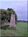
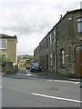
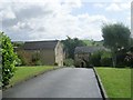
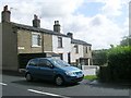
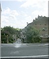
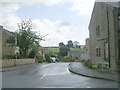
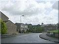
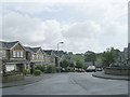
Photos of BD4 6SW
Area Information
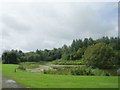
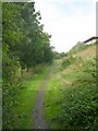
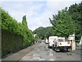
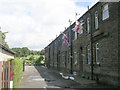
Living in BD4 6SW means inhabiting a small, tightly knit residential cluster in the City of Bradford, West Yorkshire. With a population of 2,081 and a density of 937 people per square kilometre, the area is compact yet rich in historical character. Situated along Tong Lane, it lies southeast of Bradford city centre, within a conservation area that preserves 18th-century architecture, including Grade I listed buildings like Tong Hall and St James’s Church. Daily life here blends modern convenience with heritage; the area’s origins as a pre-Norman settlement are evident in its red-brick and gritstone structures. Residents benefit from proximity to Bradford’s urban amenities while retaining a village-like atmosphere. The community is predominantly home-owning, with 79% of properties owned by residents, and most dwellings are houses rather than flats. This mix of history, density, and practicality makes BD4 6SW a distinctive choice for those seeking a balance between tradition and accessibility.
- Area Type
- Postcode
- Area Size
- Not available
- Population
- 2081
- Population Density
- 937 people/km²
The property market in BD4 6SW is dominated by owner-occupied homes, with 79% of properties owned by residents. This indicates a stable, long-term community rather than a rental-heavy area. The accommodation type is primarily houses, which is unusual for a postcode area of this size but aligns with the village-like character of Tong Ward. This suggests a mix of larger properties, possibly family homes, rather than apartments or terraced housing. For buyers, this means the area is less likely to cater to short-term renters or young professionals seeking smaller units. The small size of the postcode area also means the immediate surroundings are limited, so buyers should consider nearby districts for additional options. The focus on houses may appeal to those prioritising space and permanence, though the market’s depth is constrained by the area’s compact nature.
House Prices in BD4 6SW
No properties found in this postcode.
Energy Efficiency in BD4 6SW
Residents of BD4 6SW have access to nearby retail outlets such as Tesco Low, Asda Ring, and Asda Bradford, providing essential shopping options. The area’s rail stations connect to Bradford’s urban centres, offering access to broader leisure and dining opportunities. While the postcode itself is small, the proximity to Tong’s conservation area adds historical and cultural value, with listed buildings like Tong Hall and St James’s Church offering local interest. The village layout along Tong Lane fosters a close-knit community feel, though amenities are limited to immediate needs. For those prioritising convenience, the area’s practical reach includes basic retail and transport, but more extensive facilities require travel to nearby districts. The blend of heritage and accessibility makes BD4 6SW appealing to those valuing both tradition and practicality.
Amenities
Schools
Residents of BD4 6SW have access to several primary schools, including Woodlands CofE Primary School, Gregory Middle School, St Blaise RC Middle School, and Newhall Park Primary School, which holds a ‘good’ Ofsted rating. Woodlands Church of England Primary Academy also receives a ‘good’ rating. The presence of multiple primary schools suggests a strong local education network, though secondary options are not listed. The mix of church-affiliated and state schools provides families with choices in religious or secular education. The ‘good’ ratings indicate satisfactory standards, but parents should consider proximity and specific school policies when deciding on a home. The concentration of primary schools reflects the area’s family-oriented character, making it appealing to those prioritising education for younger children.
| Rank | School | Type | Entry gender | Ages |
|---|
Explore more schools in this area
Go to Schools tabDemographics
BD4 6SW’s population skews towards adults aged 30–64, with a median age of 47. This suggests a community of established professionals and families, rather than a younger or retired demographic. Home ownership is high at 79%, indicating stability and long-term residency. The area is predominantly occupied by White residents, though specific data on other ethnic groups is not provided. The housing stock consists mainly of houses, reflecting a suburban or semi-rural layout rather than high-density living. This profile aligns with a mature, settled population focused on family life and property investment. The absence of detailed deprivation data means the area’s quality of life cannot be fully assessed, but the high home ownership rate and median age suggest a community prioritising security and continuity over transient lifestyles.
Household Size
Accommodation Type
Tenure
Ethnic Group
Religion
Household Composition
Age
Household Deprivation
NS-SEC
Explore more demographic insights in this area
Go to Demographics tabPlanning
Planning Constraints
- Flood RiskPremium
- Ramsar Wetland SitesPremium
- Area of Outstanding Natural BeautyPremium
- Protected Nature ReservePremium
- Protected WoodlandPremium