Area Overview for BD4 6HG
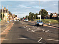
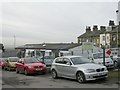
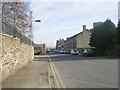
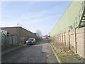
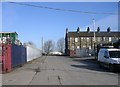
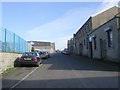
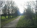
Photos of BD4 6HG


Area Information
Living in BD4 6HG means being part of a compact, residential cluster in the City of Bradford, West Yorkshire. With a population of 2,591 and a high density of 2,292 people per square kilometre, this area is tightly knit, reflecting its historic roots as the Tong Ward. Situated southeast of Bradford city centre along Tong Lane, it retains 18th-century architecture, including Grade I listed buildings like Tong Hall and St James’s Church. The area’s character is defined by its conservation status, with red brick and gritstone structures forming a linear village. Daily life here balances proximity to urban amenities with a sense of historical continuity. Residents benefit from nearby retail hubs, rail links, and schools, while the low flood risk and absence of environmental constraints make it practical for living. However, the area’s small size means its immediate surroundings are crucial for access to broader services. For those seeking a blend of heritage and modern convenience, BD4 6HG offers a distinct, compact lifestyle.
- Area Type
- Postcode
- Area Size
- Not available
- Population
- 2591
- Population Density
- 2292 people/km²
The property market in BD4 6HG is characterised by a 56% home ownership rate, with houses making up the majority of accommodation types. This suggests a market skewed towards owner-occupied properties rather than rentals, though the small area size means the housing stock is limited. The predominance of houses over flats indicates a focus on family homes, which may appeal to buyers seeking space and stability. Given the area’s compact nature, property values are likely influenced by proximity to amenities such as schools, rail stations, and retail hubs. Buyers should consider the limited availability of properties and the importance of nearby infrastructure when evaluating the area. The absence of planning constraints like protected woodlands or AONB designations also makes it practical for development, though the high crime risk may affect desirability.
House Prices in BD4 6HG
No properties found in this postcode.
Energy Efficiency in BD4 6HG
Residents of BD4 6HG enjoy access to essential amenities within practical reach. Retail options include Asda Ring, Asda Bradford, and Morrisons Daily, providing convenience for grocery shopping and daily needs. The area’s rail network, with stations like Bradford Interchange and Low Moor, connects it to broader transport routes, facilitating commuting and travel. While the data does not specify parks or leisure facilities, the conservation area status suggests preserved green spaces, potentially offering recreational opportunities. The presence of multiple primary schools and proximity to historical sites like Tong Hall add cultural and educational value. Overall, the lifestyle in BD4 6HG balances practical amenities with a historic setting, though the small area size means residents must rely heavily on nearby districts for additional services.
Amenities
Schools
Residents of BD4 6HG have access to several primary schools, including St John’s CofE Primary School, which holds an Ofsted rating of outstanding. Other nearby institutions are Bierley CofE First School and Broomwood Middle School, though the latter’s rating is not specified. The presence of multiple primary schools suggests a strong local education network, though secondary options are not listed in the data. For families, the availability of primary education within walking distance is a key advantage, particularly for those prioritising convenience. However, the absence of secondary schools in the immediate area may require residents to travel further for higher education. The outstanding rating at St John’s CofE Primary School highlights a high standard of early education, which could be a significant draw for prospective buyers.
| Rank | School | Type | Entry gender | Ages |
|---|
Explore more schools in this area
Go to Schools tabDemographics
BD4 6HG has a median age of 47, with the majority of residents aged 30–64. This suggests a mature, stable community, likely with established households. Home ownership stands at 56%, indicating a mix of owner-occupied properties and rentals, though the predominance of houses over flats suggests a focus on family homes. The area is predominantly White, with no specific data on other ethnic groups. The population density of 2,292 people per square kilometre implies a closely packed residential environment, which may influence local services and social dynamics. While no deprivation data is provided, the high home ownership rate and presence of schools suggest a middle-income demographic. The absence of significant diversity metrics means the community profile remains largely homogenous, with families forming the core of the population.
Household Size
Accommodation Type
Tenure
Ethnic Group
Religion
Household Composition
Age
Household Deprivation
NS-SEC
Explore more demographic insights in this area
Go to Demographics tabPlanning
Planning Constraints
- Flood RiskPremium
- Ramsar Wetland SitesPremium
- Area of Outstanding Natural BeautyPremium
- Protected Nature ReservePremium
- Protected WoodlandPremium