Area Overview for BD4 6BQ
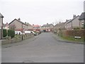
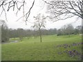
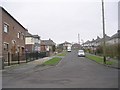
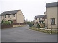
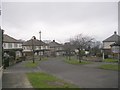
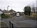
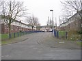
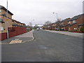
Photos of BD4 6BQ
Area Information
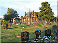
Living in BD4 6BQ means being part of a small, tightly knit residential cluster in the historic Tong Ward of Bradford, West Yorkshire. With a population of 2,660, this area is defined by its compact size and traditional character. The ward, which includes the village of Tong, has roots stretching back to pre-Norman times, with 18th-century buildings like Tong Hall and St James’s Church forming its architectural backbone. Daily life here is shaped by proximity to local amenities, including five retail outlets such as Asda Ring and Farmfoods Home, and five railway stations, including Low Moor and Bradford Interchange, which provide easy access to nearby cities. The area’s conservation status ensures a preserved sense of history, with red brick and gritstone buildings standing out. While it is a quiet, low-density area, its connectivity to Bradford’s urban centres and surrounding regions makes it practical for commuters. The community, skewed toward adults aged 30–64, reflects a mature demographic with a focus on stability, making BD4 6BQ a choice for those seeking a blend of heritage and modern convenience.
- Area Type
- Postcode
- Area Size
- Not available
- Population
- 2660
- Population Density
- 7434 people/km²
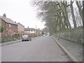
The property market in BD4 6BQ is characterised by a 42% home ownership rate, meaning nearly two-thirds of properties are rented. This suggests a rental market that may be more competitive than owner-occupied, particularly for first-time buyers seeking stability. The area’s accommodation type is predominantly houses, which contrasts with urban areas where flats are more common. This aligns with the ward’s traditional, low-density layout and its conservation area status, which preserves historic buildings like Tong Hall and 18th-century homes. For buyers, this means the housing stock is likely to be older, with characterful features but potentially requiring maintenance. The small size of the area means the immediate surroundings offer limited new builds, so buyers may need to look further afield for modern properties. However, the presence of listed buildings and historic infrastructure could appeal to those prioritising heritage over contemporary amenities.
House Prices in BD4 6BQ
No properties found in this postcode.
Energy Efficiency in BD4 6BQ
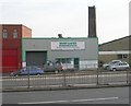
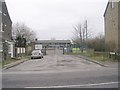
Residents of BD4 6BQ have access to a range of nearby amenities, including five retail outlets such as Asda Ring, Asda Bradford, and Farmfoods Home, offering everyday shopping convenience. The area’s proximity to multiple railway stations, including Low Moor and Bradford Interchange, ensures easy access to public transport for commuting or leisure. While the data does not mention parks or leisure facilities, the historic character of the ward—marked by 18th-century buildings and conservation status—suggests a quiet, low-traffic environment. The blend of traditional architecture and practical amenities creates a lifestyle that balances heritage with modern necessities. For those prioritising convenience, the cluster of shops and transport options makes daily errands and travel efficient, though the area’s small size means larger retail or entertainment options require venturing further afield.
Amenities
Schools
The nearest school to BD4 6BQ is Hambledon First School, a primary school serving the local community. No Ofsted rating is provided in the data, so its educational quality remains unspecified. As a primary school, it caters to younger children, but families requiring secondary education would need to look beyond the area, as no secondary schools are listed. The presence of a primary school suggests the area is suitable for young families, though the absence of higher-level educational institutions may be a consideration for those planning long-term residency. The school’s proximity to homes in BD4 6BQ makes it a practical option for parents, but the limited range of school types highlights the need for additional research into nearby secondary options.
| Rank | School | Type | Entry gender | Ages |
|---|
Explore more schools in this area
Go to Schools tabDemographics
The population of BD4 6BQ is 2,660, with a median age of 47, indicating a community dominated by middle-aged adults. The most common age range is 30–64 years, suggesting a stable, established population with limited youth or elderly presence. Home ownership sits at 42%, meaning nearly 60% of residents rent, which points to a rental market that may be more active than owner-occupied. The area is primarily composed of houses rather than flats, aligning with its traditional, low-density character. The predominant ethnic group is White, though no further breakdown is provided. This demographic profile implies a community focused on long-term living rather than transient populations, with limited data on deprivation levels. The age distribution suggests a balance between family households and single occupants, but the absence of specific figures on household composition or diversity means the area’s social dynamics remain partially opaque.
Household Size
Accommodation Type
Tenure
Ethnic Group
Religion
Household Composition
Age
Household Deprivation
NS-SEC
Explore more demographic insights in this area
Go to Demographics tabPlanning
Planning Constraints
- Flood RiskPremium
- Ramsar Wetland SitesPremium
- Area of Outstanding Natural BeautyPremium
- Protected Nature ReservePremium
- Protected WoodlandPremium