Area Overview for BD3 9WP
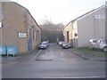
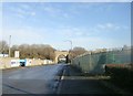
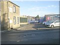
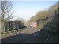
Photos of BD3 9WP
Area Information
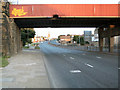
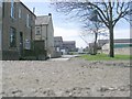
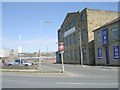
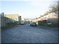
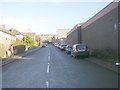
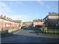
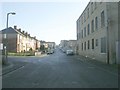
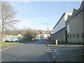
Living in BD3 9WP means residing in a compact residential cluster just east and south of Bradford city centre, within the Bowling and Barkerend electoral ward. This area, bounded by the Bradford Inner Ring Road, railway lines, and local streets like Otley Road, is a mix of historic and modern elements. With a population of 2043, it’s a small but defined community, shaped by its proximity to Bradford’s core. The area includes districts like East Bowling and Goose Hill, with remnants of industrial heritage such as the partially demolished Barkerend Mills. Daily life here is influenced by its transport links, including multiple railway stations and nearby airports, while community spaces like St Clement’s Church and Karmand Centre offer cultural and recreational opportunities. The ward’s boundaries, defined by roads and rail lines, create a distinct identity, blending residential living with accessibility to urban amenities. For those seeking a balance between suburban calm and city connectivity, BD3 9WP offers a compact, practical living environment.
- Area Type
- Postcode
- Area Size
- Not available
- Population
- 2043
- Population Density
- 6550 people/km²
The property market in BD3 9WP is defined by its low home ownership rate (30%) and a focus on houses rather than flats or apartments. This suggests a rental-dominated market with limited owner-occupied properties, which may make purchasing a home here competitive or challenging. The small area’s housing stock likely consists of family homes, given the prevalence of houses, though the exact age and condition of these properties are not specified. Buyers should consider the area’s proximity to Bradford’s amenities, including rail links and retail hubs, which could enhance property value. However, the compact nature of BD3 9WP means the immediate surroundings are critical for assessing housing options. Prospective buyers may need to look beyond the postcode to find properties, balancing the area’s practical connectivity with its limited internal housing supply.
House Prices in BD3 9WP
No properties found in this postcode.
Energy Efficiency in BD3 9WP
Residents of BD3 9WP have access to a range of amenities within practical reach, including five retail outlets such as Lidl Undercliffe, Sainsburys Bradford, and local Spar stores, ensuring daily shopping needs are met. The area’s rail network, with stations like Bradford Interchange, connects to broader transport systems, facilitating travel to work, education, or leisure. Nearby, Karmand Centre offers community activities, including cricket facilities managed by BD3 Sports Association, while St Clement’s Church adds cultural and historical significance. The proximity to Leeds Bradford International Airport provides convenience for travel. While the area lacks large parks or entertainment venues, its compact layout ensures essential services are nearby, supporting a practical, accessible lifestyle. The mix of retail, transport, and community hubs makes BD3 9WP a functional base for those prioritising connectivity over expansive leisure options.
Amenities
Schools
| Rank | School | Type | Entry gender | Ages |
|---|
Explore more schools in this area
Go to Schools tabDemographics
The community in BD3 9WP is predominantly composed of adults aged 30–64, with a median age of 22, suggesting a mix of younger residents and families. Home ownership here is relatively low at 30%, indicating a higher proportion of rental properties. The area is characterised by houses rather than flats, reflecting a focus on single-family dwellings. The predominant ethnic group is Asian, which shapes the cultural fabric of the neighbourhood. This demographic profile suggests a community that may prioritise family-oriented living, though the lower home ownership rate could imply a transient population or reliance on rental markets. The absence of specific deprivation data means quality of life factors like access to services and employment opportunities remain unquantified, but the presence of retail, rail, and community facilities suggests a functional, if modest, living environment.
Household Size
Accommodation Type
Tenure
Ethnic Group
Religion
Household Composition
Age
Household Deprivation
NS-SEC
Explore more demographic insights in this area
Go to Demographics tabPlanning
Planning Constraints
- Flood RiskPremium
- Ramsar Wetland SitesPremium
- Area of Outstanding Natural BeautyPremium
- Protected Nature ReservePremium
- Protected WoodlandPremium