Area Overview for BD3 9QP
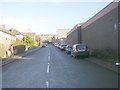
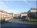
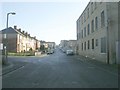
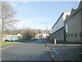
Photos of BD3 9QP
Area Information
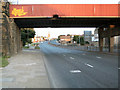
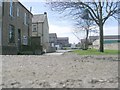
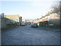
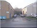
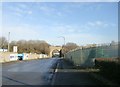
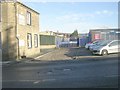
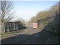
Bowling and Barkerend forms a small residential cluster within the City of Bradford Metropolitan District Council, located immediately east and south of Bradford city centre in West Yorkshire. This specific postcode area, defined by the BD3 9QP designation, encompasses a total land mass of 8264 square metres. Despite its compact size, the location houses a population of 1739 people, creating a dense community environment. The area sits within the Yorkshire and the Humber region, bounded by significant infrastructure including the Bradford Inner Ring Road, the Outer Ring Road, and local streets such as Rooley Lane and Otley Road. Life here is characterised by proximity to major arterial routes and industrial heritage. The landscape remains marked by historical features, including the site of Barkerend Mills founded in 1815 and St Clement's Church, which features Pre-Raphaelite decorations by Sir Edward Burne-Jones. While the area offers convenience through its location near the railway line connecting Bradford Interchange to Halifax, the small footprint means residents operate within a tightly defined neighbourhood. Those considering homes in BD3 9QP must be aware that daily life revolves around this specific, established ward that integrates modern accessibility with deep historical roots. The density means you live amongst a distinct community rather than spread across a vast sprawl.
- Area Type
- Postcode
- Area Size
- 8264 m²
- Population
- 1739
- Population Density
- 5054 people/km²
The property market for BD3 9QP is characterised by a balanced split between ownership and rental living. Home ownership accounts for 47% of residents, indicating that less than half the population owns their homes. The remaining 53% are tenants, suggesting a strong presence of rented accommodation within this postcode area. This split often reflects areas that host students or young professionals who have not yet entered the property ladder. Because the accommodation type is primarily houses, the stock is likely composed of semi-detached or terraced family homes rather than the high-rise flats found in other dense urban centres. Buying homes in BD3 9QP requires navigating a market where the supply is limited due to the small total area size of 8264 square metres. You will find a limited selection of properties because the ward is an electoral ward with small, defined boundaries. The 47% ownership rate signals that many sellers are long-term residents, potentially leading to competition between buyers and landlords. If you are looking for a family home, the prevalence of houses offers a traditional suburban feel within the urban fringe of Bradford. However, the high population density and small land area mean that property values may fluctuate based on demand from those seeking proximity to the city centre and transport links.
House Prices in BD3 9QP
Showing 5 properties
| Address | Type | Beds | Baths | Last Sale Price | Last Sale Date | |
|---|---|---|---|---|---|---|
| 11 Buck Street, Bradford, BD3 9QP | house | - | - | £60,000 | Nov 2022 | |
| 9 Buck Street, Bradford, BD3 9QP | house | - | - | £40,000 | Jun 2005 | |
| 1 Buck Street, Bradford, BD3 9QP | Terraced | 5 | 1 | - | - | |
| Discount Leisure Store, First Floor Office, Buck House, Buck Street, Bradford, BD3 9QP | Office | - | - | - | - | |
| Spectrum Computer Supplies Limited, Buck House, Buck Street, Bradford, BD3 9QP | warehouse | - | - | - | - |
Energy Efficiency in BD3 9QP
Residents of BD3 9QP benefit from a convenient cluster of amenities within a short radius. You have easy access to five retail outlets, including Spar, Lidl Undercliffe, and Sainsburys Bradford, which cover everyday shopping needs for groceries and household items. The area is also serviced by five railway stations, providing frequent train services to Bradford Interchange and beyond. Going to Leeds Bradford Airport is also feasible for those who travel by air. Beyond shopping, the area features the Karmand Centre, which serves as a focal point for community activity and includes an outdoor cricket area run by the BD3 Sports Association. Children's centres and the Barkerend Environment Group further enrich the local lifestyle, offering spaces for leisure and community engagement. St Clement's Church on Barkerend Road provides a historic landmark that anchors the neighbourhood visually and historically. Living in BD3 9QP means you have immediate access to practical essentials and community facilities without needing to travel far for daily errands.
Amenities
Schools
Families considering schools near BD3 9QP will find specific educational options within the immediate vicinity. The most notable institution listed is Feversham College, which operates as an independent school. This provides an alternative to the state sector for parents seeking different educational philosophies or curricula. Independent schools often carry different fees and entrance requirements compared to maintained schools, so prospective parents must check admission criteria carefully. The limited number of named institutions means that parents may need to look slightly further afield depending on catchment areas for state primary and secondary education, though specific state school names are not detailed in the available records. The presence of Feversham College adds a layer of high-quality choice for families with the means to pay for private education. Living in this area gives you access to independent education, which stands out given the compact nature of the ward.
| Rank | School | Type | Entry gender | Ages |
|---|
Explore more schools in this area
Go to Schools tabDemographics
The community in BD3 9QP is defined by a young resident base. The median age for people living in this area is 22 years, indicating a population that is significantly younger than the national average. While the demographic data lists Adults aged 30-64 as the most common age range to identify with the most common group, the extremely low median age suggests many young adults, students, or recent graduates dominate the household composition. House ownership stands at 47%, meaning just over half of residents own their homes outright or with a mortgage, while nearly half rent their properties. This split reflects a mix of long-term homeowners and a substantial tenant population. The primary form of accommodation consists of houses, which shapes the physical layout and street scenes of the neighbourhood. The area also displays a predominantly Asian ethnic composition, contributing to the cultural character of the ward. With a population density reaching 210,428 people per square kilometre, the area feels crowded and urban. High density often coincides with vibrant street life but can also strain local resources if infrastructure remains static. Living in BD3 9QP means engaging with a compact, diverse, and youthful population that relies heavily on shared public spaces and community centres like the Karmand Centre to foster local interaction.
Household Size
Accommodation Type
Tenure
Ethnic Group
Religion
Household Composition
Age
Household Deprivation
NS-SEC
Explore more demographic insights in this area
Go to Demographics tabPlanning
Planning Constraints
- Flood RiskPremium
- Ramsar Wetland SitesPremium
- Area of Outstanding Natural BeautyPremium
- Protected Nature ReservePremium
- Protected WoodlandPremium