Area Overview for BD3 8LZ
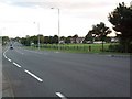
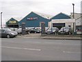
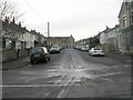
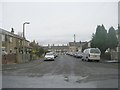
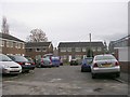
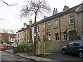
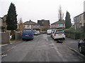
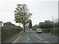
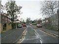
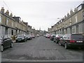
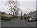
Photos of BD3 8LZ
Area Information
Living in BD3 8LZ means being part of a small, residential cluster in the City of Bradford, West Yorkshire. With a population of 1,699, the area is compact yet connected to broader regional networks. Situated in the Bradford Moor Ward, it blends historical roots with modern living. The postcode lies east of Bradford city centre, near coordinates 53.80195, -1.709963, and is surrounded by a mix of residential and commercial development. Daily life here is shaped by proximity to transport hubs like New Pudsey Station and nearby airports, making it accessible for commuters. The area’s character is defined by its modest scale, with a focus on local amenities and community ties. While it lacks large-scale attractions, its practicality and connectivity to major routes, including the A642, offer a balance of convenience and tranquillity. The presence of six Grade II listed buildings adds a touch of heritage, though the area remains primarily residential. For those seeking a compact, functional living space with easy access to regional infrastructure, BD3 8LZ provides a straightforward, no-frills option.
- Area Type
- Postcode
- Area Size
- Not available
- Population
- 1699
- Population Density
- 7279 people/km²
The property market in BD3 8LZ is characterised by a low home ownership rate of 36%, suggesting that the area functions more as a rental market than an owner-occupied one. Despite this, the accommodation type is predominantly houses, which may indicate a mix of larger properties available for long-term lettings. This dynamic implies that buyers considering the area should focus on investment opportunities rather than owner-occupation, given the limited availability of owner-occupied homes. The small scale of the postcode area means that property choices are limited, and buyers may need to look beyond BD3 8LZ itself to find a broader range of housing stock. The presence of houses rather than flats or apartments also suggests a preference for traditional, family-sized homes, which could appeal to specific buyer profiles. However, the low home ownership rate underscores the area’s role as a transient or rental-focused market.
House Prices in BD3 8LZ
No properties found in this postcode.
Energy Efficiency in BD3 8LZ
Residents of BD3 8LZ have access to a range of local amenities within practical reach. The area includes five retail outlets, such as Aldi Thornbury, Morrisons Fagley, and Iceland Woodhall, offering everyday shopping needs. Rail connectivity is strong, with five stations providing links to New Pudsey and broader regional networks. The proximity to Leeds Bradford Airport ensures easy access to national and international travel. While the area lacks large-scale leisure facilities, its compact size and nearby transport links make it convenient for residents to access larger urban centres for dining, entertainment, and cultural activities. The presence of retail options and transport hubs contributes to a practical, functional lifestyle, though the area’s small scale means it relies on surrounding regions for more extensive amenities.
Amenities
Schools
| Rank | School | Type | Entry gender | Ages |
|---|
Explore more schools in this area
Go to Schools tabDemographics
The community in BD3 8LZ is predominantly composed of adults aged 30–64, with a median age of 47. This suggests a population skewed towards middle-aged residents, likely including families and professionals. Home ownership rates here are 36%, indicating that the majority of households are renters, which may reflect the area’s role as a rental market rather than a primary owner-occupied zone. The accommodation type is primarily houses, which contrasts with the lower home ownership percentage, hinting at a mix of rental properties and owner-occupied homes. The predominant ethnic group is Asian, reflecting broader demographic trends in the region. While specific deprivation data is not provided, the age profile and housing stock suggest a stable, working-age population with established community networks. The absence of detailed socioeconomic data means the area’s quality of life can only be inferred from its infrastructure and amenities, which appear to meet basic needs.
Household Size
Accommodation Type
Tenure
Ethnic Group
Religion
Household Composition
Age
Household Deprivation
NS-SEC
Explore more demographic insights in this area
Go to Demographics tabPlanning
Planning Constraints
- Flood RiskPremium
- Ramsar Wetland SitesPremium
- Area of Outstanding Natural BeautyPremium
- Protected Nature ReservePremium
- Protected WoodlandPremium