Area Overview for BD3 0LS
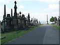
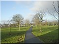
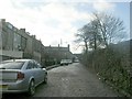
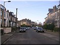
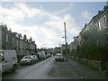
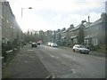
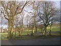
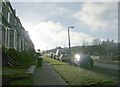
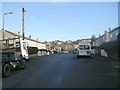
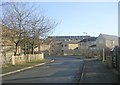
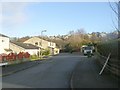
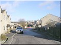
Photos of BD3 0LS
Area Information
Living in BD3 0LS means being part of a compact residential cluster in the City of Bradford, nestled east and south of the city centre. With a population of 2,429, the area is defined by its proximity to key infrastructure like the Bradford Inner Ring Road, railway lines, and the Outer Ring Road. Historically, the ward includes sites such as Barkerend Mills, a 19th-century steam-powered worsted spinning mill, and St Clement’s Church, adorned with Pre-Raphaelite art by Sir Edward Burne-Jones. Modern life here is shaped by its transport links, including five railway stations within reach, and proximity to Leeds Bradford Airport. The community is characterised by a mix of older housing stock and recent developments, with a focus on practical living. While the area lacks natural beauty designations, its accessibility to urban amenities and educational institutions makes it a functional choice for families and commuters. The presence of community centres like Karmand and local groups such as the Barkerend Environment Group suggests a grassroots focus on social cohesion.
- Area Type
- Postcode
- Area Size
- Not available
- Population
- 2429
- Population Density
- 4170 people/km²
The property market in BD3 0LS is dominated by houses, with 44% of residents owning their homes. This suggests a mix of owner-occupied and rental properties, though the exact balance of the latter is unclear. The prevalence of houses over flats or apartments indicates a focus on family-friendly housing, which may appeal to those prioritising space and privacy. Given the area’s compact size, the housing stock is likely concentrated within a small geographical footprint, potentially limiting availability for buyers seeking larger properties. The 44% home ownership rate also implies that a significant portion of the housing market is rental-based, which could affect property values and demand. For buyers, this means a smaller pool of available homes, necessitating a focus on the immediate vicinity for more options. The lack of high-rise or commercial properties further reinforces the area’s residential, semi-suburban character.
House Prices in BD3 0LS
No properties found in this postcode.
Energy Efficiency in BD3 0LS
Residents of BD3 0LS have access to a range of amenities within walking or short driving distance. Retail options include Morrisons Daily, Farmfoods Manningham, and Tesco Undercliffe, providing everyday shopping needs. The area’s rail network connects to major hubs, with stations like Bradford Interchange offering links to national rail services. For leisure, the Karmand Centre hosts outdoor cricket facilities managed by BD3 Sports Association, while community groups like the Barkerend Environment Group contribute to local initiatives. Though the area lacks large parks, its proximity to the city centre and transport links ensures easy access to cultural and recreational opportunities elsewhere in Bradford. The combination of retail, transport, and community facilities supports a convenient, though compact, lifestyle.
Amenities
Schools
Residents of BD3 0LS have access to several primary schools within practical reach, including St Augustine’s CofE Community School, Undercliffe Middle School, St George RC Middle School, Westminster Church of England Primary Academy, and Feversham College. All are primary institutions, though the absence of secondary schools means families may need to look beyond the immediate area for secondary education. The concentration of primary schools suggests a focus on early education, potentially supporting local families with young children. However, the lack of secondary options could be a limitation for those planning long-term residency. The presence of multiple schools may also indicate a competitive environment for school places, though no Ofsted ratings are provided to assess quality.
| Rank | School | Type | Entry gender | Ages |
|---|
Explore more schools in this area
Go to Schools tabDemographics
The demographic profile of BD3 0LS reflects a population skewed towards adults aged 30–64, despite a median age of 22. This suggests a mix of working-age residents and younger households, though the 22 median age may indicate a higher proportion of students or young professionals. Home ownership stands at 44%, meaning nearly half of residents rent, which aligns with the area’s mix of housing types, primarily houses. The predominant ethnic group is Asian, a figure that contextualises the cultural landscape and informs local services and community dynamics. While no deprivation data is provided, the high proportion of owner-occupied homes and the presence of family-focused amenities like primary schools imply a stable, middle-income demographic. The age range of 30–64 also suggests a community with established careers and families, which may influence the area’s social fabric and local demand for services.
Household Size
Accommodation Type
Tenure
Ethnic Group
Religion
Household Composition
Age
Household Deprivation
NS-SEC
Explore more demographic insights in this area
Go to Demographics tabPlanning
Planning Constraints
- Flood RiskPremium
- Ramsar Wetland SitesPremium
- Area of Outstanding Natural BeautyPremium
- Protected Nature ReservePremium
- Protected WoodlandPremium