Area Overview for BD3 0DS
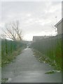
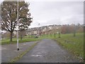
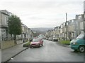
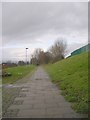
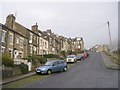
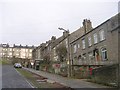
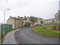
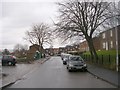
Photos of BD3 0DS
Area Information
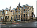
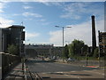
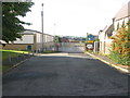
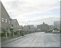
Living in BD3 0DS means inhabiting a small, densely populated residential cluster in the heart of Bradford, West Yorkshire. This postcode area, part of the Bowling and Barkerend electoral ward, lies immediately east and south of Bradford city centre, bounded by the Inner Ring Road, railway lines, and local streets like Otley Road. With a population of 2,833 and a density of 2,731 people per square kilometre, the area is compact and tightly knit. Daily life here is shaped by proximity to the city’s core, with easy access to transport networks and community hubs. Historically, the area was marked by industrial landmarks like Barkerend Mills, though much of that heritage now lies in ruins. Today, residents benefit from modern retail options, rail links, and schools, while the area’s proximity to both Bradford’s urban energy and its surrounding green spaces offers a balance of convenience and character. The ward’s boundaries reflect a mix of residential streets and infrastructure, creating a dynamic but tightly focused living environment.
- Area Type
- Postcode
- Area Size
- Not available
- Population
- 2833
- Population Density
- 2731 people/km²
The property market in BD3 0DS is characterised by a low rate of home ownership—just 28% of residents own their homes—which suggests a strong rental market. Flats are the dominant accommodation type, reflecting the area’s compact nature and historical development as a residential cluster. This concentration of flats may limit housing diversity, making it challenging for buyers seeking larger properties or family homes. The small size of the postcode area means the housing stock is limited, and buyers may need to look beyond BD3 0DS to find options. However, the proximity to Bradford’s broader urban area offers nearby alternatives. For those considering purchase, the market’s rental focus and flat-centric stock may influence both availability and price trends, requiring careful scrutiny of local listings and surrounding neighbourhoods.
House Prices in BD3 0DS
No properties found in this postcode.
Energy Efficiency in BD3 0DS
The lifestyle in BD3 0DS is shaped by its proximity to retail, transport, and community spaces. Nearby amenities include Morrisons Daily, Lidl Undercliffe, and Farmfoods Manningham, providing essential shopping. Rail stations like Bradford Forster Square and Bradford Interchange offer easy access to regional travel, while Leeds Bradford Airport is within reach. The area’s historical sites, such as St Clement’s Church with its Pre-Raphaelite art, and the Karmand Centre’s outdoor cricket facilities, add cultural and recreational value. Local groups like the Barkerend Environment Group contribute to community engagement. The mix of retail, transport, and heritage sites creates a convenient, though compact, living environment where daily needs are met without leaving the immediate area.
Amenities
Schools
Residents of BD3 0DS have access to a range of school options, from nursery to independent institutions. Midland Road Nursery School provides early education, while Wapping First School offers primary education. For independent schooling, TLG Bradford and Al Mumin Primary and Secondary School cater to families seeking non-state education, both rated as satisfactory by Ofsted. One In A Million Free School, an academy, also falls within the satisfactory category. This mix of state and independent schools offers flexibility for families, though the ratings indicate that none are outstanding. Parents should consider visiting schools to assess quality beyond Ofsted labels. The presence of multiple options within proximity ensures that families have choices, though the area’s small size means competition for places may be keen.
| Rank | School | Type | Entry gender | Ages |
|---|
Explore more schools in this area
Go to Schools tabDemographics
The community in BD3 0DS is predominantly young, with a median age of 22, though the most common age range is adults aged 30–64. Only 28% of residents own their homes, suggesting a rental-dominated market, and flats are the primary accommodation type. The area’s demographic profile is shaped by its Asian population, which constitutes the largest ethnic group. This mix influences local culture and community dynamics. The low home ownership rate may indicate a transient population or a focus on rental housing, which can affect long-term stability. However, the presence of families and working-age adults suggests a functional, active community. The age distribution hints at a blend of young professionals, students, and families, though the lack of data on deprivation means the area’s socioeconomic challenges remain unquantified.
Household Size
Accommodation Type
Tenure
Ethnic Group
Religion
Household Composition
Age
Household Deprivation
NS-SEC
Explore more demographic insights in this area
Go to Demographics tabPlanning
Planning Constraints
- Flood RiskPremium
- Ramsar Wetland SitesPremium
- Area of Outstanding Natural BeautyPremium
- Protected Nature ReservePremium
- Protected WoodlandPremium