Area Overview for BD24 9BG
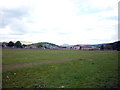
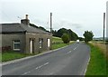
Photos of BD24 9BG
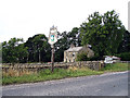
![Cast iron milestone on the Keighley & Kendal Road [B6480] in BD24 9BG](https://images.propbar.co.uk/images/geograph/59/72/5972433_120.jpg)
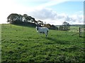
66 photos from this area
Area Information
Key information about the BD24 9BG including its size, population, and administrative classification.
- Area Type
- Postcode
- Area Size
- 5144 m²
- Population
- 1702
- Population Density
- 27 people/km²
House Prices in BD24 9BG
10
Properties
£202,833
Average Sold Price
£85,000
Lowest Price
£287,000
Highest Price
Showing 10 properties
| Address | Type | Beds | Baths | Last Sale Price | Last Sale Date | |
|---|---|---|---|---|---|---|
| 6, Ings Avenue, Cammock Lane To Settle Bypass, Settle, BD24 9BG | Semi-detached | 3 | 1 | £287,000 | Feb 2024 | |
| 1, Ings Avenue, Cammock Lane To Settle Bypass, Settle, BD24 9BG | house | 3 | - | £250,000 | Jul 2021 | |
| 2, Ings Avenue, Cammock Lane To Settle Bypass, Settle, BD24 9BG | Semi-detached | 3 | - | £175,000 | Mar 2013 | |
| 5, Ings Avenue, Cammock Lane To Settle Bypass, Settle, BD24 9BG | Semi-detached | - | - | £220,000 | Aug 2007 | |
| 10, Ings Avenue, Cammock Lane To Settle Bypass, Settle, BD24 9BG | house | - | - | £200,000 | Dec 2006 | |
| 3, Ings Avenue, Cammock Lane To Settle Bypass, Settle, BD24 9BG | Semi-detached | - | - | £85,000 | Jul 1999 | |
| 9, Ings Avenue, Cammock Lane To Settle Bypass, Settle, BD24 9BG | Detached | 3 | 1 | - | - | |
| 4, Ings Avenue, Cammock Lane To Settle Bypass, Settle, BD24 9BG | Semi-detached | - | - | - | - | |
| 7, Ings Avenue, Cammock Lane To Settle Bypass, Settle, BD24 9BG | house | - | - | - | - | |
| 8, Ings Avenue, Cammock Lane To Settle Bypass, Settle, BD24 9BG | house | - | - | - | - |
Energy Efficiency in BD24 9BG
Amenities
Schools
| Rank | School | Type | Entry gender | Ages |
|---|
Explore more schools in this area
Go to Schools tabDemographics
Household Size
Two person
most common
Accommodation Type
Houses
most common
Tenure
71
majority
Ethnic Group
White
most common
Religion
N/A
most common
Household Composition
N/A
most common
Age
47
median
Elderly (65+ years)
most common
Household Deprivation
N/A
with no deprivation
NS-SEC
35
in Lower managerial occupations
Explore more demographic insights in this area
Go to Demographics tabPlanning
Planning Constraints
- Flood RiskPremium
- Ramsar Wetland SitesPremium
- Area of Outstanding Natural BeautyPremium
- Protected Nature ReservePremium
- Protected WoodlandPremium