Area Overview for BD23 4SQ
Photos of BD23 4SQ
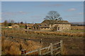
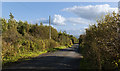
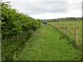
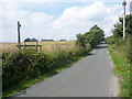
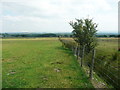
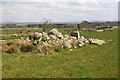
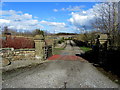
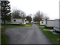
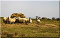
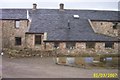
10 photos from this area
Area Information
Key information about the BD23 4SQ including its size, population, and administrative classification.
- Area Type
- Postcode
- Area Size
- 1.1 km²
- Population
- 1702
- Population Density
- 27 people/km²
House Prices in BD23 4SQ
18
Properties
£343,000
Average Sold Price
£60,000
Lowest Price
£524,000
Highest Price
Showing 18 properties
| Address | Type | Beds | Baths | Last Sale Price | Last Sale Date | |
|---|---|---|---|---|---|---|
| Hartleys Farm, Longtons Lane, Tosside, BD23 4SQ | house | - | - | £60,000 | Sep 2021 | |
| The Croft, Road From Tosside To Coolam, Tosside, BD23 4SQ | Detached | 4 | - | £399,000 | Sep 2021 | |
| Bowland House, Road From Tosside To Coolam, Tosside, BD23 4SQ | Semi-detached | 4 | - | £390,000 | Jun 2021 | |
| The Old Coach House, Road From Tosside To Coolam, Tosside, BD23 4SQ | Detached | 4 | 3 | £524,000 | Jul 2020 | |
| Lidick Cottage, Grunsagill Road, Bolton By Bowland, BD23 4SQ | Semi-detached | 4 | 2 | £249,999 | May 2015 | |
| Houghton School Hall, Longtons Lane, Tosside, BD23 4SQ | Detached | 4 | 3 | £478,000 | Mar 2015 | |
| Smithy Cottage, Wigglesworth Road, Slaidburn, BD23 4SQ | Detached | 3 | 2 | £300,000 | Jun 2014 | |
| Barn End Cottage, Grunsagill Road, Bolton By Bowland, BD23 4SQ | Semi-detached | 4 | 2 | - | - | |
| Managers Accomodation, Dog And Partridge, Wigglesworth Road, Slaidburn, BD23 4SQ | Detached | 9 | 6 | - | - | |
| The Old Post House, Wigglesworth Road, Slaidburn, BD23 4SQ | Detached | 5 | 4 | - | - |
Page 1 of 2
Energy Efficiency in BD23 4SQ
Amenities
Schools
| Rank | School | Type | Entry gender | Ages |
|---|
Explore more schools in this area
Go to Schools tabDemographics
Household Size
Two person
most common
Accommodation Type
Houses
most common
Tenure
71
majority
Ethnic Group
White
most common
Religion
N/A
most common
Household Composition
N/A
most common
Age
47
median
Elderly (65+ years)
most common
Household Deprivation
N/A
with no deprivation
NS-SEC
35
in Lower managerial occupations
Explore more demographic insights in this area
Go to Demographics tabPlanning
Planning Constraints
- Flood RiskPremium
- Ramsar Wetland SitesPremium
- Area of Outstanding Natural BeautyPremium
- Protected Nature ReservePremium
- Protected WoodlandPremium