Area Overview for BD23 3NA
Photos of BD23 3NA
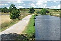


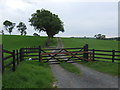
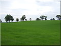


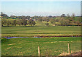


38 photos from this area
Area Information
Key information about the BD23 3NA including its size, population, and administrative classification.
- Area Type
- Postcode
- Area Size
- 59.7 hectares
- Population
- 1455
- Population Density
- 214 people/km²
House Prices in BD23 3NA
13
Properties
£472,000
Average Sold Price
£415,000
Lowest Price
£565,000
Highest Price
Showing 13 properties
| Address | Type | Beds | Baths | Last Sale Price | Last Sale Date | |
|---|---|---|---|---|---|---|
| 8 Hellifield Road, Gargrave, BD23 3NA | house | - | - | £565,000 | Jun 2021 | |
| 4 Hellifield Road, Gargrave, BD23 3NA | house | - | - | £493,000 | Oct 2020 | |
| 6 Hellifield Road, Gargrave, BD23 3NA | house | - | - | £415,000 | Jul 2019 | |
| Hallsby House, Hellifield Road, Gargrave, BD23 3NA | Detached | 4 | 2 | £415,000 | Mar 2009 | |
| The Cottage, Hellifield Road, Gargrave, BD23 3NA | Detached | - | - | - | - | |
| Town Head, Hellifield Road, Gargrave, BD23 3NA | house | - | - | - | - | |
| Agricultural Building 1, Heber House, Hellifield Road, Gargrave, BD23 3NA | Farm | - | - | - | - | |
| Agricultural Building 2, Heber House, Hellifield Road, Gargrave, BD23 3NA | Farm | - | - | - | - | |
| Agricultural Building 3, Heber House, Hellifield Road, Gargrave, BD23 3NA | Farm | - | - | - | - | |
| Town Head Cottage, Hellifield Road, Gargrave, BD23 3NA | house | 3 | 2 | - | - |
Page 1 of 2
Energy Efficiency in BD23 3NA
Amenities
Schools
| Rank | School | Type | Entry gender | Ages |
|---|
Explore more schools in this area
Go to Schools tabDemographics
Household Size
Two person
most common
Accommodation Type
Houses
most common
Tenure
70
majority
Ethnic Group
White
most common
Religion
N/A
most common
Household Composition
N/A
most common
Age
47
median
Adults (30-64 years)
most common
Household Deprivation
N/A
with no deprivation
NS-SEC
40
in Lower managerial occupations
Explore more demographic insights in this area
Go to Demographics tabPlanning
Planning Constraints
- Flood RiskPremium
- Ramsar Wetland SitesPremium
- Area of Outstanding Natural BeautyPremium
- Protected Nature ReservePremium
- Protected WoodlandPremium