Area Overview for BD23 2AW
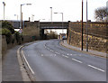
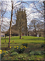
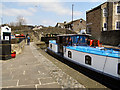
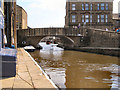
Photos of BD23 2AW

Area Information
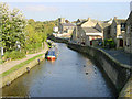
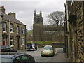
Living in BD23 2AW means being part of a tightly knit residential cluster in North Yorkshire, where the population of 1,288 is spread across 4,722 square metres. This small area is historically significant, situated near Skipton, a market town with roots in the Domesday Book and a legacy of wool trade. The community here is compact, with a population density of 1,001 people per square kilometre, suggesting a mix of established homes and proximity to local amenities. Daily life is shaped by the area’s proximity to Skipton’s historic sites, including Skipton Castle, and its role in a broader network of towns and villages. While the area is small, it is connected to nearby towns via rail and road, offering access to retail, leisure, and transport hubs. The presence of schools, including primary and special education institutions, supports families, while the local economy, historically tied to mills and building societies, continues to influence the area’s character. For those seeking a quiet, community-focused environment with historical depth, BD23 2AW offers a distinct blend of residential comfort and regional heritage.
- Area Type
- Postcode
- Area Size
- 4722 m²
- Population
- 1288
- Population Density
- 1001 people/km²
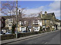
The property market in BD23 2AW is characterised by a 52% home ownership rate, indicating a mix of owner-occupied and rental properties. The accommodation type is predominantly houses, which is typical for a small residential cluster with limited high-density development. This suggests the area is more suited to families or individuals seeking larger homes rather than flats or apartments. Given the small size of the area and its proximity to Skipton, property values may reflect the broader regional market, influenced by historical and infrastructural factors. Buyers should consider the limited number of homes available, as the area’s compact size may restrict options. The predominance of houses also implies that the market is less likely to cater to short-term renters, making it a stable but niche choice for those prioritising space and a quiet, established environment.
House Prices in BD23 2AW
No properties found in this postcode.
Energy Efficiency in BD23 2AW
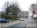
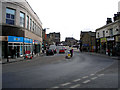
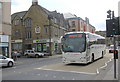
Residents of BD23 2AW have access to a range of amenities within practical reach. Retail options include major stores like Tesco Skipton, Morrisons Skipton, and Morrisons Daily, providing everyday shopping convenience. The area is also served by four rail stations and two metro stops, ensuring easy access to nearby towns and leisure opportunities. While specific parks or recreational spaces are not detailed in the data, the proximity to Skipton suggests access to green spaces and historic sites like Skipton Castle. The mix of retail, transport, and local services contributes to a lifestyle that balances convenience with the charm of a small, historic community. For families, the availability of schools and shops within walking or short driving distance enhances the area’s appeal as a self-contained residential option.
Amenities
Schools
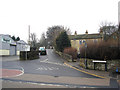
The schools nearest to BD23 2AW include Christ Church Church of England Voluntary Controlled Primary School and Christ Church Church of England Primary School, both of which are primary institutions. Additionally, Brooklands School serves as a special needs education provider. This mix of primary and special schools caters to a range of educational requirements, making the area suitable for families with children of varying needs. The presence of two primary schools suggests a focus on early education, while Brooklands School addresses specific learning requirements. However, the absence of secondary schools in the immediate vicinity may necessitate commuting to nearby towns for older students. For parents, this combination of school types offers flexibility but also highlights the importance of considering long-term educational planning when choosing this area.
| Rank | School | Type | Entry gender | Ages |
|---|
Explore more schools in this area
Go to Schools tabDemographics
The population of BD23 2AW is predominantly adults aged 30–64, with a median age of 47. This suggests a mature, settled community, likely with families and professionals. Home ownership stands at 52%, indicating a balance between owner-occupied properties and rental homes. The accommodation type is primarily houses, reflecting a residential area with larger properties rather than flats or apartments. The predominant ethnic group is White, which aligns with broader trends in the region. The population density of 1,001 people per square kilometre implies a relatively tight-knit community, though not overly crowded. For buyers, this demographic profile suggests a stable, low-turnover market with homes suited to families or individuals seeking space. The absence of specific data on deprivation means this area’s quality of life must be inferred from its amenities and infrastructure, which appear to support a middle-to-upper-income lifestyle.
Household Size
Accommodation Type
Tenure
Ethnic Group
Religion
Household Composition
Age
Household Deprivation
NS-SEC
Explore more demographic insights in this area
Go to Demographics tabPlanning
Planning Constraints
- Flood RiskPremium
- Ramsar Wetland SitesPremium
- Area of Outstanding Natural BeautyPremium
- Protected Nature ReservePremium
- Protected WoodlandPremium