Area Overview for BD22 9EN
Photos of BD22 9EN
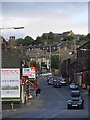
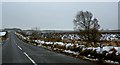
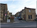


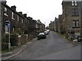
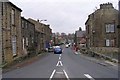
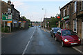
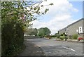
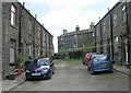
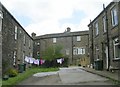
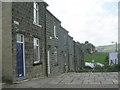
96 photos from this area
Area Information
Key information about the BD22 9EN including its size, population, and administrative classification.
- Area Type
- Postcode
- Area Size
- 1.3 hectares
- Population
- 1769
- Population Density
- 1564 people/km²
House Prices in BD22 9EN
35
Properties
£129,480
Average Sold Price
£63,950
Lowest Price
£339,995
Highest Price
Showing 35 properties
| Address | Type | Beds | Baths | Last Sale Price | Last Sale Date | |
|---|---|---|---|---|---|---|
| 32 Lees Bank Road, Cross Roads, Keighley, BD22 9EN | house | - | - | £140,000 | Jul 2023 | |
| 1A Lees Bank Road, Cross Roads, Keighley, BD22 9EN | Retail | 3 | 1 | £181,000 | Dec 2022 | |
| 36 Lees Bank Road, Cross Roads, Keighley, BD22 9EN | house | 3 | 1 | £339,995 | Jun 2022 | |
| 31 Lees Bank Road, Cross Roads, Keighley, BD22 9EN | Terraced | 3 | 2 | £120,000 | May 2021 | |
| 17 Lees Bank Road, Cross Roads, Keighley, BD22 9EN | house | - | - | £115,000 | Oct 2020 | |
| 43 Lees Bank Road, Cross Roads, Keighley, BD22 9EN | Detached | 3 | - | £150,000 | Nov 2015 | |
| 39 Lees Bank Road, Cross Roads, Keighley, BD22 9EN | house | - | - | £118,250 | Apr 2015 | |
| 35 Lees Bank Road, Cross Roads, Keighley, BD22 9EN | house | 3 | - | £125,000 | Oct 2014 | |
| 38 Lees Bank Road, Cross Roads, Keighley, BD22 9EN | house | - | - | £173,000 | Apr 2014 | |
| 7 Lees Bank Road, Cross Roads, Keighley, BD22 9EN | Terraced | - | - | £133,000 | Sep 2007 |
Page 1 of 4
Energy Efficiency in BD22 9EN
Amenities
Schools
| Rank | School | Type | Entry gender | Ages |
|---|
Explore more schools in this area
Go to Schools tabDemographics
Household Size
Two person
most common
Accommodation Type
Houses
most common
Tenure
89
majority
Ethnic Group
White
most common
Religion
N/A
most common
Household Composition
N/A
most common
Age
47
median
Adults (30-64 years)
most common
Household Deprivation
N/A
with no deprivation
NS-SEC
34
in Lower managerial occupations
Explore more demographic insights in this area
Go to Demographics tabPlanning
Planning Constraints
- Flood RiskPremium
- Ramsar Wetland SitesPremium
- Area of Outstanding Natural BeautyPremium
- Protected Nature ReservePremium
- Protected WoodlandPremium