Area Overview for BD22 7RZ
Photos of BD22 7RZ
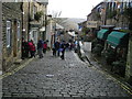
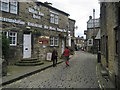
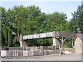
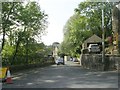
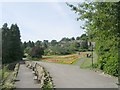
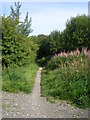
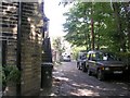
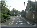
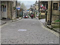
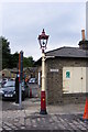
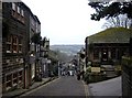
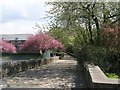
100 photos from this area
Area Information
Key information about the BD22 7RZ including its size, population, and administrative classification.
- Area Type
- Postcode
- Area Size
- 2.7 hectares
- Population
- 1613
- Population Density
- 55 people/km²
House Prices in BD22 7RZ
23
Properties
£189,610
Average Sold Price
£117,950
Lowest Price
£253,000
Highest Price
Showing 23 properties
| Address | Type | Beds | Baths | Last Sale Price | Last Sale Date | |
|---|---|---|---|---|---|---|
| 10, Springhead Mills, Spring Head Road, Haworth, Keighley, BD22 7RZ | Terraced | 2 | 2 | £250,000 | Aug 2023 | |
| 25, Springhead Mills, Spring Head Road, Haworth, Keighley, BD22 7RZ | Terraced | 3 | 2 | £215,000 | May 2022 | |
| 31, Springhead Mills, Spring Head Road, Haworth, Keighley, BD22 7RZ | Retail | 3 | 3 | £253,000 | Mar 2022 | |
| 14, Springhead Mills, Spring Head Road, Haworth, Keighley, BD22 7RZ | house | 3 | - | £210,000 | Sep 2021 | |
| 29, Springhead Mills, Spring Head Road, Haworth, Keighley, BD22 7RZ | Terraced | 3 | 2 | £195,000 | May 2020 | |
| 19, Springhead Mills, Spring Head Road, Haworth, Keighley, BD22 7RZ | Terraced | 3 | - | £177,500 | Dec 2019 | |
| 37, Springhead Mills, Spring Head Road, Haworth, Keighley, BD22 7RZ | house | 4 | - | £239,950 | Mar 2019 | |
| 21, Springhead Mills, Spring Head Road, Haworth, Keighley, BD22 7RZ | Terraced | 3 | - | £173,400 | Feb 2019 | |
| 35, Springhead Mills, Spring Head Road, Haworth, Keighley, BD22 7RZ | Semi-detached | 4 | - | £210,000 | Feb 2019 | |
| 27, Springhead Mills, Spring Head Road, Haworth, Keighley, BD22 7RZ | Terraced | 4 | 1 | £199,950 | Sep 2018 |
Page 1 of 3
Energy Efficiency in BD22 7RZ
Amenities
Schools
| Rank | School | Type | Entry gender | Ages |
|---|
Explore more schools in this area
Go to Schools tabDemographics
Household Size
Two person
most common
Accommodation Type
Houses
most common
Tenure
73
majority
Ethnic Group
White
most common
Religion
N/A
most common
Household Composition
N/A
most common
Age
47
median
Adults (30-64 years)
most common
Household Deprivation
N/A
with no deprivation
NS-SEC
38
in Lower managerial occupations
Explore more demographic insights in this area
Go to Demographics tabPlanning
Planning Constraints
- Flood RiskPremium
- Ramsar Wetland SitesPremium
- Area of Outstanding Natural BeautyPremium
- Protected Nature ReservePremium
- Protected WoodlandPremium