Area Overview for BD22 7DU
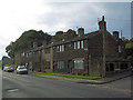
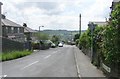
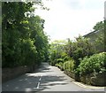
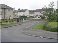
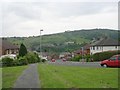
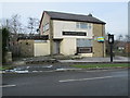
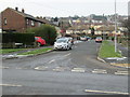
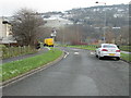
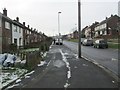
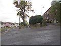
Photos of BD22 7DU

Area Information
Living in BD22 7DU means being part of a tightly knit residential cluster in the heart of Keighley, a historic market town in West Yorkshire. This postcode area, covering just 5.3 hectares, is home to 1,065 residents, resulting in a population density of 20,260 people per square kilometre—a reflection of its compact, residential character. The area’s proximity to Keighley’s historical core, once a rural market town, now blends with modern infrastructure. Residents benefit from nearby retail, transport links, and a range of amenities within walking or short driving distance. The community is defined by its modest size and the presence of local institutions, such as schools and rail stations, which anchor daily life. While the area is small, it is well-connected to surrounding towns, offering access to broader opportunities without sacrificing the intimacy of a close-knit neighbourhood. For those considering living in BD22 7DU, the balance of historical roots and practical modernity makes it a distinctive choice for those seeking a manageable, connected lifestyle.
- Area Type
- Postcode
- Area Size
- 5.3 hectares
- Population
- 1065
- Population Density
- 2833 people/km²
The property market in BD22 7DU is characterised by a 60% home ownership rate, with houses being the predominant accommodation type. This indicates a residential area where many properties are owner-occupied, rather than rented out, which can influence the dynamics of the local housing stock. The small size of the postcode area—just 5.3 hectares—means the housing supply is limited, and buyers may need to look beyond BD22 7DU to find additional options. The focus on houses suggests a market that caters to families or individuals seeking more space, rather than smaller units. For prospective buyers, this means competition for available properties could be higher, and the need to consider nearby areas is likely. The owner-occupation rate also implies a degree of stability in the market, with fewer properties changing hands frequently. Those interested in this area should be prepared to act quickly and explore adjacent postcode clusters for broader choices.
House Prices in BD22 7DU
Showing 1 properties
| Address | Type | Beds | Baths | Last Sale Price | Last Sale Date | |
|---|---|---|---|---|---|---|
| Oakbank Recreation Centre, Oakbank School, Oakworth Road, Keighley, BD22 7DU | commercial | - | - | - | - |
Energy Efficiency in BD22 7DU
Residents of BD22 7DU have access to a range of amenities within practical reach, including retail outlets such as Co-op Broomhill, Morrisons Daily, and Morrisons Eastwood. These shops provide everyday essentials, while the nearby metro and rail stations offer links to broader shopping, dining, and leisure opportunities. The presence of multiple rail stations, including Keighley Railway Station, Steeton & Silsden Railway Station, and Crossflatts Railway Station, enhances mobility, allowing residents to travel easily to neighbouring towns. The compact nature of the area means that amenities are concentrated, reducing the need for long commutes. This mix of retail, transport, and connectivity contributes to a convenient lifestyle, where daily needs are met without sacrificing the charm of a smaller, community-focused environment.
Amenities
Schools
Residents of BD22 7DU have access to two notable educational institutions: Oakbank School, a primary school, and Beckfoot Oakbank, an academy with an Ofsted rating of satisfactory. The presence of both a primary school and an academy provides families with options for their children’s education, from early years through to secondary schooling. The mix of school types suggests a range of teaching approaches and resources, though the academy’s satisfactory rating indicates there is room for improvement in certain areas. For parents, this combination offers convenience, as both schools are likely within a short commute. The lack of additional schools in the data means that families may need to consider nearby areas for further educational choices, but the existing options support a functional local education system.
| Rank | School | Type | Entry gender | Ages |
|---|
Explore more schools in this area
Go to Schools tabDemographics
The population of BD22 7DU is predominantly composed of adults aged 30–64, with a median age of 47. This suggests a mature, stable community with a strong presence of middle-aged residents. Home ownership in the area stands at 60%, indicating a mix of owner-occupied properties and rental units. The accommodation type is primarily houses, reflecting a residential profile that leans towards family homes rather than flats or apartments. The predominant ethnic group is White, with no specific data provided on other ethnicities. The age profile and ownership figures suggest a community that is settled and less transient, with a focus on long-term residency. The high proportion of adults in the 30–64 age range may influence local services and amenities, aligning them with the needs of families and professionals. This demographic structure contributes to a neighbourhood that feels established, with a clear sense of continuity and shared purpose.
Household Size
Accommodation Type
Tenure
Ethnic Group
Religion
Household Composition
Age
Household Deprivation
NS-SEC
Explore more demographic insights in this area
Go to Demographics tabPlanning
Planning Constraints
- Flood RiskPremium
- Ramsar Wetland SitesPremium
- Area of Outstanding Natural BeautyPremium
- Protected Nature ReservePremium
- Protected WoodlandPremium