Area Overview for BD22 6NX
Photos of BD22 6NX
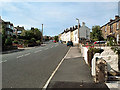
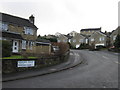
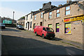
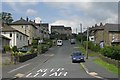
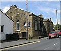
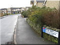
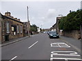
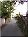


100 photos from this area
Area Information
Key information about the BD22 6NX including its size, population, and administrative classification.
- Area Type
- Postcode
- Area Size
- 4116 m²
- Population
- 1426
- Population Density
- 3835 people/km²
House Prices in BD22 6NX
15
Properties
£122,767
Average Sold Price
£56,500
Lowest Price
£299,950
Highest Price
Showing 15 properties
| Address | Type | Beds | Baths | Last Sale Price | Last Sale Date | |
|---|---|---|---|---|---|---|
| 14 High Fold, Keighley, BD22 6NX | house | 3 | - | £184,995 | Mar 2022 | |
| Ferndean, High Fold, Keighley, BD22 6NX | Detached | 3 | - | £199,995 | Aug 2021 | |
| 4 High Fold, Keighley, BD22 6NX | Semi-detached | 2 | 1 | £92,000 | Nov 2019 | |
| 2 High Fold, Keighley, BD22 6NX | Cottage | 1 | - | £102,000 | Aug 2015 | |
| 8 High Fold, Keighley, BD22 6NX | Terraced | - | - | £105,000 | Sep 2006 | |
| 18-20 High Fold, Keighley, BD22 6NX | Detached | 1 | 1 | £299,950 | Jun 2005 | |
| 24 High Fold, Keighley, BD22 6NX | house | - | - | £110,000 | Apr 2004 | |
| 6 High Fold, Keighley, BD22 6NX | Terraced | - | - | £58,000 | Apr 2003 | |
| 26 High Fold, Keighley, BD22 6NX | Terraced | 2 | 1 | £56,500 | Nov 2001 | |
| 12 High Fold, Keighley, BD22 6NX | Terraced | - | - | £60,000 | Oct 2001 |
Page 1 of 2
Energy Efficiency in BD22 6NX
Amenities
Schools
| Rank | School | Type | Entry gender | Ages |
|---|
Explore more schools in this area
Go to Schools tabDemographics
Household Size
Two person
most common
Accommodation Type
Houses
most common
Tenure
89
majority
Ethnic Group
White
most common
Religion
N/A
most common
Household Composition
N/A
most common
Age
47
median
Adults (30-64 years)
most common
Household Deprivation
N/A
with no deprivation
NS-SEC
29
in Lower managerial occupations
Explore more demographic insights in this area
Go to Demographics tabPlanning
Planning Constraints
- Flood RiskPremium
- Ramsar Wetland SitesPremium
- Area of Outstanding Natural BeautyPremium
- Protected Nature ReservePremium
- Protected WoodlandPremium