Area Overview for BD22 0NJ
Photos of BD22 0NJ
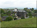
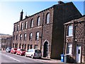
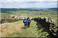

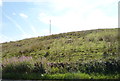
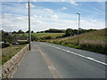
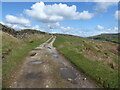
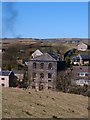
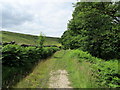
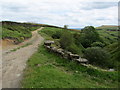
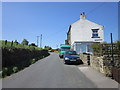
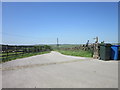
29 photos from this area
Area Information
Key information about the BD22 0NJ including its size, population, and administrative classification.
- Area Type
- Postcode
- Area Size
- 52.7 hectares
- Population
- 2458
- Population Density
- 129 people/km²
House Prices in BD22 0NJ
12
Properties
£656,667
Average Sold Price
£450,000
Lowest Price
£1,000,000
Highest Price
Showing 12 properties
| Address | Type | Beds | Baths | Last Sale Price | Last Sale Date | |
|---|---|---|---|---|---|---|
| Bankfield, Colne Road, Cowling, BD22 0NJ | Bungalow | 3 | 1 | £450,000 | Dec 2024 | |
| Lower Summerhouse Farm, Lumb Lane, Cowling, BD22 0NJ | house | 5 | 2 | £1,000,000 | Mar 2024 | |
| Intake Farm, Park Lane, Cowling, BD22 0NJ | Land | - | - | £520,000 | Feb 2017 | |
| Intake Bungalow, Park Lane, Cowling, BD22 0NJ | Bungalow | - | - | - | - | |
| Shay Bank Farm, Colne Road, Cowling, BD22 0NJ | house | - | - | - | - | |
| 2, Lower Summer House Barn, Lumb Lane, Cowling, BD22 0NJ | Semi-detached | - | - | - | - | |
| 1, Lower Summer House Barn, Lumb Lane, Cowling, BD22 0NJ | Semi-detached | - | - | - | - | |
| Shay Bank Bungalow, Lumb Lane To Shay Bank, Cowling, BD22 0NJ | Detached | - | - | - | - | |
| Lower Summerhouse Cottage, Lumb Lane, Cowling, BD22 0NJ | Semi-detached | - | - | - | - | |
| Agricultural Building, Lower Summerhouse Farm, Lumb Lane, Cowling, BD22 0NJ | Farm | - | - | - | - |
Page 1 of 2
Energy Efficiency in BD22 0NJ
Amenities
Schools
| Rank | School | Type | Entry gender | Ages |
|---|
Explore more schools in this area
Go to Schools tabDemographics
Household Size
Two person
most common
Accommodation Type
Houses
most common
Tenure
80
majority
Ethnic Group
White
most common
Religion
N/A
most common
Household Composition
N/A
most common
Age
47
median
Adults (30-64 years)
most common
Household Deprivation
N/A
with no deprivation
NS-SEC
37
in Lower managerial occupations
Explore more demographic insights in this area
Go to Demographics tabPlanning
Planning Constraints
- Flood RiskPremium
- Ramsar Wetland SitesPremium
- Area of Outstanding Natural BeautyPremium
- Protected Nature ReservePremium
- Protected WoodlandPremium