Area Overview for BD22 0LL
Photos of BD22 0LL
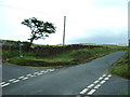
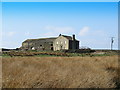
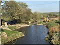
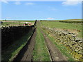
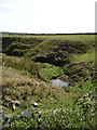
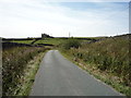
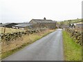
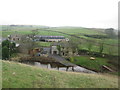
12 photos from this area
Area Information
Key information about the BD22 0LL including its size, population, and administrative classification.
- Area Type
- Postcode
- Area Size
- 1.1 km²
- Population
- 2458
- Population Density
- 129 people/km²
House Prices in BD22 0LL
20
Properties
£391,404
Average Sold Price
£350,000
Lowest Price
£470,614
Highest Price
Showing 20 properties
| Address | Type | Beds | Baths | Last Sale Price | Last Sale Date | |
|---|---|---|---|---|---|---|
| Long Syke Edge Farmhouse, Cowling Hill Lane, Cowling, BD22 0LL | Semi-detached | 4 | 2 | £470,614 | Sep 2016 | |
| Surgill Lodge, Cowling Hill Lane, Cowling, BD22 0LL | Detached | 4 | 3 | £380,000 | Nov 2015 | |
| Fold Barn, Cowling Hill Lane, Cowling, BD22 0LL | Detached | - | - | £365,000 | Oct 2003 | |
| Stable Barn, Cowling Hill Lane To Fold Barn, Cowling, BD22 0LL | house | - | - | £350,000 | Oct 2003 | |
| Rowan House, Tom Lane, Cowling, BD22 0LL | house | - | - | - | - | |
| Oak Lodge, Tom Lane, Cowling, BD22 0LL | house | 3 | 1 | - | - | |
| Long Syke Edge Farm, Cowling Hill Lane, Cowling, BD22 0LL | Farm | - | - | - | - | |
| Davy Hill Farm, Tom Lane, Cowling, BD22 0LL | house | - | - | - | - | |
| Mistle Cottage, Tom Lane, Cowling, BD22 0LL | house | - | - | - | - | |
| Moss View, Tom Lane, Cowling, BD22 0LL | house | - | - | - | - |
Page 1 of 2
Energy Efficiency in BD22 0LL
Amenities
Schools
| Rank | School | Type | Entry gender | Ages |
|---|
Explore more schools in this area
Go to Schools tabDemographics
Household Size
Two person
most common
Accommodation Type
Houses
most common
Tenure
80
majority
Ethnic Group
White
most common
Religion
N/A
most common
Household Composition
N/A
most common
Age
47
median
Adults (30-64 years)
most common
Household Deprivation
N/A
with no deprivation
NS-SEC
37
in Lower managerial occupations
Explore more demographic insights in this area
Go to Demographics tabPlanning
Planning Constraints
- Flood RiskPremium
- Ramsar Wetland SitesPremium
- Area of Outstanding Natural BeautyPremium
- Protected Nature ReservePremium
- Protected WoodlandPremium