Area Overview for BD21 4NW
Photos of BD21 4NW
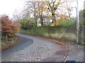
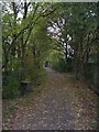


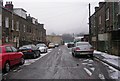


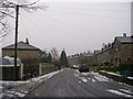

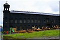
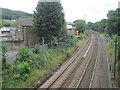
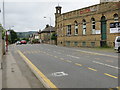
91 photos from this area
Area Information
Key information about the BD21 4NW including its size, population, and administrative classification.
- Area Type
- Postcode
- Area Size
- 1.9 hectares
- Population
- 1661
- Population Density
- 1657 people/km²
House Prices in BD21 4NW
13
Properties
£90,921
Average Sold Price
£33,000
Lowest Price
£155,000
Highest Price
Showing 13 properties
| Address | Type | Beds | Baths | Last Sale Price | Last Sale Date | |
|---|---|---|---|---|---|---|
| 193 Parkwood Street, Keighley, BD21 4NW | Semi-detached | 3 | 1 | £80,000 | Dec 2017 | |
| 197 Parkwood Street, Keighley, BD21 4NW | Semi-detached | - | - | £155,000 | Oct 2007 | |
| 187 Parkwood Street, Keighley, BD21 4NW | Retail | - | - | £120,000 | Jul 2007 | |
| 195 Parkwood Street, Keighley, BD21 4NW | house | - | - | £130,000 | Nov 2005 | |
| 189 Parkwood Street, Keighley, BD21 4NW | Semi-detached | - | - | £79,950 | Mar 2004 | |
| 213 Parkwood Street, Keighley, BD21 4NW | Semi-detached | - | - | £33,000 | Apr 2002 | |
| 191 Parkwood Street, Keighley, BD21 4NW | Semi-detached | - | - | £38,500 | Aug 1995 | |
| 211 Parkwood Street, Keighley, BD21 4NW | Semi-detached | - | - | - | - | |
| 199 Parkwood Street, Keighley, BD21 4NW | Detached | - | - | - | - | |
| 209 Parkwood Street, Keighley, BD21 4NW | Semi-detached | - | - | - | - |
Page 1 of 2
Energy Efficiency in BD21 4NW
Amenities
Schools
| Rank | School | Type | Entry gender | Ages |
|---|
Explore more schools in this area
Go to Schools tabDemographics
Household Size
Two person
most common
Accommodation Type
Houses
most common
Tenure
68
majority
Ethnic Group
White
most common
Religion
N/A
most common
Household Composition
N/A
most common
Age
47
median
Adults (30-64 years)
most common
Household Deprivation
N/A
with no deprivation
NS-SEC
21
in Lower managerial occupations
Explore more demographic insights in this area
Go to Demographics tabPlanning
Planning Constraints
- Flood RiskPremium
- Ramsar Wetland SitesPremium
- Area of Outstanding Natural BeautyPremium
- Protected Nature ReservePremium
- Protected WoodlandPremium