Area Overview for BD21 4HN
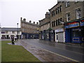
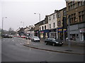
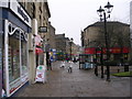
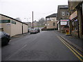
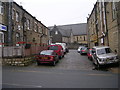
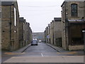
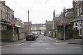
Photos of BD21 4HN

Area Information
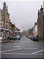
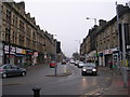
Living in BD21 4HN means being part of a small, tightly knit residential cluster in Keighley, a town with roots as a rural market settlement that evolved through the Industrial Revolution. The area’s population of 1,644 reflects a compact community where daily life is shaped by proximity to local amenities and historical infrastructure. Keighley’s origins as a hub for wool textile industries and its 19th-century market charter still influence its character, blending traditional architecture with modern needs. The area’s compact size means residents can access shops, transport, and services within walking or cycling distance, while the surrounding West Yorkshire landscape offers a quieter counterbalance. With a median age of 22 and a strong presence of adults aged 30–64, the community is a mix of young professionals, families, and long-standing residents. This postcode’s distinctiveness lies in its balance of accessibility—near rail links and retail hubs—and its role as a microcosm of Keighley’s evolving identity.
- Area Type
- Postcode
- Area Size
- Not available
- Population
- 1644
- Population Density
- Not available
The property market in BD21 4HN is characterised by a 60% home ownership rate, with houses making up the majority of accommodation types. This suggests a market skewed towards owner-occupied properties rather than rental units, which may appeal to buyers seeking stability or long-term investment. The prevalence of houses indicates a focus on family homes, potentially offering more space and garden areas compared to flats. However, the small size of the postcode area means the housing stock is limited, and buyers may need to consider nearby areas for more options. The high home ownership rate could signal a mature market with established properties, though the specific condition of individual homes is not detailed. For those prioritising proximity to amenities and transport, BD21 4HN’s compact nature may be advantageous, though the lack of larger developments could limit choice.
House Prices in BD21 4HN
No properties found in this postcode.
Energy Efficiency in BD21 4HN
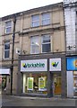
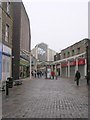
Residents of BD21 4HN have access to a range of amenities within practical reach, including five retail outlets such as Asda Keighley, Aldi Eastwood, and Iceland Keighley, ensuring everyday shopping needs are met. The area’s proximity to rail stations like Keighley Railway Station and Steeton & Silsden Railway Station provides easy access to regional hubs, while metro stops such as Oakworth and Damems add to the transport options. Though the data does not specify parks or leisure facilities, the presence of retail and transport infrastructure suggests a lifestyle focused on convenience and connectivity. The compact nature of the postcode means amenities are clustered, reducing travel time for errands or social activities. This balance of retail, transport, and proximity to larger towns like Keighley supports a practical, accessible daily life.
Amenities
Schools
| Rank | School | Type | Entry gender | Ages |
|---|
Explore more schools in this area
Go to Schools tabDemographics
BD21 4HN’s population of 1,644 includes a median age of 22, though the most common age range is 30–64 years, indicating a mix of younger residents and established households. Sixty per cent of homes are owner-occupied, suggesting a stable community with a focus on long-term residency. The area is predominantly composed of houses, which aligns with the presence of families and multi-generational living. The predominant ethnic group is Asian_total, reflecting broader demographic trends in the region. This diversity contributes to a dynamic social fabric, though specific data on deprivation or socioeconomic status is not provided. The age profile suggests a balance between younger workers and older professionals, potentially supporting local services and schools. However, the lack of data on income levels or housing affordability means the full picture of quality of life remains partially obscured.
Household Size
Accommodation Type
Tenure
Ethnic Group
Religion
Household Composition
Age
Household Deprivation
NS-SEC
Explore more demographic insights in this area
Go to Demographics tabPlanning
Planning Constraints
- Flood RiskPremium
- Ramsar Wetland SitesPremium
- Area of Outstanding Natural BeautyPremium
- Protected Nature ReservePremium
- Protected WoodlandPremium