Area Overview for BD21 4DN
Photos of BD21 4DN
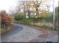
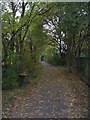


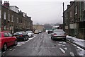


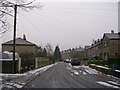

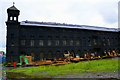
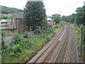
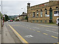
91 photos from this area
Area Information
Key information about the BD21 4DN including its size, population, and administrative classification.
- Area Type
- Postcode
- Area Size
- 3.2 hectares
- Population
- 1661
- Population Density
- 1657 people/km²
House Prices in BD21 4DN
21
Properties
£88,623
Average Sold Price
£39,950
Lowest Price
£130,000
Highest Price
Showing 21 properties
| Address | Type | Beds | Baths | Last Sale Price | Last Sale Date | |
|---|---|---|---|---|---|---|
| 47 Aireworth Road, Keighley, BD21 4DN | Terraced | 3 | 1 | £129,000 | Aug 2023 | |
| 39 Aireworth Road, Keighley, BD21 4DN | house | 3 | 1 | £109,000 | Apr 2022 | |
| 23 Aireworth Road, Keighley, BD21 4DN | house | - | - | £120,000 | Feb 2022 | |
| 65 Aireworth Road, Keighley, BD21 4DN | house | - | - | £79,000 | Nov 2020 | |
| 59 Aireworth Road, Keighley, BD21 4DN | Terraced | 3 | 1 | £63,000 | Nov 2019 | |
| 57 Aireworth Road, Keighley, BD21 4DN | house | - | - | £87,000 | Nov 2014 | |
| 25 Aireworth Road, Keighley, BD21 4DN | house | - | - | £130,000 | May 2009 | |
| 63 Aireworth Road, Keighley, BD21 4DN | Terraced | 3 | 1 | £83,500 | Oct 2008 | |
| 51 Aireworth Road, Keighley, BD21 4DN | house | 3 | - | £105,250 | Mar 2008 | |
| 55 Aireworth Road, Keighley, BD21 4DN | house | - | - | £104,950 | Oct 2006 |
Page 1 of 3
Energy Efficiency in BD21 4DN
Amenities
Schools
| Rank | School | Type | Entry gender | Ages |
|---|
Explore more schools in this area
Go to Schools tabDemographics
Household Size
Two person
most common
Accommodation Type
Houses
most common
Tenure
68
majority
Ethnic Group
White
most common
Religion
N/A
most common
Household Composition
N/A
most common
Age
47
median
Adults (30-64 years)
most common
Household Deprivation
N/A
with no deprivation
NS-SEC
21
in Lower managerial occupations
Explore more demographic insights in this area
Go to Demographics tabPlanning
Planning Constraints
- Flood RiskPremium
- Ramsar Wetland SitesPremium
- Area of Outstanding Natural BeautyPremium
- Protected Nature ReservePremium
- Protected WoodlandPremium